Download
3D Flyover
Add to list
More
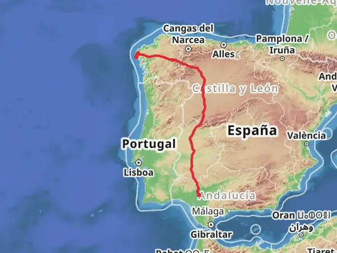
20.8 km
~4 hrs 52 min
436 m
Multi-Day
The PR G 148 Ruta do Mar de Corme e Ribeira do Anllóns is a 20.8 km trail that starts in Ponteceso, Ponteceso, Spain. Based on our data, the hike is graded as Easy. For information on how we grade trails, please read measuring the difficulty of a hiking trail on hiiker. Also, check our latest community posts for trail updates. This hike can be completed in approx 4 hrs 53 mins. Caution is advised on trail times as this depends on multiple variables. For more info read about how we calculate hike time.

Frequently asked questions
How long does PR G 148 Ruta do Mar de Corme e Ribeira do Anllóns take to hike?
PR G 148 Ruta do Mar de Corme e Ribeira do Anllóns is 20.75 km long with 436 m of climbing, so most hikers should allow the better part of a day. Strong walkers may finish the route in around 5 to 7 hours, while a more relaxed pace with stops at beaches and viewpoints can take longer.
Is PR G 148 Ruta do Mar de Corme e Ribeira do Anllóns an easy hike?
PR G 148 Ruta do Mar de Corme e Ribeira do Anllóns is graded easy, but it is still a 20.75 km route with 436 m of elevation gain. That makes it manageable for many hikers with decent fitness, though the overall length means it is more demanding than a short coastal walk.
What are the main sights on PR G 148 Ruta do Mar de Corme e Ribeira do Anllóns?
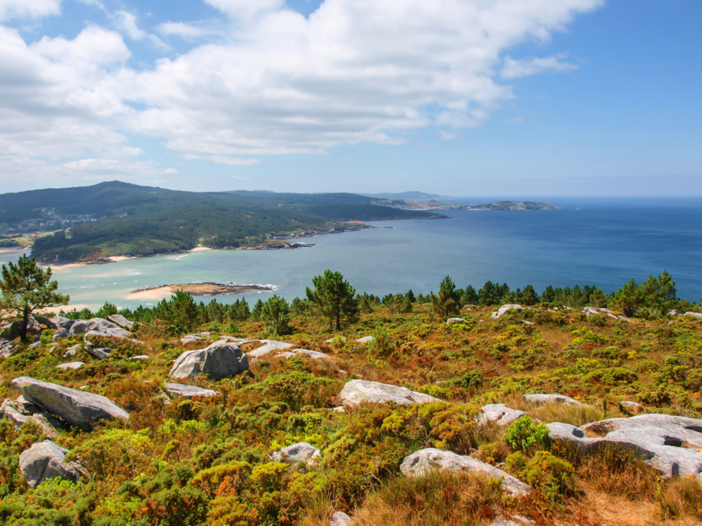
The route links the coast between Corme and Ponteceso with the estuary of the Anllóns River. Named highlights on the main route include Arnela Beach, Osmo Beach, Ermida Beach, Pedra da Serpe, Balarés Beach, and Monte Branco, where the Anllóns meets the sea near the islets of Tiñosa and Dos Cagallóns.
Does PR G 148 Ruta do Mar de Corme e Ribeira do Anllóns go from Ponteceso to Corme?
Yes. Local route descriptions identify PR G 148 Ruta do Mar de Corme e Ribeira do Anllóns as a walk between Ponteceso and Corme, following the Anllóns estuary out toward the coast. One commonly described direction starts in Ponteceso and finishes in Corme Porto after passing Balarés and Pedra da Serpe.
Is there a shorter option on PR G 148 Ruta do Mar de Corme e Ribeira do Anllóns?
Yes. The route has an inland alternative signed as PR G 148.1 as well as the main coastal line. The principal route follows the beaches and shoreline, while the inland variant climbs more gently for views over the Ría de Corme e Laxe, making it useful for hikers who want a different or shorter combination.
What kind of terrain is on PR G 148 Ruta do Mar de Corme e Ribeira do Anllóns?
PR G 148 Ruta do Mar de Corme e Ribeira do Anllóns combines riverside and coastal terrain. The route is known for estuary paths near Ponteceso, beach sections around Arnela, Osmo, Ermida, and Balarés, and higher ground around Monte Branco, so surfaces can change several times over the course of the hike.
Comments and Reviews
User comments, reviews and discussions about the PR G 148 Ruta do Mar de Corme e Ribeira do Anllóns, Spain.
average rating out of 5
0 rating(s)