Download
3D Flyover
Add to list
More
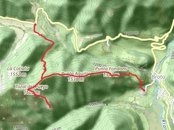
24.7 km
~7 hrs 16 min
1404 m
Multi-Day
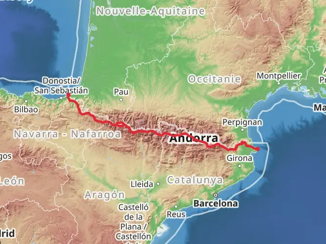
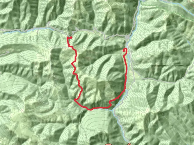
The Pradera de Ordesa - Cola de Caballo - Refugio de Goriz is a 24.7 km trail that starts in Torla-Ordesa, Sobrarbe, Spain. Based on our data, the hike is graded as Extra Difficult. For information on how we grade trails, please read measuring the difficulty of a hiking trail on hiiker. Also, check our latest community posts for trail updates. This hike can be completed in approx 7 hrs 16 mins. Caution is advised on trail times as this depends on multiple variables. For more info read about how we calculate hike time.

Frequently asked questions
How long does the Pradera de Ordesa - Cola de Caballo - Refugio de Goriz hike take?
Pradera de Ordesa - Cola de Caballo - Refugio de Goriz is a 24.67 km multi-day route with 1,404 m of elevation gain, so it is usually treated as a full-day mountain outing or an overnight hike using Refugio de Goriz. The route is rated Extra Difficult, and the climb from the valley floor to the refuge at 2,200 m adds significant time beyond the walk to Cola de Caballo.
How do you get to Cola de Caballo on the Pradera de Ordesa - Cola de Caballo - Refugio de Goriz route?
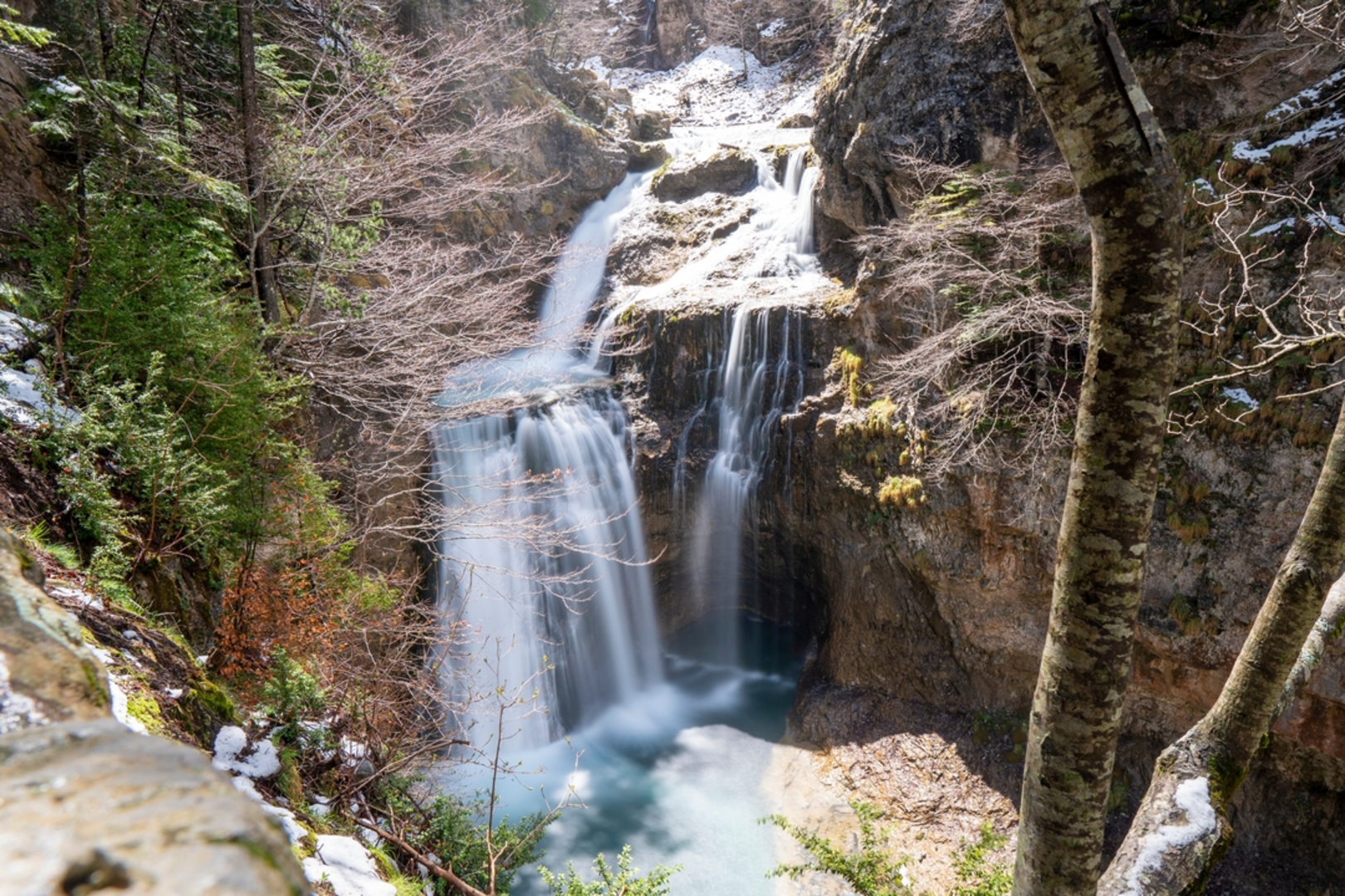
The Pradera de Ordesa - Cola de Caballo - Refugio de Goriz route starts at Pradera de Ordesa and follows the Ordesa Valley upstream toward the Circo de Soaso and the Cola de Caballo waterfall. From there, the route continues climbing out of the valley to Refugio de Goriz, which sits at 2,200 m inside Ordesa y Monte Perdido National Park.
How much elevation gain is on the Pradera de Ordesa - Cola de Caballo - Refugio de Goriz hike?
The total elevation gain on Pradera de Ordesa - Cola de Caballo - Refugio de Goriz is 1,404 m. That is a substantial climb for a 24.67 km route and one of the main reasons it is graded Extra Difficult rather than a standard valley walk to Cola de Caballo.
Where do you park for the Pradera de Ordesa - Cola de Caballo - Refugio de Goriz hike?
The usual trailhead parking for Pradera de Ordesa - Cola de Caballo - Refugio de Goriz is the Pradera de Ordesa parking area. In the busy summer season, private vehicle access to the Pradera is restricted and the mandatory shuttle bus from Torla is used instead, so access logistics can differ depending on the time of year.
What is the altitude of Refugio de Goriz on the Pradera de Ordesa - Cola de Caballo - Refugio de Goriz hike?
Refugio de Goriz stands at 2,200 m above sea level. On Pradera de Ordesa - Cola de Caballo - Refugio de Goriz, that high-mountain finish is a key part of the route, and it explains why weather, temperature, and snow conditions can feel very different from the Pradera de Ordesa trailhead.
Is the Pradera de Ordesa - Cola de Caballo - Refugio de Goriz route the normal approach to Refugio de Goriz?
Yes. Pradera de Ordesa - Cola de Caballo - Refugio de Goriz follows the standard foot approach from the Pradera de Ordesa through the Ordesa Valley to Refugio de Goriz. The refuge can only be reached on foot, and this is the classic access line used by hikers heading to Goriz and by many parties continuing toward Monte Perdido.
Are the Clavijas de la Cola de Caballo part of the Pradera de Ordesa - Cola de Caballo - Refugio de Goriz hike?
Not necessarily. Pradera de Ordesa - Cola de Caballo - Refugio de Goriz is commonly approached by the main valley route from Pradera de Ordesa to Cola de Caballo and then up to Goriz, while the clavijas are a separate equipped option in the area that requires more caution and is not the standard line for reaching the refuge. For many hikers, the normal route avoids turning the day into a technical scrambling outing.
Comments and Reviews
User comments, reviews and discussions about the Pradera de Ordesa - Cola de Caballo - Refugio de Goriz, Spain.
average rating out of 5
0 rating(s)