Download
3D Flyover
Add to list
More
276.0 km
~12 days
7163 m
Multi-Day
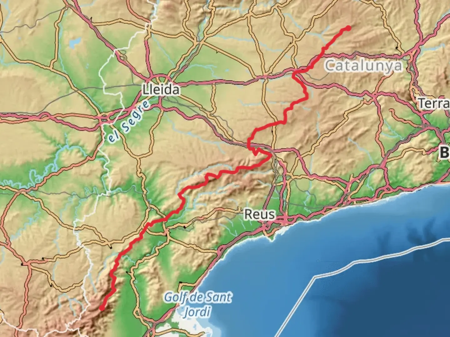
The GR 171 Del Santuario de Pinós a los Puertos de Beceit is a 276.0 km trail that starts in Pinós, Solsonès, Spain. Based on our data, the hike is graded as Difficult. For information on how we grade trails, please read measuring the difficulty of a hiking trail on hiiker. Also, check our latest community posts for trail updates. This hike can be completed in approx 12 days. Caution is advised on trail times as this depends on multiple variables. For more info read about how we calculate hike time.

Frequently asked questions
How long is the GR 171 Del Santuario de Pinós a los Puertos de Beceit and how hard is it?
The GR 171 Del Santuario de Pinós a los Puertos de Beceit is 275.97 km long with 7,163 m of total ascent. It is rated Difficult and is set up as a multi-day long-distance route, so it is better suited to experienced hikers who are comfortable with sustained elevation gain over many days.
How many stages does the GR 171 Del Santuario de Pinós a los Puertos de Beceit usually take?
A commonly published breakdown of the GR 171 lists 15 main stages from the Santuari de Pinós to the Refugi de Caro in Els Ports. Those stages include places such as Castellfollit de Riubregós, Cervera, Montblanc, Prades, Escaladei, La Figuera, Prat de Comte, and Paüls, which gives a practical framework for planning a full crossing.
Where does the GR 171 Del Santuario de Pinós a los Puertos de Beceit start and finish?
The route starts at the Santuari de Pinós in Solsonès and finishes at the Refugi de Caro in the Ports massif near the Puertos de Beceit area. Along the way it crosses central and southern Catalonia, linking inland sections around Cervera and Montblanc with mountain terrain in Montsant, Terra Alta, and Els Ports.
Which towns and landmarks does the GR 171 Del Santuario de Pinós a los Puertos de Beceit pass?
The GR 171 passes a long chain of named places including Castellfollit de Riubregós, Cervera, Talavera, Coll de Forès, Vimbodí, Montblanc, Prades, Albarca, the Cartuja de Escaladei, La Figuera, Fontcalda, Prat de Comte, and Paüls. It also reaches the Caro refuge and passes through major natural areas including the Prades Mountains, Montsant, and Els Ports.
Is there public transportation on the GR 171 Del Santuario de Pinós a los Puertos de Beceit?
Public transportation is available at some stage towns on the GR 171, but not at every trailhead. Published stage information shows no public transit at the start in Pinós, while places such as Cervera have rail and bus links, and some later stage endpoints such as Forés and Vimbodí i Poblet also have bus connections.
What is the final mountain section like on the GR 171 Del Santuario de Pinós a los Puertos de Beceit?
The southern end of the GR 171 is one of the toughest parts of the route. From the Priorat and Terra Alta side it heads past the Ebro area, Fontcalda, Prat de Comte, and Paüls, then climbs through Els Ports Natural Park to the Refugi de Caro, with steep slopes and a more mountainous feel than the earlier inland stages.
Comments and Reviews
User comments, reviews and discussions about the GR 171 Del Santuario de Pinós a los Puertos de Beceit, Spain.
average rating out of 5
0 rating(s)