Download
Preview
Add to list
More
14.9 km
~2 days
1349 m
Multi-Day
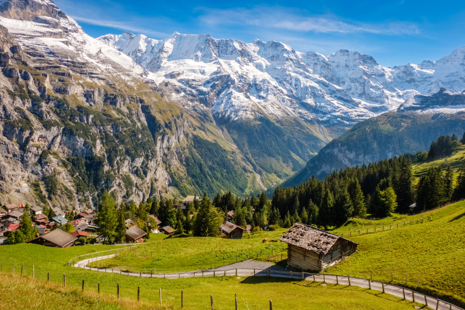
The Stechelberg - Oberhorn Lake is a 14.9 km trail that starts in Stechelberg, Interlaken-Oberhasli administrative district, Switzerland. Based on our data, the hike is graded as Extra Difficult. For information on how we grade trails, please read measuring the difficulty of a hiking trail on hiiker. Also, check our latest community posts for trail updates. This hike can be completed in approx 5 hrs 13 mins. Caution is advised on trail times as this depends on multiple variables. For more info read about how we calculate hike time.

Frequently asked questions
How hard is the Stechelberg - Oberhorn Lake hike and who is it best suited for?
Stechelberg - Oberhorn Lake is rated Extra Difficult, with 14.86 km of hiking and 1,349 meters of elevation gain. The route climbs high above the upper Lauterbrunnen Valley toward Oberhornsee, and hikers regularly describe sections near the lake as steep and narrow, so it is best suited to experienced mountain hikers with strong fitness and sure footing.
How long does the Stechelberg - Oberhorn Lake hike usually take?
A hike with 14.86 km of distance and 1,349 meters of ascent is typically a full-day mountain outing for most hikers. The climb from Stechelberg up the Lauterbrunnen side valley toward Oberhornsee is sustained rather than flat, so pace depends heavily on fitness, trail conditions, and how long is spent at viewpoints and rest stops along the route.
Where do you start the Stechelberg - Oberhorn Lake hike and is there parking in Stechelberg?
The hike starts in Stechelberg at the upper end of the Lauterbrunnen Valley. Stechelberg has a large paid parking area by the Schilthornbahn valley station, and the village is also reached by PostBus from Lauterbrunnen, which connects onward to rail services in the Jungfrau region.
Can you camp on the Stechelberg - Oberhorn Lake hike?
There is no established campsite on the Stechelberg - Oberhorn Lake route itself. For overnight stays near the trailhead, Camping Breithorn in Stechelberg is one of the nearest formal campgrounds, while any plan to camp higher on the route should be checked carefully against local rules and land-use restrictions in the Lauterbrunnen area.
What is the trail like on the Stechelberg - Oberhorn Lake hike?
The Stechelberg - Oberhorn Lake hike is a steep alpine route that climbs from the valley floor into high mountain terrain above Stechelberg. Hikers report forested sections, waterfalls, narrow mountain path, and a final steeper push toward Oberhornsee, so the route feels much more like a serious mountain hike than a casual valley walk.
Is there a map available for the Stechelberg - Oberhorn Lake hike?
Yes. The Stechelberg - Oberhorn Lake route is mapped as a staged trail, which helps with planning a point-to-point or longer mountain day in the Interlaken-Oberhasli area. Because the route is 14.86 km long with 1,349 meters of ascent, a detailed map is important for judging timing, elevation, and any nearby junctions around Trachsellauenen and Oberhornsee.
Comments and Reviews
User comments, reviews and discussions about the Stechelberg - Oberhorn Lake, Switzerland.
average rating out of 5
0 rating(s)