Download
3D Flyover
Add to list
More
616.9 km
~24 days
12596 m
Multi-Day
“Embark on a historic and scenic trek challenging both endurance and spirit across Switzerland's majestic Alps.”
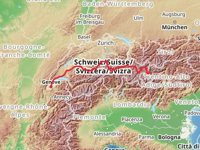
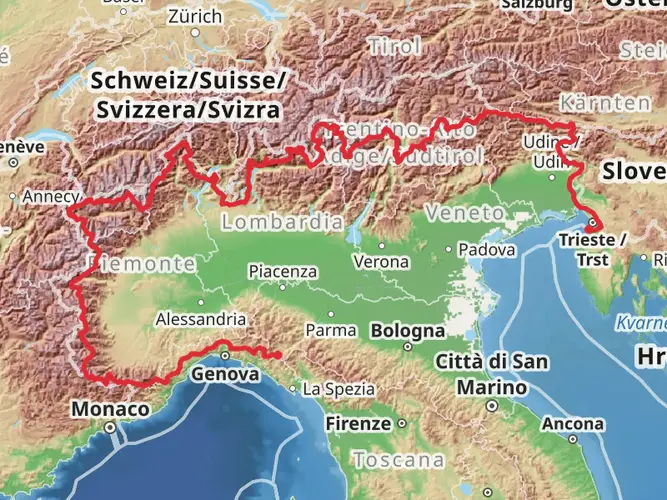
Embarking on the Camino Müstair-Geneva via Martigny is a journey through the heart of the Swiss Alps, encompassing a distance of approximately 617 kilometers (383 miles) and an elevation gain of around 12,500 meters (41,010 feet). This point-to-point trail is a challenging adventure, rated as difficult due to its length and the demanding terrain it traverses.
Getting to the Trailhead
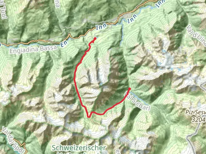
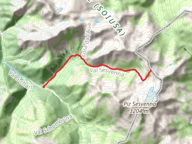
The trailhead is located near the region of Engiadina Bassa/Val Müstair, which is accessible by public transport. Travelers can take a train to Zernez, and from there, a bus will bring them to Müstair, where the adventure begins. For those coming by car, parking is available in the area, but it's advisable to check for any parking restrictions or permits required.
The Journey Through the Alps
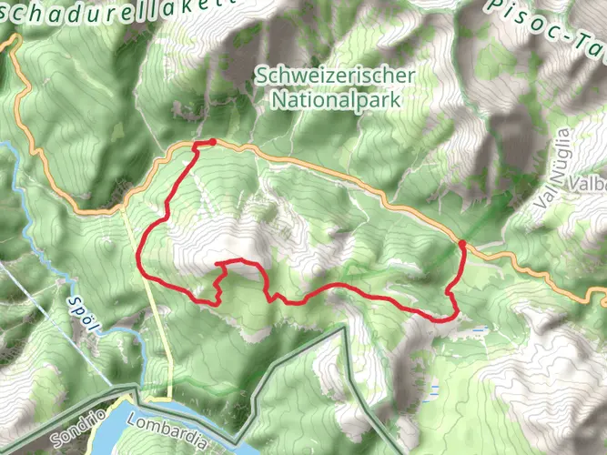
As you set out from the picturesque valley of Val Müstair, the trail will lead you through a mosaic of landscapes, from lush meadows to rugged mountain passes. The initial stages of the hike are characterized by a gradual ascent, allowing your body to acclimatize to the increasing altitude.
Historical Significance and Landmarks
The Camino Müstair-Geneva is steeped in history, with the route passing by numerous cultural landmarks. One of the early highlights is the UNESCO World Heritage Site of the Convent of St. John at Müstair, which dates back to the Carolingian era. As you progress, the trail takes you through the historic town of Martigny, located at a key junction of ancient Roman roads. Here, the Martigny Castle and the Roman Amphitheatre are must-see attractions that offer a glimpse into the region's storied past.
Natural Beauty and Wildlife
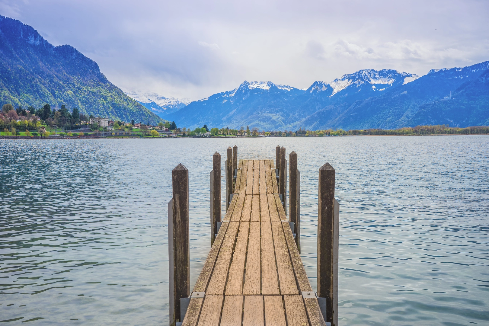
The path winds through diverse ecosystems, providing opportunities to witness the rich flora and fauna of the Alps. You'll encounter a variety of wildlife, including chamois, ibex, and marmots, as well as a plethora of bird species. The trail also offers breathtaking views of iconic peaks such as the Matterhorn and Mont Blanc, weather permitting.
Navigating the Trail
Hikers are advised to use the HiiKER app for navigation, as it provides detailed maps and trail information that are invaluable for a trek of this magnitude. The app will help you stay on track and identify key waypoints, water sources, and potential camping spots.
Preparation and Logistics
Given the trail's difficulty, it's essential to be well-prepared with appropriate gear, including sturdy hiking boots, weather-appropriate clothing, and a reliable tent for multi-day treks. It's also crucial to plan for food and water, as resupply points may be sparse along certain sections of the trail.
Conclusion
The Camino Müstair-Geneva via Martigny is a journey that will challenge and reward in equal measure. With its rich history, stunning alpine scenery, and the opportunity to immerse oneself in the natural beauty of the Swiss Alps, it's a trail that offers an unforgettable experience for the intrepid hiker.

Frequently asked questions
How long is the Camino Müstair-Geneva via Martigny and how many days does it usually take?
The Camino Müstair-Geneva via Martigny is 616.95 km long with 12,596 m of total ascent, so it is firmly in long-distance trek territory. Most hikers would need several weeks rather than a few days, and the route’s Extra Difficult rating reflects both the distance and the cumulative climbing across Switzerland.
How hard is the Camino Müstair-Geneva via Martigny compared with other long-distance hikes in Switzerland?
The Camino Müstair-Geneva via Martigny is rated Extra Difficult, which places it among the more demanding Swiss multi-day routes. The challenge comes from the combination of 616.95 km on foot and 12,596 m of elevation gain, not just one steep section, so stamina, recovery, and logistics matter as much as day-hiking fitness.
Where does the Camino Müstair-Geneva via Martigny start and finish?
The Camino Müstair-Geneva via Martigny starts in Müstair in the Val Müstair area of southeastern Switzerland and finishes in Geneva, with Martigny forming a key waypoint in the route name and line of travel. That means the walk links the eastern edge of the Swiss Alps with western Switzerland in a true point-to-point crossing.
Can the Camino Müstair-Geneva via Martigny be reached by public transport?
Yes. Müstair is linked to the Swiss rail network by traveling first to Zernez and then continuing by PostBus through Val Müstair, while Geneva is one of the country’s main rail hubs. Martigny is also a major public-transport town in Valais with rail connections and local transport, which makes staging sections of the route more practical.
Is there parking near the start of the Camino Müstair-Geneva via Martigny in Müstair?
Parking is available in and around Müstair, but long-distance hikers should check local restrictions before leaving a vehicle for multiple days. In the wider Val Müstair and Swiss National Park region, parking is controlled in designated areas, so it is better to plan around official parking rather than assume unrestricted roadside parking.
What are the main landmarks on the Camino Müstair-Geneva via Martigny?
One of the standout landmarks at the eastern end is the Benedictine Convent of St. John in Müstair, a UNESCO World Heritage Site. The route also passes through Martigny, an important historic town in Valais, before continuing toward Geneva, so the trail combines major cultural stops with a long alpine crossing.
Is the Camino Müstair-Geneva via Martigny dog-friendly?
Dog access can vary by stage, so this is not a route to assume is fully dog-friendly from end to end. The Camino Müstair-Geneva via Martigny begins in the Val Müstair region beside protected landscapes including the Swiss National Park area, where strict nature rules apply, and in many Swiss hiking areas dogs are expected to be kept on a lead.
Comments and Reviews
User comments, reviews and discussions about the Camino Müstair-Geneva via Martigny, Switzerland.
4.0
average rating out of 5
5 rating(s)