LaFollette to Cove Lake State Park via Volunteer Loop, Tank Springs and Eagle Bluff
Download
3D Flyover
Add to list
More
17.7 km
~4 hrs 48 min
764 m
Point-to-Point
“A rugged Cumberland Trail journey pairs steep ridge climbs, sandstone vistas, and beaver-pond calm.”
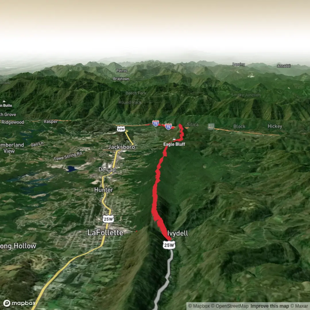
This point-to-point hike links LaFollette with Cove Lake State Park on the Cumberland Trail system, combining the Volunteer Loop, the Tank Springs approach, and the Eagle Bluff section into a solid medium outing of about 17.7 to 18 km / 11.0 to 11.2 miles. HiiKER lists it at 17.7 km with roughly 597 m / 1,959 ft of ascent, though your estimate of around 800 m / 2,625 ft is a reasonable planning figure if you include short side movements, rolling terrain, and the cumulative effect of repeated climbs and descents. It is generally graded medium, but it can feel harder than that for hikers who are not used to sustained ridge climbing, rocky tread, and a longer one-way day. (hiiker.app)
The route starts near the Tank Springs Trailhead in LaFollette, which is just off Tennessee Avenue near the bridge over Big Creek. The nearest practical landmark is the paved Tank Springs Trailhead parking area off North Tennessee Avenue in LaFollette, Tennessee. On the opposite end, the route finishes near Bruce Gap Road at Cove Lake State Park, close to I-75 Exit 134 in Caryville. The Bruce Gap Road Trailhead sits within state park lands and connects directly to the Cumberland Trail and the Volunteer Loop. (cumberlandtrail.org)
For drivers, the simplest shuttle setup is to leave one vehicle at the Bruce Gap Road Trailhead near Cove Lake State Park and another at Tank Springs in LaFollette. The Bruce Gap access is reached from I-75 Exit 134 by following the local road network toward Royal Blue Road / Old TN 63 and then Bruce Gap Road; the Tank Springs trailhead is also reached from Exit 134 by continuing east on US 25W / TN 63 into LaFollette, then turning onto Tennessee Avenue and entering the paved lot just before the Big Creek bridge. (cumberlandtrail.org)
Public transport is limited in this part of Campbell County, so most hikers should plan on arriving by car or arranging a private shuttle. If relying on transit, it is best to check current Campbell County and regional services in advance and expect that a rideshare or local pickup may still be needed for the final approach to either trailhead.
What the route is like
Starting from LaFollette, the trail climbs away from Tank Springs and works up onto Cumberland Mountain, where the grade can be the crux of the day if you are heading toward Cove Lake. The Cumberland Trail Conservancy notes that the hardest climb in the southbound direction is the ascent above the Tank Springs Trailhead, while the Bruce Creek side is the hardest climb when traveling north. That means hikers going from LaFollette toward Cove Lake should be ready for a demanding early climb before the route settles into ridge travel. (cumberlandtrail.org)
Once on the mountain, expect a mix of narrow singletrack, older and more primitive trail construction, and repeated elevation changes rather than one continuous ascent. Some sections are well built with bridges, steps, and switchbacks, while older stretches are rougher underfoot and require more attention. White blazes mark the route, but they are not perfectly consistent everywhere, so carrying the route in HiiKER is a smart move for junctions and for staying confident through the more complex sections. (cumberlandtrail.org)
The Eagle Bluff section is known for its ridge walking, sandstone outcrops, and broad views over Powell Valley. One of the standout landmarks is Devils Racetrack Overlook, reached by a short spur from the main trail. This overlook sits on pale sandstone and gives a wide view over Cove Lake, Jacksboro, the interstate corridor, and the surrounding mountains. It is one of the signature viewpoints on this stretch and a natural place to pause. (cumberlandtrail.org)
Farther along, the Volunteer Loop adds a more scenic variation near Cove Lake State Park. Rather than simply staying on the main Cumberland Trail, this loop drops toward Powder Springs Beaver Pond before climbing back to rejoin the main route. The pond is one of the most distinctive natural features on the hike, with an old beaver dam and wetland habitat that contrasts nicely with the drier ridge sections above. (cumberlandtrail.org)
Landmarks, terrain, and natural features
Bruce Creek is one of the most memorable water features on the route. On the Cove Lake side, the trail follows the creek and passes a dramatic series of cascades and waterfalls totaling about 21 m / 70 ft

Surfaces
Ground
Unknown
Dirt
Comments and Reviews
User comments, reviews and discussions about the LaFollette to Cove Lake State Park via Volunteer Loop, Tank Springs and Eagle Bluff, Tennessee.
average rating out of 5
0 rating(s)