Rainbow Falls, Signal Point and Edwards Point via Cumberland Trail
Download
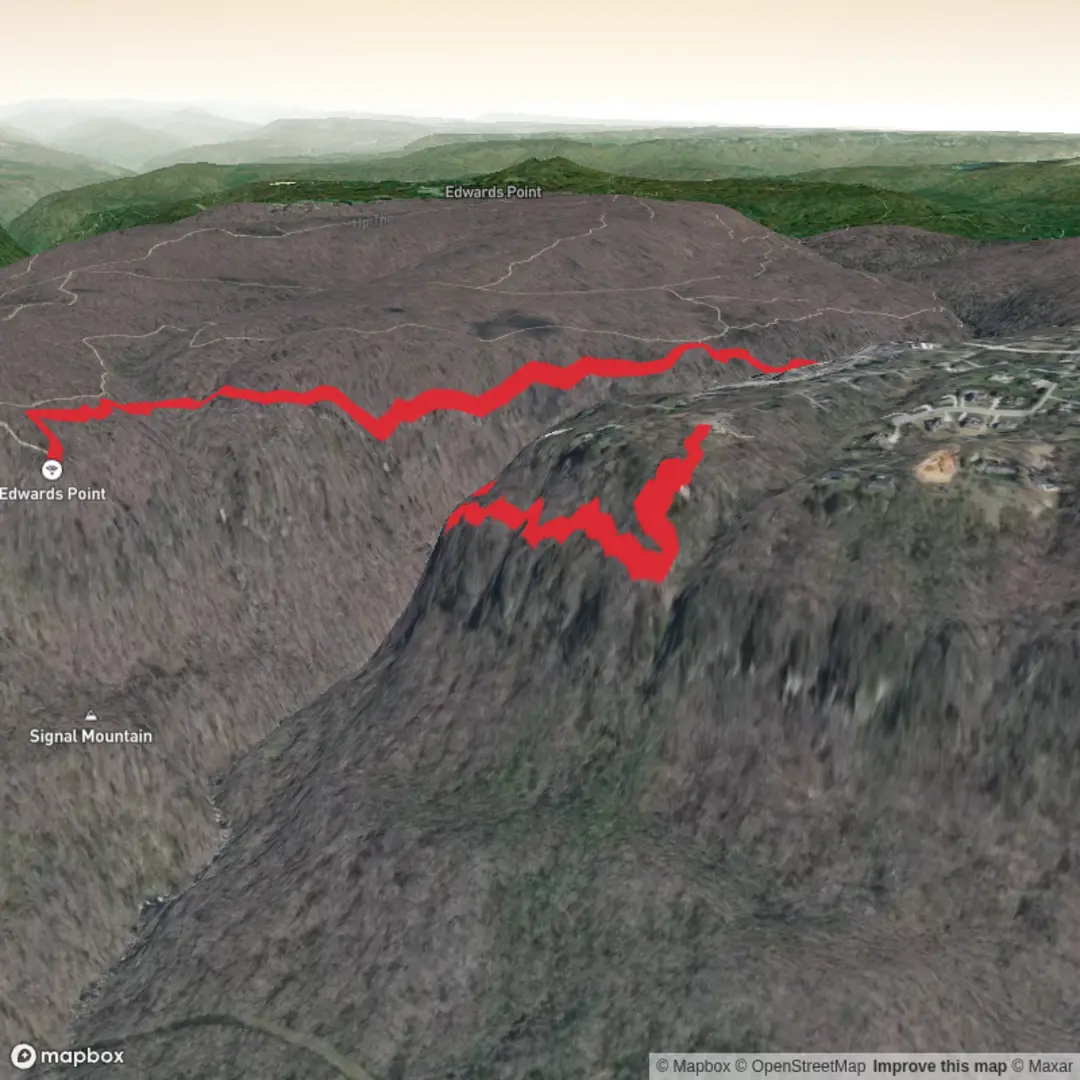
3D Flyover
Add to list
More
8.4 km
~2 hrs
197 m
Out and Back
“Blufftop vistas, shadowy gorge woods, and a shy waterfall make this a richly rewarding ramble.”
This medium-difficulty outing on Signal Mountain links three of the area’s best-known features in one compact walk: the broad Tennessee River Gorge views from Signal Point, the wooded gorge and cascade at Rainbow Falls, and the dramatic overlook at Edwards Point. Expect roughly 8 km / 5 miles overall with about 200 m / 650 ft of elevation gain, though the exact total varies depending on whether you begin at Signal Point or the Rainbow Lake access on Ohio Avenue and how far you walk at each overlook. The terrain is varied rather than relentlessly steep: short rocky descents and climbs, rooty forest tread, creekside sections, and bluff-edge viewpoints that reward steady footing and a bit of patience. (cumberlandtrail.org)
The most practical starting landmark is Signal Point, near 106 Signal Point Road, Signal Mountain, Tennessee 37377, or alternatively the Rainbow Lake Trailhead on Ohio Avenue near Alexian Village and the golf course, commonly mapped around 304 Ohio Avenue, Signal Mountain, Tennessee 37377. Signal Point is the more scenic and historically rich start, while Ohio Avenue can shorten the outing and reduce some of the early descent and re-climb. Rainbow Lake itself was created in 1916 as part of the old Signal Mountain Hotel property, which adds a small but interesting historic layer before you even reach the deeper gorge scenery. (violetskyadventures.com)
If arriving by car from Chattanooga, the usual approach is to take US 27 to the Signal Mountain exit and follow roads up the mountain toward Signal Point or Ohio Avenue. Parking is typically easiest at the designated trailhead areas, but spaces can fill quickly on pleasant weekends because this is one of the most popular hiking zones near Chattanooga. Public transport is limited: CARTA serves Chattanooga and the surrounding area, but service directly to the trailheads on Signal Mountain is not something most hikers should count on without checking current routes and arranging a taxi or rideshare for the final leg. For planning the route itself, use HiiKER rather than relying on informal junction assumptions, especially where local access trails meet the Cumberland Trail. (gocarta.org)
What the route feels like
Starting from Signal Point, the trail begins with one of the best immediate payoffs in the region: a high overlook above the Tennessee River Gorge. From there, the Cumberland Trail drops into Middle Creek Gorge, and that descent is where the “medium” rating starts to make sense. It is not especially long, but the footing can be uneven with rock, exposed roots, and occasional slick patches after rain. Hikers who are comfortable on rolling woodland trails will usually find it manageable, but trekking poles can help on the return climb. (cumberlandtrail.org)
As you continue, the route passes through the Rainbow Lake Wilderness Area, where the character shifts from open bluff views to a cooler, more enclosed forested ravine. Depending on recent rainfall, Rainbow Falls can range from a light trickle to a much more photogenic cascade. In dry spells, the waterfall may be less impressive than the name suggests, so it helps to think of this section as a gorge-and-forest walk first, waterfall walk second. The creek crossings and damp rock around the falls deserve extra care, particularly in cooler months when wet leaves can hide slick stone. (cumberlandtrail.org)
Beyond Rainbow Lake, the trail trends toward Edwards Point through mixed hardwood forest and sandstone outcrops. This section is often more forgiving underfoot than the gorge descent, but it still includes roots, embedded rock, and occasional muddy spots. The payoff at Edwards Point is a wide, elevated view over the Tennessee River Gorge and surrounding ridges, one of the signature vistas on the southern end of the Cumberland Trail. (cumberlandtrail.org)
Landmarks, scenery, and natural features
Signal Point is both a scenic overlook and a historic site. Long before the Civil War, Indigenous peoples used this mountain location for signaling across the valley, and during the Civil War the point became strategically important in communications connected with the fighting around Chattanooga. Today, that same geography gives hikers a sweeping introduction to the gorge landscape they will spend the day traversing. (en.wikipedia.org)
Middle Creek Gorge and the Rainbow Lake area bring a different atmosphere: hemlock and hardwood shade, mossy rock, creek sounds, and a tucked-away feel that contrasts nicely with the exposed overlooks. Rainbow Lake’s man-made origins from the 1916 hotel era are easy to miss if

Surfaces
Ground
Paved
Unknown
Unpaved
Comments and Reviews
User comments, reviews and discussions about the Rainbow Falls, Signal Point and Edwards Point via Cumberland Trail, Tennessee.
average rating out of 5
0 rating(s)