Cummins Falls Overlook via Falls Overlook Trail and Black Fork River Trail
Download
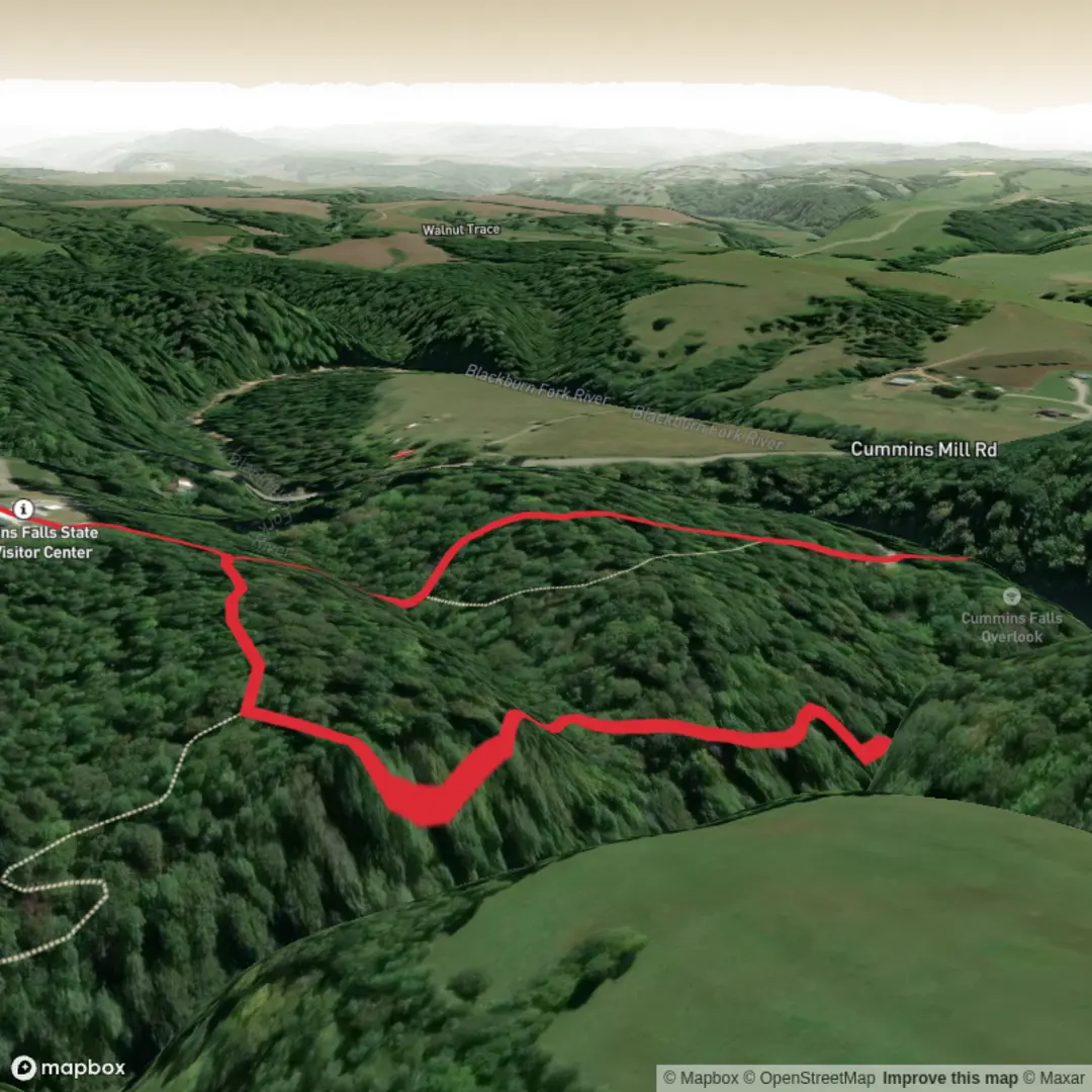
3D Flyover
Add to list
More
1.5 km
~21 min
31 m
Loop
“A short, lively forest walk delivers a stirring overlook of Cummins Falls, despite tricky footing.”
This short outing at Cummins Falls State Park packs a lot into roughly 2 km / 1.2 miles, combining an easy-to-follow approach with one of the best elevated views of a major Tennessee waterfall. Although the elevation gain is minimal—about 0 m / 0 ft overall—the terrain can still feel moderately demanding in places because of uneven tread, exposed roots, damp rock, and the steady foot traffic that comes with one of the state’s most popular waterfall destinations. The route is best thought of as a scenic walk to the overlook with connecting sections along the Black Fork/Blackburn Fork river corridor, rather than a sustained climb. The main reward is a broad view of 75-foot / 23-metre Cummins Falls on the Blackburn Fork State Scenic River. (cumberlandriverbasin.org)
The nearest significant trailhead landmark is Cummins Falls State Park, 390 Cummins Falls Lane, Cookeville, TN 38501, where the main parking, restrooms, picnic area, and overlook access are located. Some older trail references also mention 1225 Cummins Mill Road, Cookeville, TN 38501; for planning purposes, the state park entrance and visitor access are best associated with Cummins Falls Lane. (tn.gov)
By car, the park is about 9 miles / 14.5 km north of Cookeville, reached by local roads leading to the state park entrance. Parking is at the main day-use area above the falls, and from there the overlook trail begins close to the visitor facilities. Public transport is limited: there is no regular transit service directly to the trailhead, so hikers without a car generally need to arrange a taxi, rideshare, or private shuttle from Cookeville or nearby communities. (tn.gov)
What the route is like
From the parking area, the walk begins on the Falls Overlook Trail, a short path of about 0.4 to 0.5 miles / 0.6 to 0.8 km one way, depending on the exact segment counted. This section is the most straightforward part of the outing and is the reason many visitors choose the overlook route instead of the strenuous gorge descent. The tread is relatively gentle compared with the base-of-falls route, but “gentle” here does not always mean perfectly smooth—expect natural-surface trail, occasional mud after rain, and slick spots where moisture lingers in shaded sections. (cumberlandriverbasin.org)
As the trail nears the overlook, the forest begins to open just enough to hint at the gorge ahead. The overlook itself is the signature landmark: a dramatic vantage above the river cut, with Cummins Falls dropping into the gorge below. In 2024, the park unveiled an ADA-accessible overlook area at the end of the Falls Overlook Trail, improving access to the main view. Even with that improvement, hikers should still expect a busy setting on weekends and warm-weather afternoons. (tn.gov)
If your planned route includes the connecting Black Fork River Trail segment, the character shifts slightly from overlook walk to riverside connector. Distances remain short, but footing can become rougher and more irregular near the river corridor. This is where the “medium” difficulty estimate makes sense: not because of major climbing, but because wet rock, streamside erosion, and uneven natural surfaces demand attention. Using HiiKER before setting out is worthwhile for confirming junctions and keeping track of the short connecting paths around the overlook and river access area.
Landmarks, scenery, and natural features
Cummins Falls is the dominant feature of the hike and one of Tennessee’s most notable waterfalls by volume. The falls drop about 75 feet / 23 metres, and the surrounding gorge is part of the Blackburn Fork Scenic River landscape on the Highland Rim/Upper Cumberland region. The river has cut through resistant rock layers to create the steep-sided ravine, rocky banks, and ledges that give the park its rugged feel despite the short mileage. (cumberlandriverbasin.org)
The forest around the trail is typical of Middle Tennessee river gorge habitat: mixed hardwoods, dense green cover in the growing season, and a cooler, shaded feel near the water. In spring and summer, expect lush vegetation and a humid microclimate around the gorge. In autumn, the overlook can be especially attractive when the hardwood canopy turns and the waterfall is framed by color. After rain, the falls are often more dramatic, but trail

Surfaces
Ground
Unknown
Comments and Reviews
User comments, reviews and discussions about the Cummins Falls Overlook via Falls Overlook Trail and Black Fork River Trail, Tennessee.
average rating out of 5
0 rating(s)