Download
3D Flyover
Add to list
More
3.5 km
~49 min
74 m
Loop
“A compact gorge loop with waterfall drama, sandstone shadows, and a climb that punches above its length.”
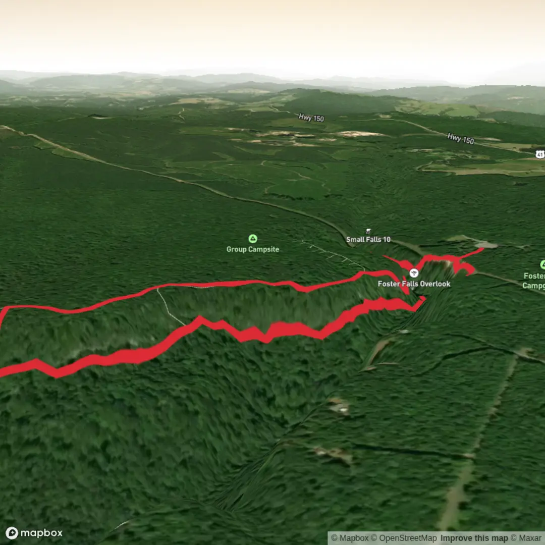
This moderate loop in the Foster Falls area of South Cumberland State Park packs a lot into a short outing: a major waterfall, a steep descent into a gorge, cliffside walking beneath sandstone walls, and a return along the southern end of the Fiery Gizzard Trail. Expect roughly 4 km / 2.5 miles overall with about 100 m / 330 ft of elevation gain, though the effort feels a bit bigger than the numbers suggest because the route drops sharply into the gorge and then climbs back out on uneven terrain. The hike begins at the Fiery Gizzard South / Foster Falls trailhead, whose commonly used address is 11745 U.S. 41, Monteagle, Tennessee 37356, just off US-41 near the Foster Falls Volunteer Fire Department. (friendsofsouthcumberland.org)
From the parking area, the opening section is straightforward and family-friendly, following a boardwalk and paved path toward the accessible overlook. This first stretch is short and easy, and it gives an early look into the gorge before the route becomes more rugged. Foster Falls itself drops about 60 ft / 18 m and is the tallest waterfall in the park, plunging into a deep pool that is especially striking after rain or during wetter seasons. (friendsofsouthcumberland.org)
What the route is like
After the overlook, the character of the hike changes quickly. The trail continues on the Foster Climbers’ Access Trail, descending by stairs and then a steeper footpath into the gorge. This is where the “medium” rating makes sense: footing can be rocky, slick, and rooty, and the climb back out is short but noticeably steep. Near the bottom, a cable bridge crosses below the falls, and a spur leads to the plunge pool. In warm weather this area attracts swimmers, but rocks around the water can be very slippery, and water levels can change the feel of the crossing and the base area. (friendsofsouthcumberland.org)
Continuing left from the base of the falls, the loop follows the cliff line on the Climbers Loop section. This is one of the most distinctive parts of the hike: tall sandstone bluffs rise overhead, and the path passes below many established climbing routes. Hikers should stay alert here, give climbers and belayers space, and watch for loose rock or gear activity near the wall. The tread can be rough and broken in places, so sturdy footwear is a better choice than casual sneakers. (friendsofsouthcumberland.org)
The route then climbs out of the gorge by one of the marked exits and joins the southernmost stretch of the Fiery Gizzard Trail. Back on top, the trail shifts again, trading the enclosed gorge for bluff-top walking and elevated views. One of the standout vantage points looks down toward the Foster Falls plunge pool from roughly 120 ft / 37 m above the water. From there, the trail continues past the Father Adamz campsite area, crosses a steel bridge over Little Gizzard Creek, and follows the stone wall above the falls before reconnecting with the boardwalk near the trailhead. (friendsofsouthcumberland.org)
Landmarks, terrain, and what to watch for
The waterfall is the obvious centerpiece, but the gorge itself is just as memorable. This part of the Cumberland Plateau is known for deep stream-cut ravines, rock shelters, bluff lines, and hemlock-rich coves, all shaped by the plateau’s resistant sandstone cap and the erosive power of creeks cutting through it. That geology is a big reason the hike feels dramatic despite its short length. (tn.gov)
Wildlife and plant life vary with season, but hikers should expect a mix of hardwood forest on the plateau and cooler, moister gorge habitat below. The broader Fiery Gizzard corridor is known for waterfalls, hemlock cove forest, steep cliffs, and rich wildflower habitat. Birds are often more noticeable than larger animals, and reptiles may be seen sunning on rocks in warm months. As in much of the Southeast, ticks, poison ivy, and heat are practical concerns in spring through early fall. After rain, mud and slick stone become more important hazards than mileage alone would suggest. (tn.gov)
For navigation, this is a good route to load in HiiKER before setting out, especially because several short connectors, overlook spurs, and climber access paths can make the area feel busier than a simple out-and-back waterfall

Comments and Reviews
User comments, reviews and discussions about the Foster Falls via Fiery Gizzard Trail and Climbers Loop Trail, Tennessee.
average rating out of 5
0 rating(s)