Download
3D Flyover
Add to list
More
61.8 km
~3 days
2037 m
Multi-Day
“Embark on the Cumberland Trail's New River Segment for a historical trek through Tennessee's rugged, biodiverse splendor.”
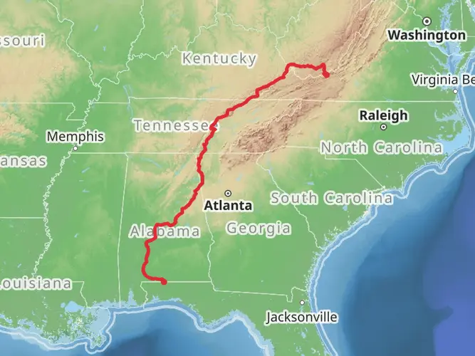
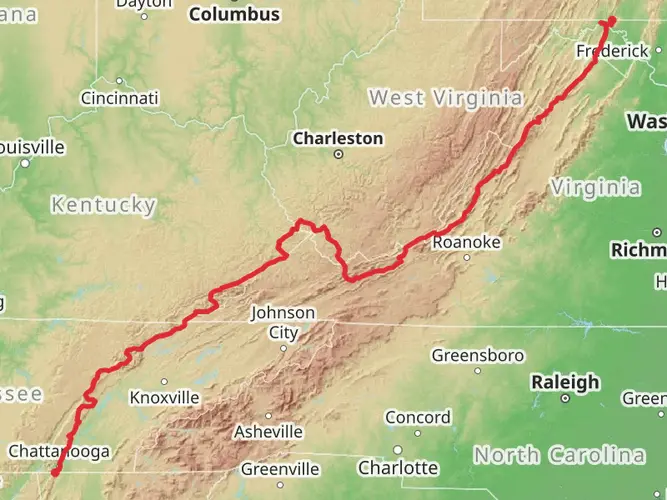
The Cumberland Trail - New River Segment is a challenging and rewarding point-to-point hike that spans approximately 62 kilometers (about 38.5 miles) with an elevation gain of around 2000 meters (approximately 6562 feet). This trail is nestled in the scenic region near Morgan County, Tennessee, and is known for its rugged terrain, rich biodiversity, and historical significance.
Getting to the Trailhead
To reach the trailhead, hikers can drive to the area near Morgan County. If you're coming from out of town, the closest major city with an airport is Knoxville, Tennessee. From Knoxville, you can rent a car and drive approximately 50 miles northwest to the trailhead. There is no direct public transportation to the trailhead, so a car is necessary for this journey.
Navigating the Trail
Hikers should prepare for a difficult trek, as the trail offers steep inclines and rocky paths. It's essential to have a reliable navigation tool like HiiKER to help stay on track, as the trail can be complex with its twists and turns through the dense forests of the Cumberland Plateau.
Landmarks and Natural Features
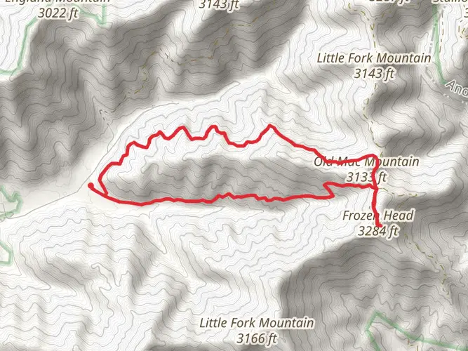
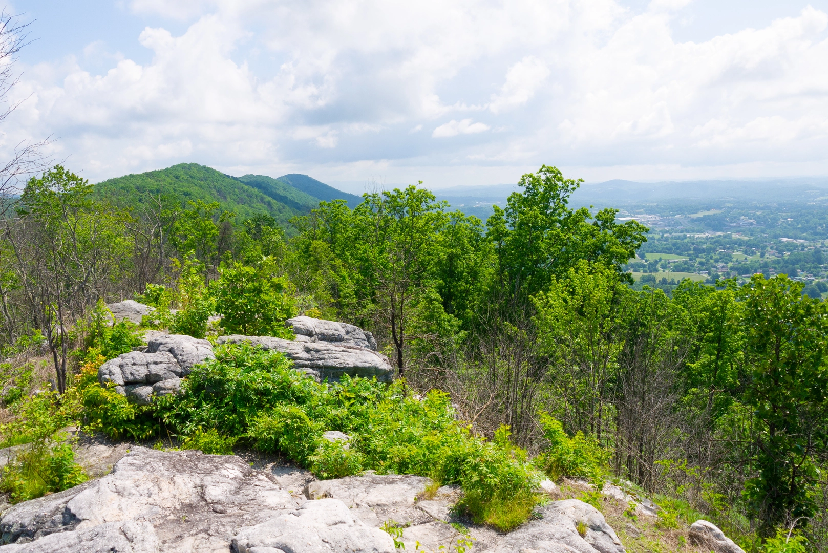
As you embark on the New River Segment of the Cumberland Trail, you'll be greeted by a diverse array of flora and fauna. The trail meanders through lush forests, home to oak, hickory, and pine trees, and crosses clear streams that are a vital part of the local ecosystem. Approximately 15 kilometers (9 miles) into the hike, you'll encounter the stunning Emory River Gorge, where the river cuts through the plateau, creating dramatic cliffs and waterfalls.
Wildlife is abundant, with the possibility of spotting white-tailed deer, wild turkeys, and a variety of bird species. The trail also offers a chance to see the colorful display of wildflowers in the spring and the rich hues of changing leaves in the fall.
Historical Significance
The region holds a deep historical significance, with the trail itself crossing paths with remnants of the past. Around the 30-kilometer (18.6-mile) mark, hikers will pass through areas that were once bustling with coal mining activity in the early 20th century. Abandoned mines and old railroad beds serve as a reminder of the region's industrial heritage.
Preparation and Safety
Given the trail's difficulty, it's crucial to be well-prepared with the right gear, including sturdy hiking boots, a map, and plenty of water. Weather conditions can change rapidly, so pack layers and be ready for varying temperatures. It's also wise to inform someone of your hiking plans and expected return time.
Conclusion
The Cumberland Trail - New River Segment offers an immersive experience into the natural beauty and history of Tennessee's wilderness. With its challenging terrain and stunning vistas, it's a hike that promises adventure and a deep connection with the great outdoors.

What to expect?
Activity types
Frequently asked questions
How long does the Cumberland Trail - New River Segment take to hike?
The Cumberland Trail - New River Segment is 61.83 km, or about 38.5 miles, with 2,037 m of climbing, so it is usually treated as a multi-day backpacking route rather than a single long day hike. Strong hikers often break it into 2 to 4 days depending on pace, shuttle logistics, and how much time is spent on steep climbs around Anderson Mountain, Cross Mountain, and the New River valley.
Where are the trailheads and parking for the Cumberland Trail - New River Segment?
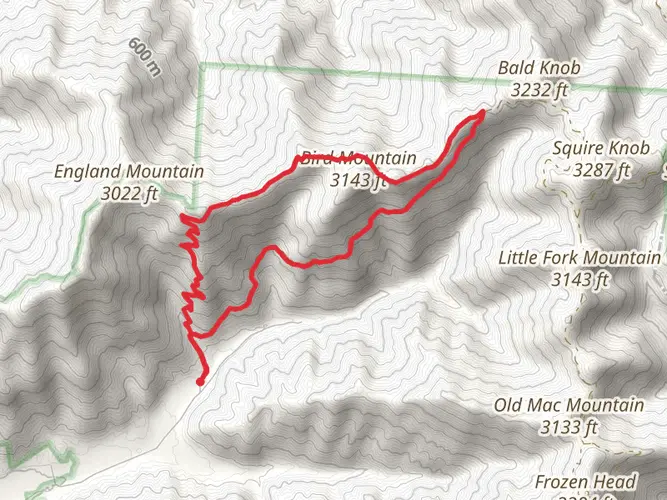
The segment runs between the northeast corner of Frozen Head State Park and the Bruce Gap Trailhead at Cove Lake State Park near Caryville. On the north end, Bruce Gap Road has a Cumberland Trail kiosk and parking area just off I-75 Exit 134, and the Anderson and Cross Mountains section also has parking at the Norma Road Trailhead, where a kiosk and gravel lot sit just before the trail crossing.
Is the Cumberland Trail - New River Segment difficult?
Yes. The Cumberland Trail - New River Segment is rated Difficult, and that fits the terrain: nearly 62 km of hiking with 2,037 m of elevation gain, long ridge climbs, rocky footing, and remote stretches. The official section description notes steep switchbacks, stone steps, old roadbeds, and rugged descents into creek valleys such as Greens Branch and Montgomery Fork.
What are the main landmarks on the Cumberland Trail - New River Segment?
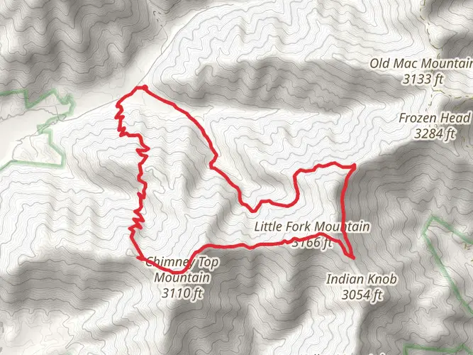
Notable features on the Cumberland Trail - New River Segment include the New River valley, Anderson Mountain, Cross Mountain, Greens Branch, Montgomery Fork Creek, Adkins Branch, the Red Ash Bridge, and the Bruce Gap Trailhead at Cove Lake State Park. The route also passes seasonal viewpoints, old mining benches, a 60-foot bluff line, and the highest elevation on the Cumberland Trail atop Cross Mountain.
Are dogs allowed on the Cumberland Trail - New River Segment?
Dogs are allowed on the Cumberland Trail, but they should be kept on a leash. That makes the Cumberland Trail - New River Segment an option for experienced hikers with trail-ready dogs, though the route is long, steep, and remote, with rocky sections, creek crossings, and limited easy bailout points, so it is better suited to strong backpacking teams than casual day outings.
Are there creek crossings on the Cumberland Trail - New River Segment?
Yes. The Cumberland Trail - New River Segment includes multiple stream and branch crossings, especially around Greens Branch, Montgomery Fork Creek, Adkins Branch, and Cove Creek. One official section note specifically warns that the Greens Branch footbridge was aging and that high-water conditions can affect access roads and crossings, so recent rain can make this segment significantly harder.
What is the best season to hike the Cumberland Trail - New River Segment?
Spring and fall are usually the best times for the Cumberland Trail - New River Segment. Spring brings wildflowers such as trillium, iris, and violets along the Anderson and Cross Mountains section, while fall and winter open up longer views through the hardwood forest into the surrounding valleys; summer can be much hotter and more humid on the long exposed climbs.
Comments and Reviews
User comments, reviews and discussions about the Cumberland Trail - New River Segment, Tennessee.
4.64
average rating out of 5
14 rating(s)