Download
3D Flyover
Add to list
More
7.2 km
~1 hrs 38 min
113 m
Out and Back
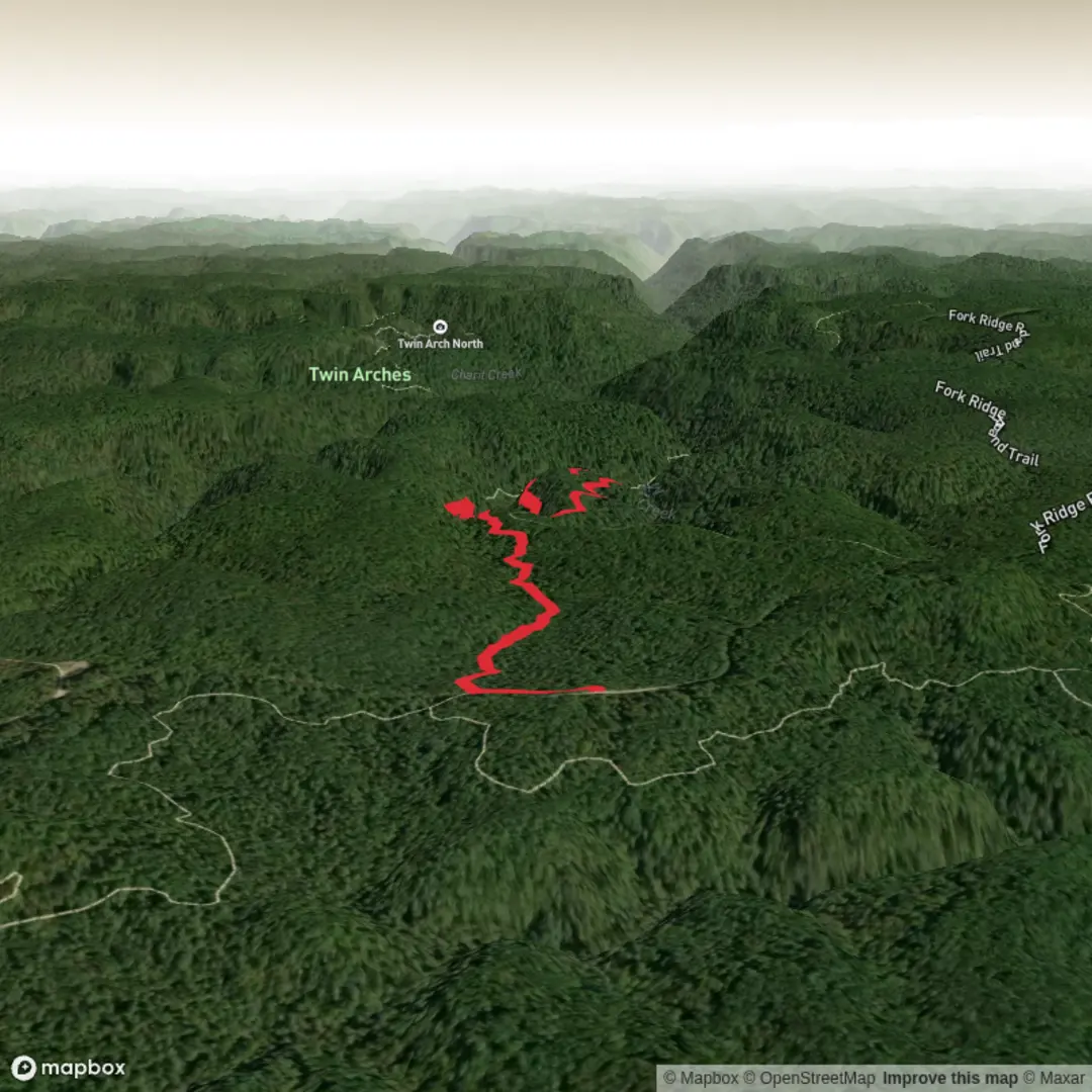
“A gentle plateau loop unfurls waterfalls, sandstone wonder, and hushed forest drama with a few slick spots.”
This easy loop near the Sawmill Trailhead in Big South Fork National River and Recreation Area packs a lot into a relatively short outing: a waterfall, a sandstone arch, broad forested ridges, and classic Cumberland Plateau scenery. Expect roughly 7 km / 4.3 miles overall with about 100 m / 330 ft of elevation gain, though nearby park materials also list a shorter Slave Falls/Needle Arch outing of about 2.4 miles / 3.9 km depending on exactly which connecting paths and loop options are used from the Sawmill area. (nps.gov)
The route is generally well suited to hikers looking for a relaxed half-day walk rather than a strenuous climb. The grade is modest by plateau standards, but the trail still includes uneven natural tread, exposed roots, rock steps, and potentially slick sections around the falls and under rock overhangs. After rain, the sandstone and leaf-covered ground can become slippery, so lightweight footwear with dependable grip is a better choice than casual trainers. In drier late-summer and fall conditions, the walking is often easier, but water flow over Slave Falls may be much lighter than in wetter seasons. (nps.gov)
The hike begins near the Sawmill Trailhead on Fork Ridge Road in the western Tennessee section of the park. The nearest clearly identified landmark for the start is the Sawmill Trailhead off Divide Road, reached by turning from Highway 154 onto Divide Road, continuing about 1 mile / 1.6 km, then turning right onto Fork Ridge Road. Needle Arch is specifically identified by the National Park Service as being reached from the Sawmill Trailhead on Fork Ridge Road. (nps.gov)
What to expect on the trail
The opening part of the walk usually moves through upland hardwood forest typical of the plateau, with a gentle rolling feel rather than a sustained ascent. This is the kind of terrain where the elevation gain is spread out in short rises and dips, so the route feels approachable for most walkers, families with trail experience, and anyone comfortable on natural surfaces. The forest here is often a mix of oak, hickory, maple, and tulip poplar, with seasonal wildflowers and ferns in moister pockets. Big South Fork and the adjoining Daniel Boone landscape are known for abundant wildlife, so hikers should keep an eye out for white-tailed deer, wild turkey, squirrels, songbirds, and signs of smaller mammals along the trail corridor. (fs.usda.gov)
One of the main landmarks is Slave Falls, a waterfall dropping about 60 ft / 18 m into the pool below. The falls are the visual centerpiece of the route and are usually most impressive after periods of rain or during wetter seasons. In dry spells, especially late summer and fall, the flow can shrink considerably, but the surrounding rock shelter, gorge walls, and cool, shaded setting still make this section worthwhile. Around the falls, expect damp rock, muddy patches, and a cooler microclimate than on the ridge. (nps.gov)
The other standout feature is Needle Arch, a delicate sandstone arch formed when erosion left a thin remnant standing apart from the larger rock shelter system it once belonged to. This is one of the classic geological sights in Big South Fork and gives the hike more variety than a simple waterfall out-and-back. The arch is a reminder that this landscape has been shaped over immense spans of time by water, weathering, and the gradual breakdown of the plateau’s sandstone cliffs and shelters. (nps.gov)
Geology, scenery, and trail character
This part of Big South Fork sits within the Cumberland Plateau, a region known for sandstone bluffs, rock shelters, arches, narrow gorges, and deeply dissected stream valleys. On this loop, that geology shows up in the form of overhangs, cliff-lined drainage, and the arch itself. Even on an easy-rated hike, these features create a more dramatic feel than the modest elevation profile suggests. The trail can alternate between open ridge walking and enclosed, shaded sections near the drainage, so temperatures may feel noticeably different from one segment to the next. (nps.gov)
Because the route passes through classic rock-shelter country, hikers should watch for dripping ledges, loose gravel on sloped bedrock, and shallow puddling after rain. In cooler months, wet rock can stay slick all day in shaded areas. Trekking poles are optional rather than essential here, but they can help on short descents near the falls or where the tread is covered in leaves.
Navigation is usually straightforward on established park trails, but it is still

Surfaces
Dirt
Unknown
Ground
Comments and Reviews
User comments, reviews and discussions about the Slave Falls Loop Trail, Tennessee.
average rating out of 5
0 rating(s)