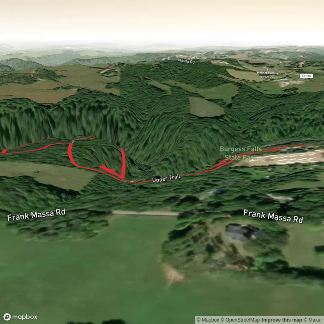
Little Falls, Middle Falls and Burgess Falls via River Trail and Upper Trail
Download
3D Flyover
Add to list
More
2.5 km
~33 min
40 m
Loop
“A short, vivid gorge walk delivers cascading falls, lush forest, and a few slippery surprises.”
This short waterfall walk in Burgess Falls State Park packs a lot into roughly 2 km / 1.2–1.5 miles, with very little overall elevation gain if you use the River Trail out and the Upper Trail back, though there are still some uneven sections, stairs, and short grades that can feel steeper than the numbers suggest. The route begins near Burgess Falls State Park, 4000 Burgess Falls Drive, Sparta, TN 38583, just off Tennessee State Route 135, about 12–13 miles southwest of Cookeville and roughly midway between Cookeville and Sparta. The park is open daily from 8:00 a.m. Central until 30 minutes before sunset. (tn.gov)
From the start, the walk follows the Falling Water River through one of Middle Tennessee’s best-known waterfall corridors. The broader natural area sits on the eastern edge of the Highland Rim, where the river drops nearly 250 feet / 76 m in less than 1 mile / 1.6 km, carving a steep limestone-and-shale gorge. That geology is the reason the waterfalls arrive in quick succession and why the overlooks feel so dramatic despite the hike’s short length. (tn.gov)
What to expect on the trail
The first part of the route is the easiest and most family-friendly, with a well-used path leading toward the river and the first viewpoints. Very early on, you reach the cascades area near the old dam, then continue to views of Little Falls, which drops about 30 feet / 9 m, followed farther downstream by Middle Falls, a larger cascade of about 80 feet / 24 m. The full loop to the main overlook is commonly listed at about 1.5 miles / 2.4 km, so if your planned outing focuses on Little Falls, Middle Falls, and the connecting Upper Trail return, expect a compact walk of around 2 km / 1.2 miles, depending on exactly where you turn around and how you link the paths. (en.wikipedia.org)
Although the hike is often described as easy because of its short distance, it is better approached as an easy walk with a few caution points. Surfaces can be rocky, damp, and slick near overlooks, especially after rain. The gorge edges are steep, and the river can be volatile in wet weather; the park may close during periods of high precipitation. Good footwear with grip is more useful here than the mileage alone would suggest. (en.wikipedia.org)
Landmarks, scenery, and natural interest
The main attraction is the sequence of waterfalls along the Falling Water River, but the surrounding forest is also worth noticing. The gorge supports mixed mesophytic forest more typical of richer Appalachian settings, including eastern hemlock, umbrella magnolia, cucumber magnolia, basswood, buckeye, maple, oak, hickory, tulip poplar, and beech. In spring, hikers may see wildflowers such as bloodroot, trillium, trout lily, columbine, foamflower, goldenseal, dwarf crested iris, and shooting star. (tn.gov)
Wildlife is typical of a wooded river gorge in Tennessee: songbirds are common, and quieter visitors may notice squirrels, chipmunks, reptiles basking on warm rock, and seasonal insect activity near the water. Because this is a protected natural area, it is best to expect a relatively undisturbed habitat rather than developed riverside recreation. Staying on the marked trail helps protect both the vegetation and the fragile gorge edges. The official park planning documents also note ongoing efforts to improve accessibility and overlook access in parts of the park, so trail conditions and facilities may evolve over time. (tn.gov)
Historical significance of the area
Burgess Falls is named for Tom Burgess, a Revolutionary War veteran who settled here in the 1810s. The Burgess family used the Falling Water River to power a grist mill and later a sawmill, supplying early settlers with meal and lumber. In the early 20th century, Cookeville also used the river for hydroelectric generation: an earthen dam was built in 1924, destroyed by flooding in 1928,

Comments and Reviews
User comments, reviews and discussions about the Little Falls, Middle Falls and Burgess Falls via River Trail and Upper Trail, Tennessee.
average rating out of 5
0 rating(s)