Download
3D Flyover
Add to list
More
3.4 km
~53 min
132 m
Out and Back
“A compact gorge adventure with blufftop drama, lush forest, and a slippery waterfall finale.”
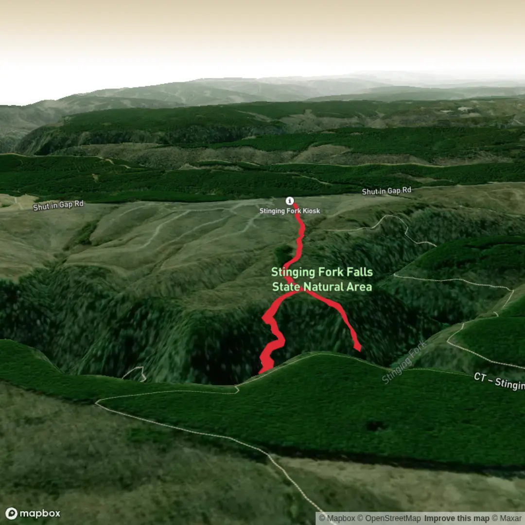
This is a short but rewarding out-and-back in the Stinging Fork Falls State Natural Area near Spring City, Tennessee, combining a gorge overlook with a waterfall finish. Expect roughly 3 km / 1.9 miles round trip with about 100 m / 330 feet of elevation change overall, which fits a medium rating well: the mileage is modest, but the descent into the gorge and the climb back out can feel steeper than the numbers suggest, especially on wet rock, roots, and leaf-covered tread. The route begins from the signed parking area on Shut-In Gap Road, about 5.1 miles / 8.2 km from the junction of US 27 and TN 68 in Spring City. The nearest significant access point is the Stinging Fork Falls Trailhead parking area on Shut-In Gap Road, west-northwest of downtown Spring City. (cumberlandtrail.org)
From the trailhead, the path heads into mixed forest and quickly reaches the main junction area. One branch leads toward Stinging Fork Falls, while a short yellow-blazed spur reaches the overlook above the gorge. If you include both highlights, the walk stays compact but varied: first a wooded approach, then a dramatic bluff view, then a descent toward the creek and falls. The terrain is typical Cumberland Plateau country, with a combination of packed dirt, exposed stone, short steeper pitches, and damp sections that can become slick after rain. The waterfall itself is about 30 feet / 9 m high, dropping into a rocky basin that often draws hikers to linger. (cumberlandtrail.org)
What to expect on the trail
The Indian Head overlook portion is the quicker payoff. The spur to the bluff is short, and the view opens over the Stinging Fork Gorge from a rock outcrop on the plateau edge. When leaves are off the trees, the sightlines are broader; in full leaf, the overlook still gives a strong sense of the gorge’s depth and the rugged relief of the surrounding forest. This section is where extra care matters most around edges, especially in damp or windy conditions. The rock can be uneven, and there may be little margin for error near the bluff. The Cumberland Trail Conservancy notes this overlook spur at about 0.5 mile / 0.8 km from the northern end of the section, at roughly 1,675 feet / 511 m elevation. (cumberlandtrail.org)
The waterfall leg descends more noticeably. As the trail drops toward the creek, footing becomes rougher and often wetter, with rocky steps, roots, and narrow sections. In wet weather, this is the part that can feel significantly more strenuous than a simple 3 km walk suggests. The falls are the main natural landmark: a compact but attractive cascade in a shaded gorge, framed by boulders, hemlocks, and rich cove vegetation. If there has been recent rain, the water flow is usually more impressive; in drier periods, the falls may be reduced. The return climb back to the trailhead is the effortful part of the outing, so hikers should save a little energy for the ascent. (cumberlandtrail.org)
Nature, wildlife, and seasonal conditions
This area sits within a biologically rich section of the Cumberland Plateau, where stream-cut gorges create cooler, moister microclimates than the plateau above. Along the route, hikers can expect mesophytic forest, with hemlock, mountain laurel, mixed hardwoods, mossy rock, and fern-lined creek edges. The broader Stinging Fork section is described by the Cumberland Trail Conservancy as passing through second- and third-growth mesophytic forest, which matches the lush feel of the gorge approach. (cumberlandtrail.org)
Wildlife can include white-tailed deer, salamanders, songbirds, small reptiles, and a variety of invertebrates associated with moist woodland habitat. In warmer months, ticks, mosquitoes, and stinging insects are worth preparing for, and poison ivy may appear along trail margins. Snakes are possible, as in much of eastern Tennessee, so it is wise to watch hand and foot placement around rocks and logs. After rain, creekside stones and wooden steps can be especially slippery, and the Conservancy specifically warns that rocky surfaces on this section become slick in wet weather. (cumberlandtrail.org)
Landmarks and regional significance
The most important landmarks on this hike are the gorge overlook and Stinging Fork Falls itself, but the setting also connects to the larger Cumberland Trail corridor. The nearby trail network forms part of Tennessee’s long-distance Cumberland Trail system, which links remote gorges, plateau rims, stream valleys, and mountain sections across the region. The Stinging Fork Falls area has been protected as a state natural area since 1973, preserving 783 acres / 317 hectares of scenic and ecological value in Rhea County.

Surfaces
Ground
Wood
Comments and Reviews
User comments, reviews and discussions about the Indian Head Overlook and Stinging Fork Falls, Tennessee.
average rating out of 5
0 rating(s)