Download
3D Flyover
Add to list
More
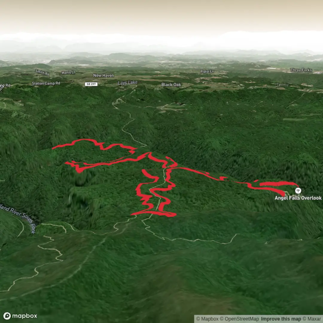
10.2 km
~2 hrs 16 min
135 m
Loop
“A gentle bluff-top ramble unfolds through sandstone forests to Angel Falls’ sweeping gorge panorama.”
This easy-going loop to Angel Falls Overlook explores one of the most scenic bluff-top sections of Big South Fork National River & Recreation Area in Tennessee. Expect roughly 10 km to 11 km (about 6.2 to 6.8 miles) if you stay on the core Grand Gap Loop route to the overlook and back to the trailhead, with only modest total climbing overall—around 100 m to 110 m (330 to 360 ft) on the flatter loop itself, though some mapped variants in the area are longer and add more elevation if you combine connectors. The route is generally best suited to hikers looking for a half-day outing with broad gorge views, sandstone features, and relatively gentle grades compared with many other Big South Fork hikes. (nps.gov)
The walk begins from the small Grand Gap Loop trailhead on Alfred Smith Road in the Bandy Creek area of Big South Fork, near Oneida, Tennessee. The nearest practical landmark is Bandy Creek Visitor Center / Bandy Creek area, with the trailhead reached by driving out Duncan Hollow Road and then turning onto Alfred Smith Road; the National Park Service notes the small trailhead parking is about 1.8 miles (2.9 km) down Alfred Smith Road. (nps.gov)
For drivers, the simplest approach is to head toward Bandy Creek, Big South Fork National River & Recreation Area, near Oneida, Tennessee, then continue via Duncan Hollow Road to Alfred Smith Road and the signed small parking area. Roads in this part of the park can be narrow and feel remote, so allow extra time and avoid assuming strong mobile coverage. For public transport, there is no meaningful direct transit service to the trailhead; most hikers will need a private vehicle or a drop-off arranged from Oneida or the surrounding Scott County area. (nps.gov)
What the route is like
Grand Gap Loop is a shared-use trail used by both hikers and mountain bikers, and the National Park Service describes it as a mostly flat, smooth singletrack with a few more technical sections. Hiked counterclockwise, it tends to flow well and brings the best overlooks in a natural sequence. The tread is usually straightforward, but roots, embedded rock, and short uneven patches can still catch tired feet, especially after rain. Because it stays on top of the plateau for most of its length, this route feels less strenuous than the steeper river-to-rim trails nearby. (nps.gov)
In the opening miles, the trail moves through mixed hardwood forest typical of the Cumberland Plateau. You can expect a pleasant rhythm of shaded woodland, occasional sandstone outcrops, and intermittent breaks in the trees where the land suddenly falls away into the gorge. Several rockshelters occur along the route, and these shallow sandstone recesses are one of the defining landscape features of Big South Fork. (nps.gov)
The highlight is Angel Falls Overlook, an exposed rock outcrop with a wide view over the Big South Fork gorge. From here, the river bends through the plateau far below, and the scale of the sandstone bluffs becomes much clearer than it does from inside the forest. Nearby sections of trail also offer additional rim views, including overlooks toward Fall Branch and the surrounding creek valleys. (hikingproject.com)
Landmarks, nature, and wildlife
The scenery here is classic Big South Fork: sandstone cliffs, deep-cut river gorge, bluff-edge forest, and seasonal wildflowers. Hiking Project notes that spring can be especially attractive, with wildflowers from the lower slopes up onto the bluff top, while the upper loop also passes through pockets of mountain laurel and hardwood forest. In leaf-off seasons, the overlooks tend to feel even bigger and more dramatic. (hikingproject.com)
Wildlife is varied across the park’s 125,000 acres (50,585 ha). Hikers may encounter white-tailed deer, wild turkey, songbirds, reptiles basking on warm rock, and a rich range of river and forest life typical of the Cumberland Plateau. The broader Big South Fork watershed is also known for exceptional aquatic biodiversity, with the Cumberland system historically supporting one of the richest temperate freshwater fish assemblages in the world. (nps.gov)
Because the overlook is

Surfaces
Ground
Unpaved
Comments and Reviews
User comments, reviews and discussions about the Angel Falls Overlook via Grand Gap Loop, Tennessee.
average rating out of 5
0 rating(s)