Download
3D Flyover
Add to list
More
9.4 km
~2 hrs 8 min
157 m
Out and Back
“A gentle riverside ramble rises to a stirring gorge panorama, with a final climb best judged personally.”
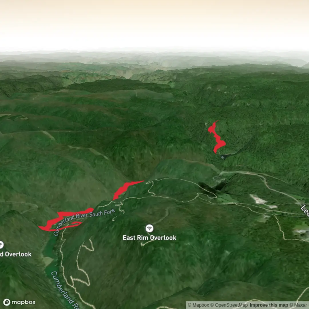
This outing in Big South Fork National River & Recreation Area is a scenic river-to-rim walk that starts gently and finishes with a short but more noticeable climb to a dramatic gorge overlook. Although your supplied figures suggest around 9 km with about 200 m of ascent, the commonly described route from Leatherwood Ford to Angel Falls Overlook and back is closer to 9.0 km / 5.6 miles round trip with roughly 150 m / 500 ft of elevation gain. Older National Park Service trail material also describes the main approach as 2.8 miles / 4.5 km one way to the overlook, with the final stretch reached by turning onto the Grand Gap Loop for about 350 yards / 320 m. (discoverscott.com)
The hike begins at Leatherwood Ford, near Leatherwood Ford Day Use Area, 4564 Leatherwood Road, Oneida, Tennessee 37841, one of the best-known access points in the park. From the parking area, the route crosses the historic low-water bridge and follows the John Muir Trail along the Big South Fork River. The first about 3.2 km / 2 miles are relatively easy, mostly ambling beside the water through forest and riverbank terrain before the trail crosses Fall Branch on a larger bridge. After that, the character changes: the route climbs about 1.3 km / 0.8 mile in switchbacks up to the bluff line, where a right turn on the Grand Gap Loop leads to the overlook itself. (npshistory.com)
What the route feels like
For an easy-rated hike, this one is forgiving at the start and more demanding near the end. Most hikers will find the riverside section straightforward, with a wide, pleasant tread and only modest undulation. The climb after Fall Branch is where you earn the view. It is not especially long, but it is the steepest part of the outing and can feel warmer and more strenuous on humid days. Expect the return trip to reverse that pattern: a quick descent from the rim, then an easier cruise back along the river. (npshistory.com)
Footing is usually manageable, but roots, damp leaves, and muddy patches can appear after rain, especially near streams and shaded sections. The overlook area is exposed and should be treated with care, particularly in wet or windy conditions. If you are planning with HiiKER, it is worth checking the route profile in advance so the late climb does not come as a surprise.
Landmarks, scenery, and notable features
The biggest visual contrast on this hike is the transition from river corridor to high bluff overlook. Early on, the Big South Fork River is the main companion, with long stretches of quiet water, boulders, and forested banks. This section is often appreciated for its calm, low-angle scenery rather than nonstop viewpoints. (npshistory.com)
A key landmark is Fall Branch, where the trail crosses a substantial bridge before beginning the ascent. From there, the switchbacks climb through mixed woodland toward the rim. At the top, Angel Falls Overlook opens out over the gorge, giving a broad perspective on the river’s course and the sandstone landscape that defines this part of the Cumberland Plateau. The overlook is named for Angel Falls Rapid below, a powerful rapid on the river rather than a vertical waterfall in the classic sense. National Park Service material specifically warns hikers to use caution near the rapid area, and paddlers are strongly encouraged to portage there because of hazardous water conditions. (npshistory.com)
The broader landscape is shaped by deep erosion into the Cumberland Plateau, creating the steep-sided gorge system for which Big South Fork is known. Regional trail information highlights the overlook as one of the standout viewpoints in this section of the park, and the surrounding Grand Gap area is known for cliff-top scenery above the river. (discoverscott.com)
Nature and wildlife
Expect a typical Big South Fork mix of hardwood forest, river-edge vegetation, sandstone bluffs, and seasonal wildflowers. In spring and early summer, the riverside section can be especially lush, while autumn brings strong color to the gorge. The forest and river corridor support common eastern woodland wildlife such as white-tailed deer, squirrels, songbirds, reptiles, and a variety of insects. Raptors may occasionally be seen using the gorge thermals near open viewpoints. This is also a good area to stay alert for ticks, poison ivy, and snakes, especially in warmer months.
Because the route spends time near water and then climbs into drier bluff terrain, temperatures can feel different between the bottom and the rim. Carry enough water even for a shorter hike, especially in summer,

Surfaces
Dirt
Unknown
Ground
Comments and Reviews
User comments, reviews and discussions about the Angel Falls Overlook via John Muir Trail, Tennessee.
average rating out of 5
0 rating(s)