Big Branch Falls, Martha's Pretty Point, Sheep Cave and Virgin Falls via Virgin Falls Trail
Download
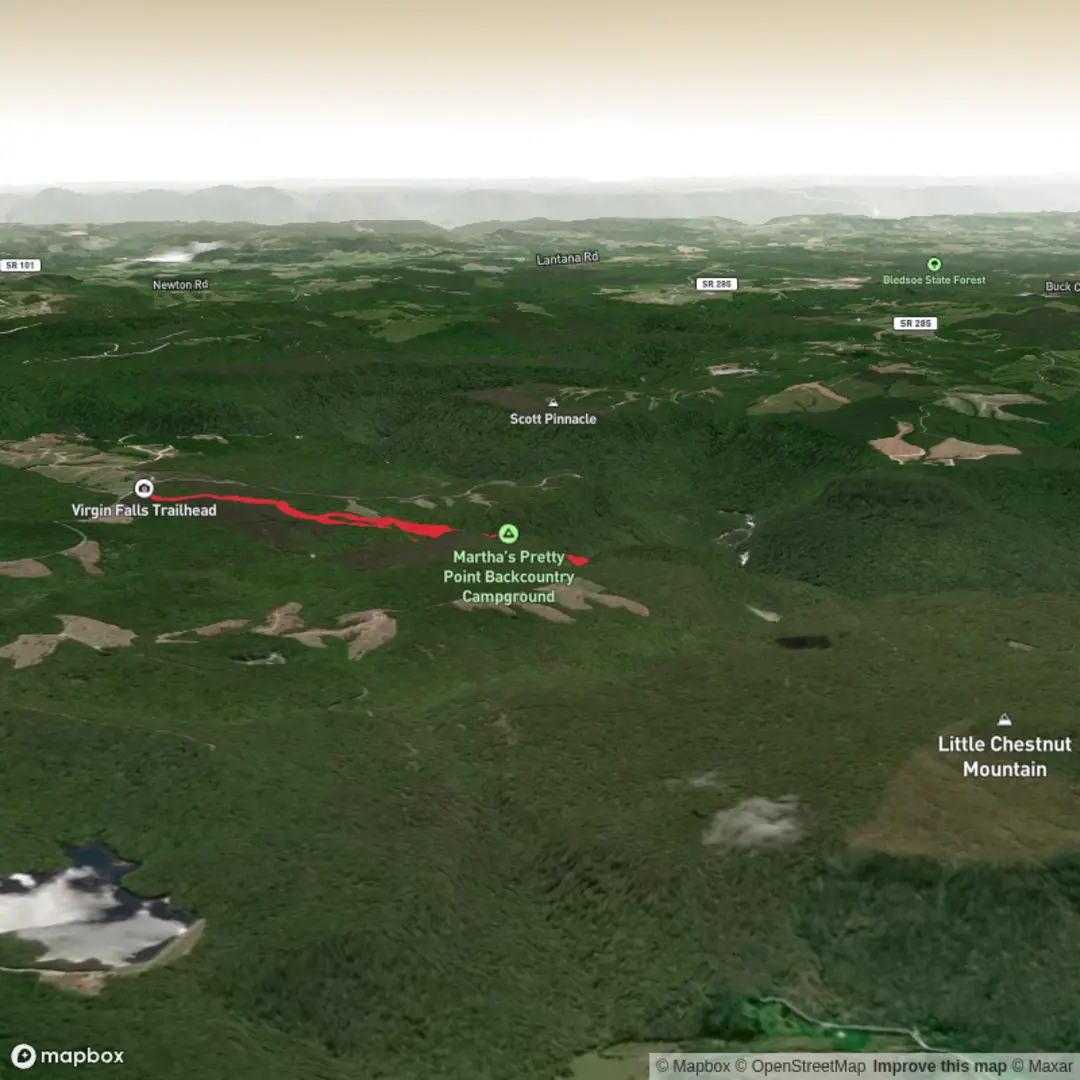
3D Flyover
Add to list
More
14.7 km
~3 hrs 39 min
424 m
Loop
“A rugged gorge adventure weaving caves, overlooks, and waterfalls into one memorable Tennessee day.”
This is a long, varied out-and-back in Virgin Falls State Natural Area near Sparta, Tennessee, with a route that links waterfalls, a major overlook, cave features, and rugged gorge scenery in one hike. Expect roughly 15 km / 9.3 miles overall with about 400 m / 1,300 ft of elevation gain, though exact totals can vary depending on whether you include every spur and viewpoint. The usual starting point is the Virgin Falls trailhead at 2080 Scotts Gulf Road, Sparta, Tennessee 38583, on the edge of the Scotts Gulf section of the Caney Fork watershed. (tn.gov)
The route begins in upland hardwood forest and quickly establishes the character of the day: uneven tread, repeated short climbs and descents, creek crossings, rock, roots, and damp sections that can become slick after rain. Although the distance is moderate for a full-day hike, the terrain makes it feel more demanding than the numbers suggest. A “Medium” rating is fair for strong day hikers in dry conditions, but it can feel closer to strenuous when the trail is wet, hot, or crowded, or if you are carrying extra water and camera gear for the falls. (tn.gov)
One of the first major landmarks is Big Branch Falls, reached near the early creek crossing area at about 2.0 km / 1.25 miles from the trailhead. This section gives a good preview of the area’s hydrology: streams slipping over limestone, water disappearing underground, and short side views into rock shelters and drainage cuts. The official trail mileage notes the crossing of Big Branch just above the falls, and this is one of the places where footing deserves attention, especially after rain or during leaf fall when slick rock can be hidden. (tn.gov)
Farther along, the route can be combined with the spur to Martha’s Pretty Point, one of the standout viewpoints in the natural area. The overlook sits high above Scotts Gulf with a dramatic view toward the Caney Fork River, roughly 275 m / 900 ft below. If included as part of your day, it adds a scenic contrast to the enclosed creek-and-cave sections of the main trail: broad gorge views, exposed bluff edges, and a better sense of the scale of the plateau landscape. (tn.gov)
Continuing deeper into the route, hikers reach the Sheep Cave junction at about 6.1 km / 3.8 miles from the trailhead. This is where the hike becomes especially interesting geologically. The area is known for caves, sinks, rockhouses, boulder fields, and streams that emerge from and vanish into the limestone. Sheep Cave and the nearby falls are part of that karst system, and the terrain around them is often damp, shaded, and uneven. Short steep pitches in this section can be tiring on the return, when the accumulated elevation gain starts to add up. (tn.gov)
The turnaround highlight is Virgin Falls, a striking waterfall that emerges from a cave, drops about 34 m / 110 ft, and then disappears into another cave at the base. It is one of Tennessee’s most unusual waterfall settings and the defining feature of the natural area. Depending on water levels, the falls can range from delicate to powerful, and the surrounding rock can stay slick even in dry weather. The official map also notes a spur leading to the top, where the creek issues from Virgin Falls Cave, but hikers should stay on designated paths and respect any closures or cave-protection measures in place. (waterfallguides.com)
What to expect on the ground
The trail surface is a mix of packed dirt, exposed roots, embedded stone, loose rock, and streamside sections. There are multiple places where hikers slow down naturally: creek crossings, narrow tread near drop-offs, and rocky approaches to waterfalls and cave mouths. Trekking poles can help on the return climb, especially if you are descending in the morning and climbing out in the warmer part of the day. Waterproof footwear is useful in wet seasons, but many hikers prefer grippy trail shoes if conditions are dry. Either way, traction matters more than ankle height here.
Water features are the main draw, but they are also the main hazard. After heavy rain, crossings can become more awkward and the rock around falls can be extremely slick. In dry periods, some cascades may be reduced, but the cave-and-karst scenery still makes the route worthwhile. Because this is a long out-and-back with several tempting side stops, it is smart to budget more time than the raw distance suggests. Using HiiKER before setting out is a good way to check the route shape, junctions, and turnaround timing.

Surfaces
Ground
Dirt
Unknown
Comments and Reviews
User comments, reviews and discussions about the Big Branch Falls, Martha's Pretty Point, Sheep Cave and Virgin Falls via Virgin Falls Trail, Tennessee.
average rating out of 5
0 rating(s)