Download
Preview
Add to list
More
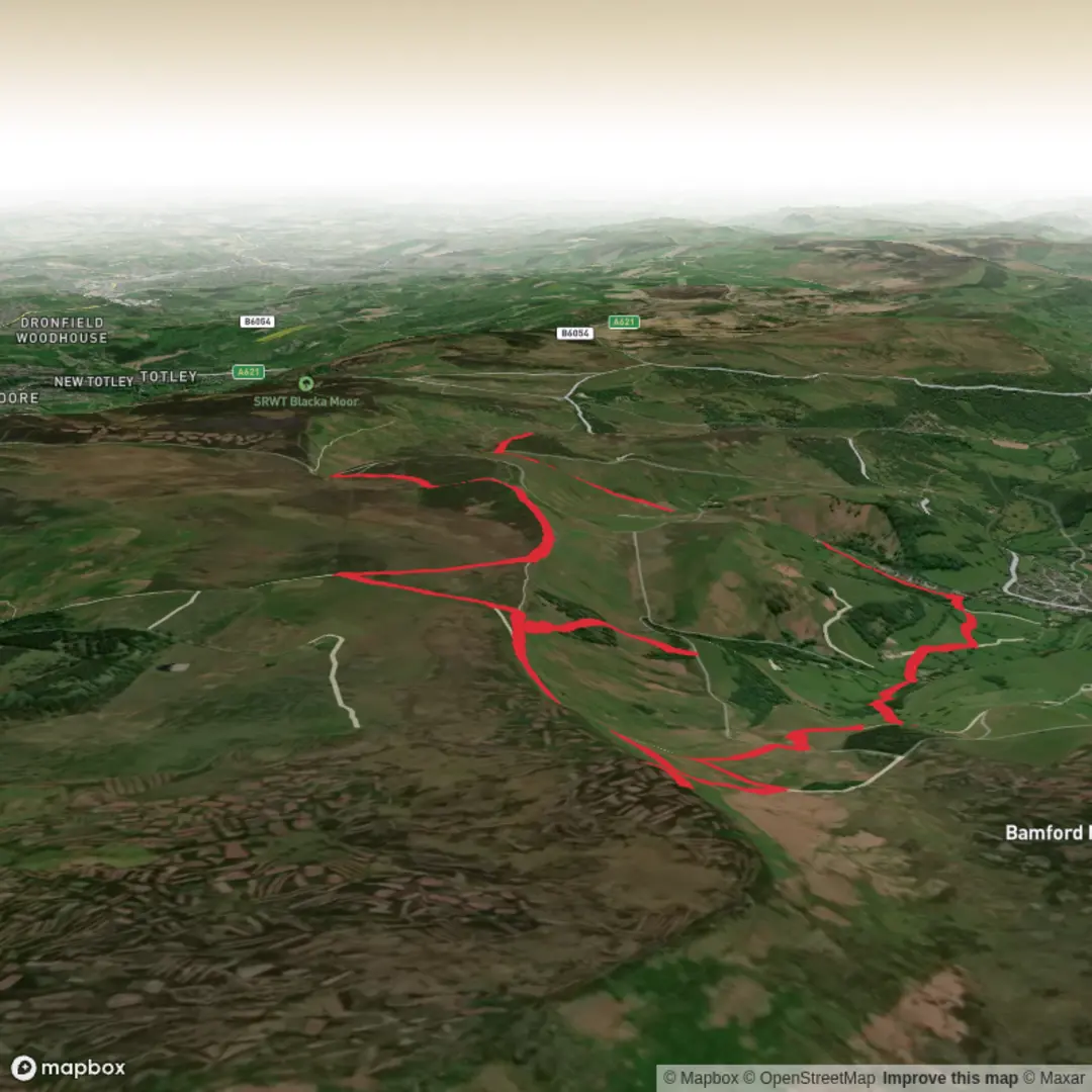
15.5 km
~3 hrs 57 min
512 m
Loop
Embark on a vibrant journey through the heart of England at the "Peak District National Park" hike scheduled for Jan 12. It's a medium difficulty trek, perfectly balanced for an exhilarating workout without overwhelming the avid hiker. On this 15.50 km hike, you'll experience an elevation gain of 513m and a descent of 538m, offering a truly dynamic trek for lovers of the great outdoors. Expect a solid commitment of 237 minutes of adventurous hiking. Though not a multi-day hike, every moment ensures an unforgettable experience. The journey starts and concludes at the same spot: Hollin Bank Road, Sheffield, offering ideal convenience. The plan provides an amazing opportunity to immerse yourself in the rugged beauty of the UK's heartland while challenging and rewarding yourself. Come explore the secrecy and charm of the Peak District!

Surfaces
Dirt
Unknown
Gravel
Unpaved
Paving Stones
Asphalt
Grass
Ground
Fine Gravel
Comments and Reviews
User comments, reviews and discussions about the Higger Tor, stanage Pole, Stanage Edge, High Neb, England.
5.0
average rating out of 5
2 rating(s)