Download
3D Flyover
Add to list
More
6.7 km
~1 hrs 35 min
147 m
Out and Back
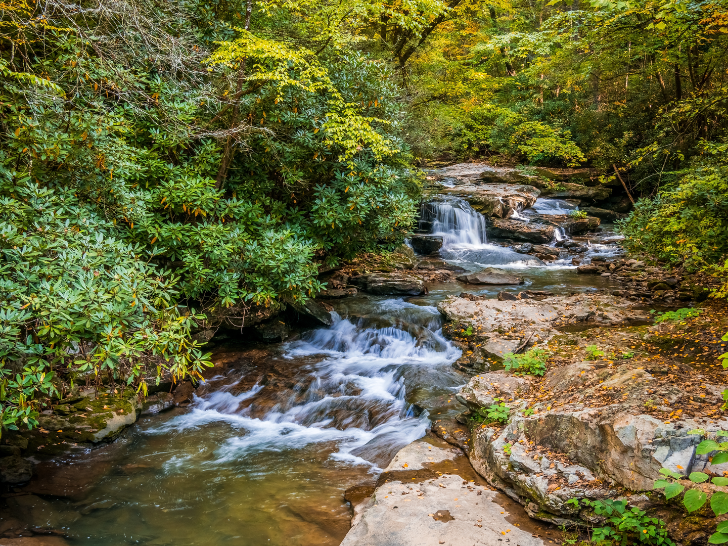
“Follow the Moormans River through rhododendron shade to Big Branch Falls, where stream crossings may surprise.”
You’ll start from the Sugar Hollow area on the western edge of Shenandoah National Park, following the North Fork Moormans River upstream to Big Branch Falls and returning the same way. For a ~7 km / ~4.3 mi outing with roughly ~100 m / ~330 ft of gain, expect a mostly gentle grade, a few short steeper pitches, and several stream crossings that can quickly change the day’s difficulty after rain.
Getting to the start (car + public transport)
Nearest well-known start point: the Sugar Hollow / Moormans River trailhead parking area at the end of Sugar Hollow Road (VA-614), just outside the Shenandoah National Park boundary near Sugar Hollow Reservoir (west of Charlottesville, near White Hall/Crozet). This is the common access for the North Fork Moormans River “boundary hike.” (en.wikipedia.org)
By car: From the Charlottesville area, you’ll generally approach via VA-614 (Sugar Hollow Road) through the White Hall area until the road dead-ends at the reservoir/trailhead parking. The lot is unpaved and can fill on weekends; have a backup plan for legal roadside parking if it’s crowded. (dwr.virginia.gov)
By public transport: There isn’t practical scheduled transit to the Sugar Hollow trailhead. The closest realistic option is to take transit into Charlottesville and then use a rideshare/taxi to reach the end of Sugar Hollow Road (plan for limited cell service near the trailhead and longer pickup times).
Navigation: Download the route in HiiKER before you arrive; service can be unreliable in the valley and along the river corridor.
What the trail is like (surface, grade, and crossings)
From the parking area, you’ll first walk a short stretch on a gravel road/old roadbed before committing to the yellow-blazed North Fork Moormans River Trail. Some itineraries include a brief road walk between parking areas before the singletrack begins. (myhikes.org)
The character is classic Blue Ridge river-trail: a narrow tread that weaves between rhododendron, hardwood forest, and riverbank, with frequent damp spots and roots. The elevation gain is modest overall (~100 m / ~330 ft), but the footing can make it feel “medium,” especially if you’re rock-hopping.
A defining feature is the set of multiple river crossings on the way to the falls—commonly described as three crossings. In normal flow they’re often straightforward rock hops or shallow wades; after storms they can become the crux of the hike. (lets-see-america.com)
Mile-by-mile expectations (approximate)
Distances vary a bit depending on exactly where you start/turn around, but for a ~7 km / ~4.3 mi out-and-back:
- 0.0–1.5 km (0.0–0.9 mi): Easy warm-up along the river corridor. You’ll hear water almost immediately, and the trail stays close to the North Fork. Expect muddy patches in low areas and slick rocks near the bank.
- ~1.5–3.0 km (0.9–1.9 mi): The first and second crossings typically appear in this middle portion. Look for stable, flat rocks; if you can’t see a safe line, don’t force it—water levels can rise fast in these steep drainages.
- ~3.0–3.5 km (1.9–2.2 mi): The final approach tends to feel a bit more enclosed and “hollower,” with thicker evergreen understory. The last crossing is often the one that decides whether boots stay dry.
Big Branch Falls is the payoff: a scenic cascade with a pool at the base in higher flow. In drier periods, the falls can be more delicate, but the setting remains shaded and cool. (ouradventuringfamily.com)
Landmarks, nature, and wildlife to watch for
- Sugar Hollow Reservoir / Moormans River watershed: You’re hiking in a drainage that’s closely tied to the region’s water supply. The **Sugar Hollow Reservoir was created by damming the Moormans River (constructed

Surfaces
Ground
Unpaved
Unknown
Comments and Reviews
User comments, reviews and discussions about the Big Branch Falls via N Fork Moormans River Trail, Virginia.
average rating out of 5
0 rating(s)