Download
3D Flyover
Add to list
More
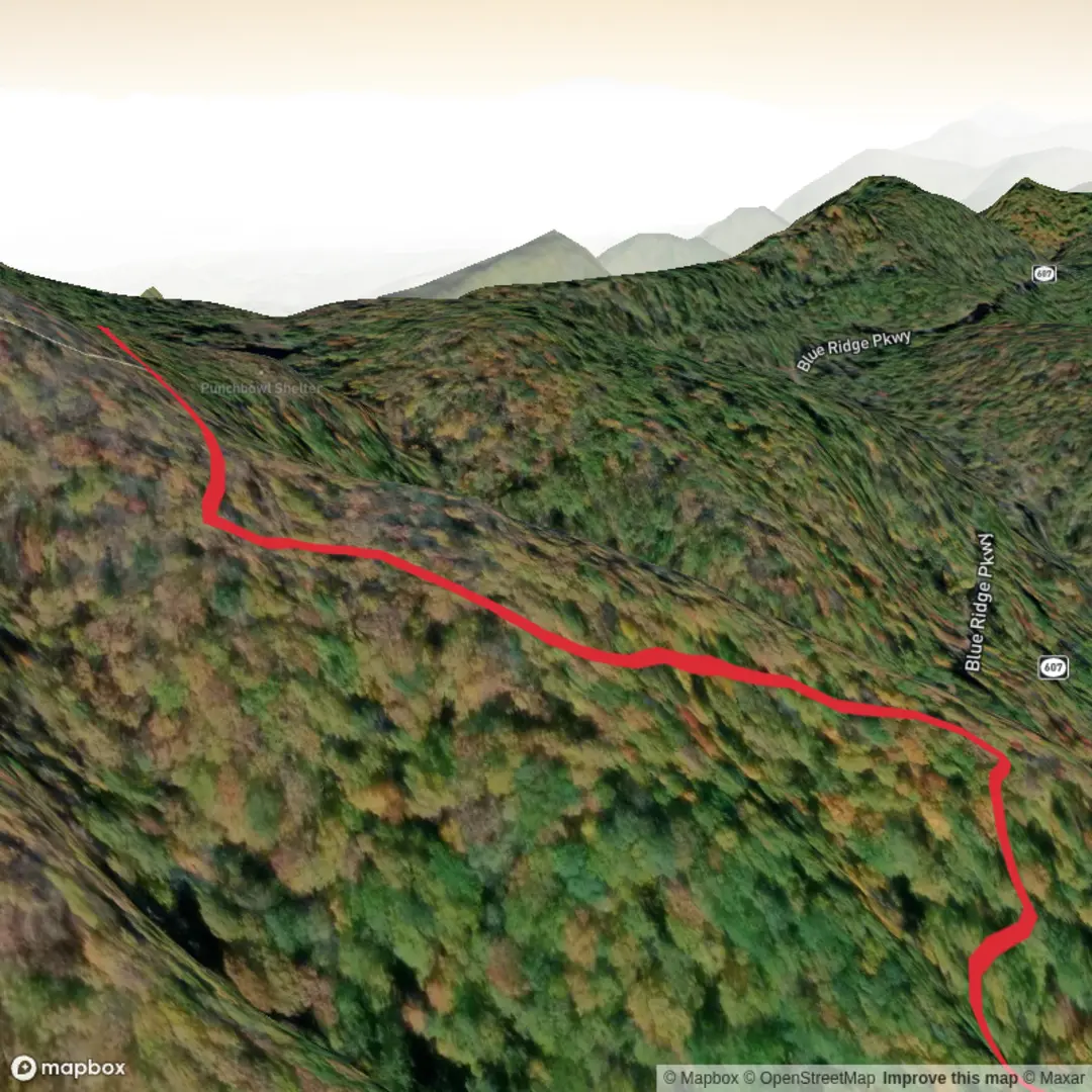
1.9 km
~35 min
132 m
Out and Back
“A short, steep pull through slick roots and rocky steps leads to a cool, bowl-like shelter nook.”
I’m missing a few key specifics to make this accurate (especially the start point). Please send either the trail’s GPS coordinates (lat, lon) for the trailhead or a HiiKER link, plus (if you have it) the state/park/nearest town. Once I have that, I’ll convert the coordinates to the nearest known address/landmark and tailor the route description, landmarks, hazards, and history to the correct “Punch Bowl Shelter Trail.”
In the meantime, here’s a planning-ready description based on what you provided (≈2 km / 1.2 mi, ≈100 m / 328 ft gain, rated Difficult), written so you can prepare—then I’ll refine it to the exact location as soon as you share the trailhead.
You’re looking at a short but punchy climb: about 2 km (1.2 mi) total with roughly 100 m (328 ft) of elevation gain. That works out to an average grade near 10%, which is why it can feel “Difficult” despite the low mileage—especially if the trail is rocky, rooty, or slick. Expect the effort to be concentrated into a relatively brief uphill, followed by a careful descent where footing matters more than fitness.
Getting to the trailhead (car + public transport)
By car: Most “shelter” trails in the U.S. are accessed from a forest road pull-off, small trailhead lot, or a gap/overlook parking area rather than a large visitor center. Plan for limited parking (often <10–20 vehicles). If you arrive late morning on weekends, have a backup plan for roadside parking rules and avoid blocking gates.
By public transport: These trailheads are often not directly served by transit. The most reliable approach is usually: - Take transit to the nearest town with service (bus/rail), then - Use a taxi/rideshare to the trailhead (service can be spotty in mountain areas), or - Arrange a shuttle with a local outfitter if one exists nearby.
If you send the lat/lon, I’ll tell you the nearest practical transit stop and the most realistic last-mile option.
What to put into HiiKER before you go: download the route for offline use, confirm the exact trailhead pin, and check whether the shelter is on a spur (common) so you don’t accidentally miss it at a junction.
You’ll typically start on a narrower footpath that gains elevation quickly. Over the first 0.5 km (0.3 mi) you may only gain 15–30 m (50–100 ft)—enough to warm up—then the trail often steepens. If the “Difficult” rating is accurate, expect one or more of these features: - Short, steep pitches where you’ll use hands for balance (not technical climbing, but “grab a root/rock” terrain) - Rock steps or eroded tread - Wet sections near seeps or drainages that turn into slick mud after rain
By around 1.0 km (0.6 mi) you’re often halfway to the shelter and may have gained 50–70 m (165–230 ft). This is where hikers tend to overheat—pace yourself, especially if the trail is enclosed and humid.
Terrain, footing, and what to watch for
Even on a 2 km (1.2 mi) hike, the “Difficult” label usually comes from footing and grade, not endurance. Plan for: - Loose rock / gravel on steeper sections (easy to slide on descent) - Roots acting like wet rungs if it’s been raining - Leaf litter hiding ankle-twisting rocks in shoulder seasons - Blowdowns (downed trees) that can force short detours—use HiiKER to confirm you rejoin the tread
If there’s any stream crossing (even minor), treat it as a slip hazard. After storms, small drainages can run higher than expected and undercut the trail edge.
Shelter area and landmarks
A “Punch Bowl” name often refers to a bowl-shaped hollow, a water-carved basin, or a natural amphitheater-like depression. If the shelter is named for that feature, the last approach may contour into a more protected, concave landform where air feels cooler and moisture lingers—good for shade, but also where mud and slick rock persist longer.
At roughly 1.0–1.2 km (0.6–0.75 mi) you’ll likely reach the shelter area (or a junction to a short spur). Shelters commonly sit: - Near a reliable water source (spring/creek) or on a slightly raised bench above it - In a flat spot suitable for resting and (where permitted) dispersed camping nearby
If you’re planning to rely on water, bring a filter and confirm on HiiKER whether the source is seasonal. In dry spells, springs can slow to a trickle.
Nature and wildlife you may encounter
Without the exact state/region I can’t responsibly list specific species, but on steep, short shelter trails in forested U.S. terrain, you should plan for: - Dense understory in warmer months (ticks thrive here) - Bird activity around edges and openings near the shelter - Small mammals habituated to food scraps around shelters (protect your snacks)
Safety notes that apply broadly: - Do a tick check after the hike; use repellent and consider long socks. - Store food securely while resting

Surfaces
Ground
Unknown
Asphalt
Comments and Reviews
User comments, reviews and discussions about the Punch Bowl Shelter Trail, Virginia.
average rating out of 5
0 rating(s)