Download
3D Flyover
Add to list
More
24.0 km
~6 hrs 6 min
785 m
Multi-Day
“Embark on the Torry Ridge - Mills Creek Loop for a historic, wildlife-rich hike with spectacular Blue Ridge vistas.”
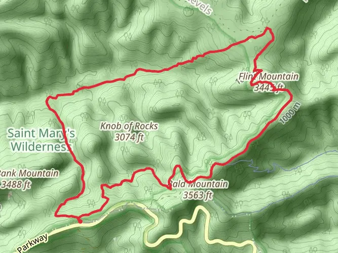
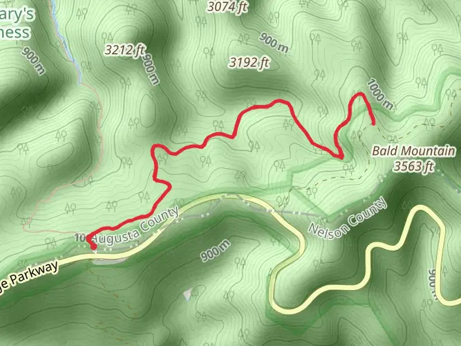
The Torry Ridge - Mills Creek Loop is a challenging and rewarding hike located near Augusta County, Virginia. This approximately 24-kilometer (15-mile) loop trail offers an elevation gain of around 700 meters (2300 feet), presenting hikers with a variety of terrains and breathtaking views of the Blue Ridge Mountains.
Getting There
To reach the trailhead, hikers can drive to the Blue Ridge Parkway, a scenic route that runs through Virginia. The closest significant landmark to the trailhead is the Sherando Lake Recreation Area, which is accessible via Sherando Lake Road off of US Highway 250. There is no direct public transportation to the trailhead, so arriving by car is the most feasible option.
Trail Experience
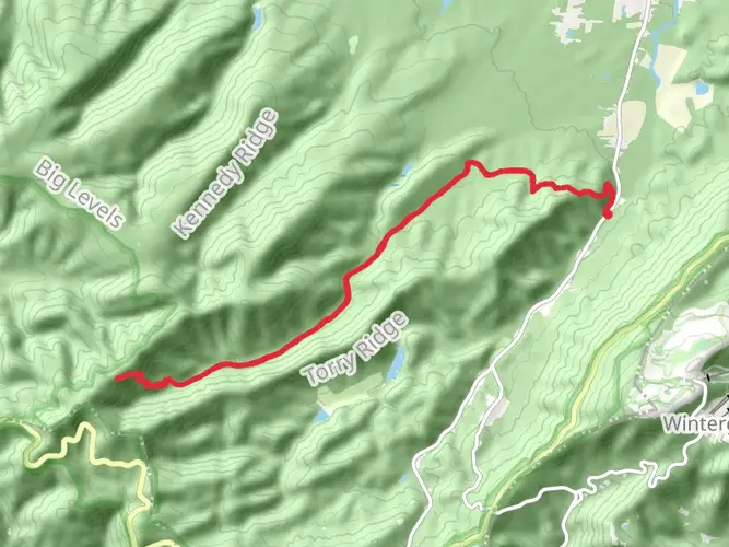
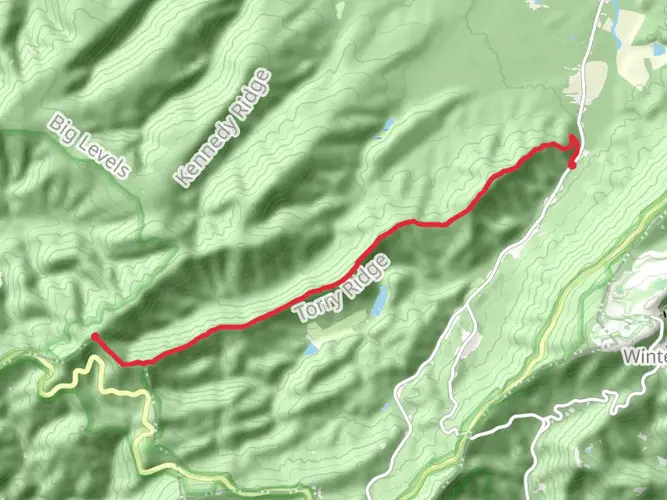
The hike begins with a steady climb up Torry Ridge, where hikers will be treated to the first of many panoramic views. The trail is well-marked, but carrying a navigation tool like HiiKER is recommended to stay on track and monitor progress. As the trail ascends, the mixed hardwood forest provides a canopy of shade, with occasional clearings that offer glimpses of the surrounding mountains.
Flora and Fauna
The area is rich in biodiversity, with a variety of plant life that changes with the seasons. Springtime brings wildflowers, while autumn showcases a vibrant display of fall foliage. Wildlife is abundant, and while hiking, one might spot deer, black bears, and a variety of bird species. It's important to be aware of your surroundings and to know what to do if you encounter wildlife.
Historical Significance
The region is steeped in history, with the Blue Ridge Mountains playing a significant role during the early settlement of Virginia and the subsequent development of the United States. The area around the trail was once inhabited by indigenous peoples, and later by European settlers who utilized the natural resources of the forests and mountains.
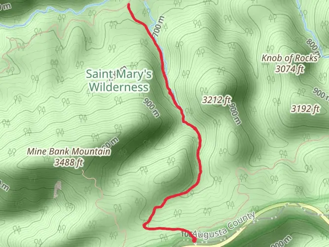
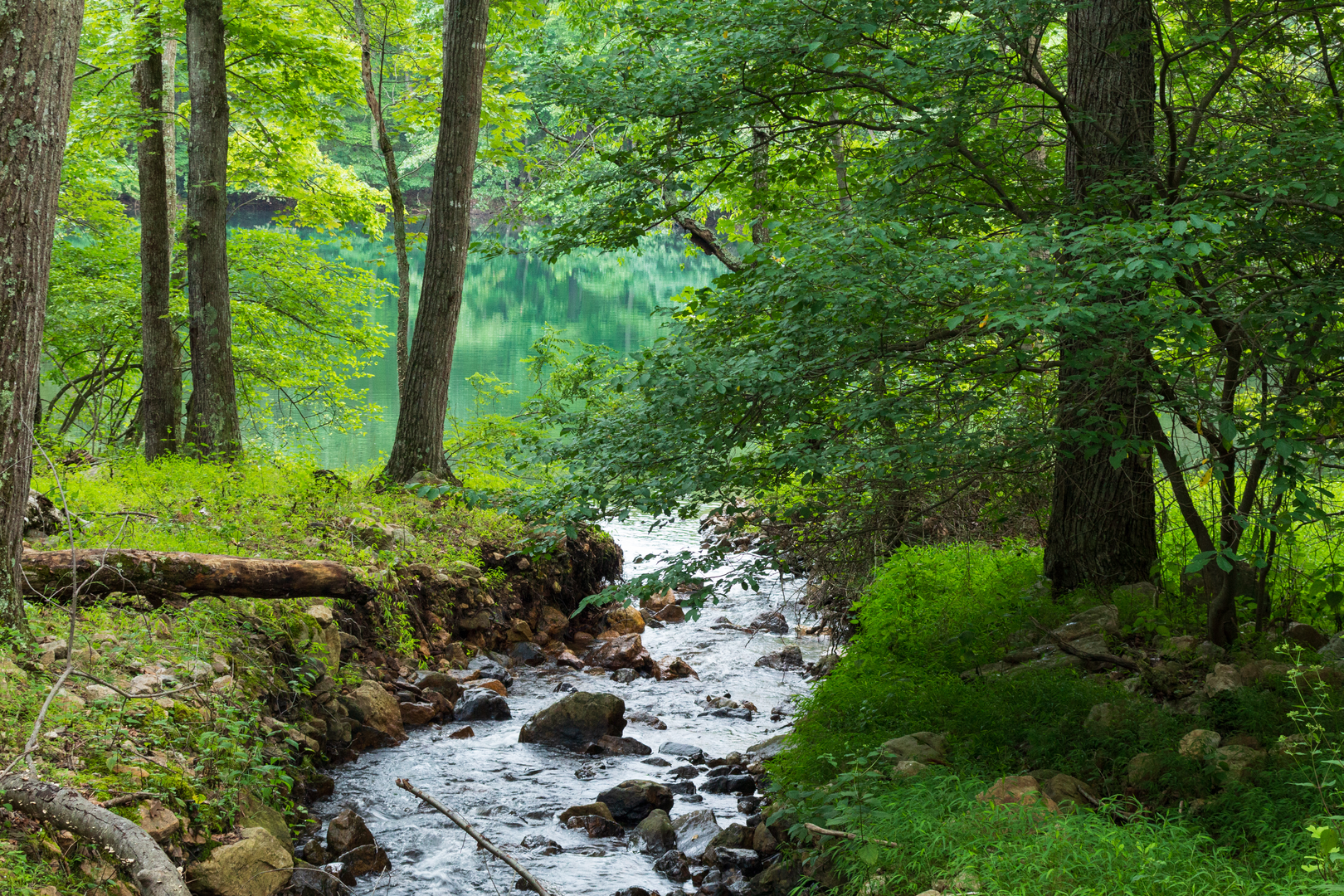
Mills Creek and Waterfalls
Approximately halfway through the hike, the trail descends towards Mills Creek. This area is a highlight for many hikers, featuring serene creek views and the chance to spot a waterfall, especially after periods of heavy rain. The sound of cascading water is a refreshing reward after the initial climb.
Preparing for the Hike
Given the trail's difficulty rating and length, it's essential to be well-prepared. Hikers should bring plenty of water, snacks, and a first-aid kit. Sturdy hiking boots are recommended due to the rocky and sometimes steep terrain. Weather can change quickly in the mountains, so layered clothing and rain gear are advisable.
Navigating the Loop
The loop can be hiked in either direction, but many choose to tackle the steeper sections first by going clockwise. This allows for a more gradual descent towards the end of the hike. Hikers should plan for a full day on the trail, starting early to ensure enough daylight to complete the hike safely.
Conclusion
The Torry Ridge - Mills Creek Loop is a hike that offers a bit of everything: challenging climbs, diverse ecosystems, historical context, and stunning natural beauty. It's a trail that demands respect and preparation, but the rewards for those who take it on are immense.

What to expect?
Activity types
Frequently asked questions
How long does the Torry Ridge - Mills Creek Loop usually take to hike?
The Torry Ridge - Mills Creek Loop is about 23.99 km, or roughly 14.9 miles, with 785 m of climbing. On a difficult loop of that length and elevation gain, most hikers should expect a full-day outing, and some split it into an overnight trip because the route is classified as multi-day.
Where do you start the Torry Ridge - Mills Creek Loop in Augusta County, Virginia?
The Torry Ridge - Mills Creek Loop is commonly accessed from the Sherando Lake area in Augusta County, with approach roads linking to the Blue Ridge Parkway near Bald Mountain Overlook at milepost 22. The Mills Creek Trail also has a trailhead at the Bald Mountain Jeep Trail, reached from the overlook via Forest Service Road 162 and Mount Torry Road through Sherando.
Is the Torry Ridge - Mills Creek Loop a hard hike?
Yes. The Torry Ridge - Mills Creek Loop is rated difficult, and the numbers explain why: nearly 24 km of hiking with about 785 m, or 2,575 feet, of elevation gain. That combination makes it better suited to hikers comfortable with sustained climbing, longer mileage, and a full day on rugged mountain terrain.
Can you backpack the Torry Ridge - Mills Creek Loop, or is it only a day hike?
The Torry Ridge - Mills Creek Loop can be done either way. At 23.99 km with difficult grading, it is long enough for a strong day hike, but its official trail type is multi-day, so it also fits a short backpacking trip for hikers who prefer to spread the mileage and climbing over more than one day.
What landmarks are near the Torry Ridge - Mills Creek Loop trailhead?
Key landmarks near the Torry Ridge - Mills Creek Loop include Sherando Lake Recreation Area, the Blue Ridge Parkway, and Bald Mountain Overlook at milepost 22. The route sits in the Blue Ridge near the community of Sherando, which helps narrow down the correct access roads and trail junctions for Torry Ridge and Mills Creek.
Is parking available for the Torry Ridge - Mills Creek Loop?
Parking for the Torry Ridge - Mills Creek Loop is typically tied to the access points near Sherando Lake Recreation Area and the Blue Ridge Parkway approach at Bald Mountain Overlook. Because one trailhead for Mills Creek is reached from Bald Mountain Overlook at milepost 22, parking is generally associated with that overlook area and nearby Forest Service access roads.
What is the best time of year to hike the Torry Ridge - Mills Creek Loop?
Spring through fall is usually the most straightforward season for the Torry Ridge - Mills Creek Loop. The route is reached from the Blue Ridge Parkway, and Parkway sections in Virginia can close in winter because of ice and snow, so cold-season access is less reliable even when lower roads around Sherando remain open.
Comments and Reviews
User comments, reviews and discussions about the Torry Ridge - Mills Creek Loop, Virginia.
4.5
average rating out of 5
8 rating(s)