Download
3D Flyover
Add to list
More
5.0 km
~1 hrs 7 min
75 m
Loop
“A gentle lakeside loop of water-glints and forest hush, with a few brief, punchy rises.”
A short, low-elevation loop of roughly 5 km (3.1 mi) with about 100 m (330 ft) of climbing, this walk is well-suited to beginners, families, and anyone looking for a relaxed outing with frequent water views and forest-edge scenery. Expect a mix of compacted dirt path and narrower singletrack, with a few short, slightly steeper pitches where most of the elevation gain is concentrated.
Getting to the trailhead (car + public transport)
I’m missing the key location details needed to give accurate directions and to convert coordinates to a nearby address/landmark:
- Where is the hike? (State/province + nearest town/city, or the park/forest name)
- “Hike head: near …” looks incomplete
- If you have them, share the trailhead coordinates (lat/long) or a parking lot name (even a rough pin is fine)
Once you send that, I can: - Provide the nearest known address or significant landmark to the trailhead (instead of raw coordinates), - Give driving approach + parking expectations, and - Suggest the most realistic public transport stop(s) and the final walk-in distance.
What to expect on the loop (distance, grade, and footing)
For planning purposes, a 5 km / 3.1 mi easy loop with ~100 m / 330 ft gain usually breaks down like this:
- First 1–1.5 km (0.6–0.9 mi): gentle warm-up on wider trail or old track, often the most “social” section with the clearest tread.
- Middle portion: the loop typically narrows and becomes more “trail-like,” with the short climbs that account for most of the elevation gain (think a couple of brief rises rather than a sustained hill).
- Final 1–2 km (0.6–1.2 mi): tends to mellow out again as it returns toward the access point, sometimes with slightly wetter ground near lake margins or drainage lines.
Underfoot, plan for: - Firm dirt and small gravel in dry weather, - Mud patches after rain (especially where the trail skirts low ground near the lake), - Occasional roots and short rocky steps where the trail climbs away from the shoreline.
If you’re navigating, load the route in HiiKER before you arrive and download it for offline use—short lake loops often have side paths that look tempting and can pull you off-route if you’re not watching your track.
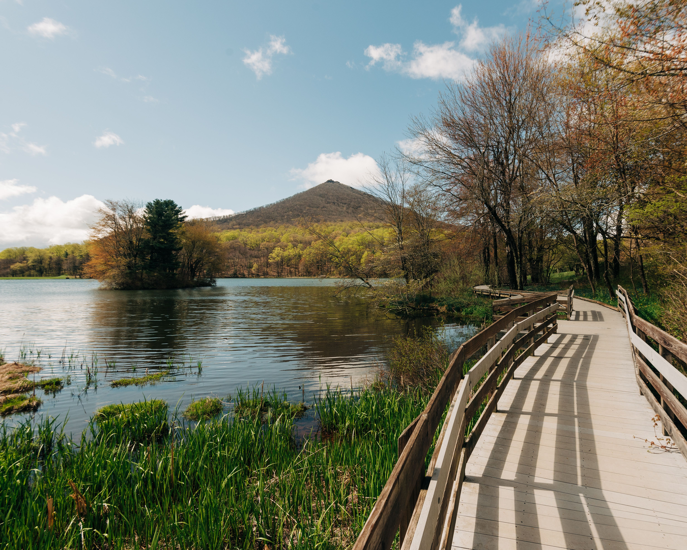
Abbott Lake: scenery, nature, and wildlife cues
The lake is the main landmark and the place where the hike feels most “special” for the effort. Even on an easy loop, lakeside sections can change character quickly with weather:
- Wind-exposed edges: cooler temperatures and stronger gusts near open water—bring a light layer even on mild days.
- Shoreline vegetation: reeds/sedges and wetland plants often indicate softer ground; step carefully to avoid slipping or widening the trail.
- Birdlife: lakes commonly attract waterfowl and songbirds along the forest edge. Early morning and late afternoon are typically the most active times.
- Insect season: if this is in a mosquito-prone region, the calm, shaded lake margins can be buggy—pack repellent in warmer months.
Wildlife considerations (general, location-dependent): - Keep food sealed and avoid leaving packs unattended—small mammals learn quickly around popular lakes. - If you’re in bear country, carry and know how to use appropriate deterrents and make noise in thicker vegetation. - Dogs should be leashed near wetlands and nesting areas to avoid disturbing birds and other wildlife.
Landmarks and “decision points” to watch for
Easy loops still have a few spots where people most often take a wrong turn:
- Loop split / junction: usually within the first third of the hike. Decide your direction (clockwise/counterclockwise) and confirm in HiiKER so you don’t accidentally do an out-and-back.
- Spur paths to viewpoints or fishing spots: these can look like the main trail. If the tread suddenly becomes faint or drops steeply toward the water, check your position.
- Wet crossings / drainage dips: after rain, the “best-looking” line may shift. Look for durable surfaces (rock, firm soil) and avoid trampling vegetation to bypass mud.
Practical prep for an easy 5 km (3.1 mi) lake loop
- Time: most hikers take 1–2 hours, depending on stops.
- Footwear: light hikers or trail runners are fine in dry conditions; choose something with better tread if it’s been wet.
- Water: for a short loop, 0.5–1 L is usually plenty, more in heat.
- Layers: lakes can feel cooler than nearby roads/trailheads due to wind and shade.
- Safety: tell someone your plan; cell coverage can be inconsistent around low terrain and forest edges.
Historical significance (once you confirm the location)
“Johnson Trail” and “Abbott Lake” are names that appear in multiple regions, and the historical context depends heavily on which one this is. After you share the state/province + nearest town (or coordinates), I’ll add accurate, place-specific notes such as: - Indigenous history and traditional land use, - Settlement-era routes, logging/mining remnants, or old access roads, - Park/land management history (protected area designation, restoration work, etc.).
Send the trailhead coordinates or the nearest town/park name, and I’ll rewrite this with precise turn-by-turn expectations, the nearest address/landmark for the start, and

Surfaces
Ground
Paved
Unknown
Asphalt
Wood
Comments and Reviews
User comments, reviews and discussions about the Johnson Trail and Abbott Lake Loop, Virginia.
average rating out of 5
0 rating(s)