Download
3D Flyover
Add to list
More
13.9 km
~3 hrs 31 min
447 m
Out and Back
“A breezy balds-to-forest loop on Wilburn Ridge—ponies, rocky scrambles, and weather that ups the drama.”
This medium loop/climb to Virginia’s high point mixes open balds, rocky ridge-walking, and classic Appalachian Trail forest—short enough to do in a half day, but exposed enough that weather and footing can make it feel bigger than the numbers suggest. Expect roughly 14 km / 8.7 mi with about 500 m / 1,640 ft of total ascent, with the “work” coming in steady, rolling climbs rather than one long grind.
Getting to the start (car + public transport options)
By car: The most common and practical start is from the Massie Gap / Wilburn Ridge Trailhead area in Grayson Highlands State Park, near Massie Gap (the main gap/parking area on VA-600 / Grayson Highlands Lane). If you’re navigating, aim for Massie Gap Parking Area (a well-known landmark and signed hub for Wilburn Ridge and the Appalachian Trail). Arrive early on weekends—this is one of the busiest trailheads in southwest Virginia.
- Parking/fees: Grayson Highlands State Park typically charges a day-use fee at certain times; bring a card/cash just in case and check current park notices before you go.
- Road notes: Access roads can be foggy and slick; in winter, ice and wind exposure up high can be serious even when valleys are mild.
By public transport: There’s no straightforward bus/train that drops you at the trailhead. The closest realistic approach is: - Get to Marion, VA (regional bus options sometimes serve Marion), then arrange a taxi/rideshare (availability can be limited) or a local shuttle from an outfitter/host in the Mount Rogers/Grayson Highlands area. - If you’re coming from farther away, the nearest larger hubs are Abingdon, VA and Bristol, VA/TN, then you’ll still need a pre-arranged ride to Massie Gap.
If you’re relying on a ride, plan your pickup window conservatively—slow hiking over rock and crowds around the balds can add time.
What the route feels like (terrain, pacing, and where the effort is)
From Massie Gap you’ll quickly transition from mixed woods into the open highlands character that makes this area famous. The Wilburn Ridge Trail is the star early on: it climbs onto a rocky spine with frequent short scrambles and step-ups. None of it is technical climbing, but you’ll use hands for balance in spots, and wet rock can be slick.
- First 2–4 km (1.2–2.5 mi): Gradual warm-up through forest and meadow edges, then the ridge begins to assert itself.
- Middle ridge section (roughly 4–8 km / 2.5–5 mi): The most rugged footing—rocky outcrops, uneven stone, and constant micro-ups/downs that quietly add to the elevation gain.
- Later approach to Mount Rogers (varies by exact junction choices): The Appalachian Trail portion trends more sheltered and forested, with a steadier grade and fewer rock “moves,” but it can be muddier.
Because the route rolls, your total ascent can feel higher than expected. Budget extra time if you like photography or if visibility is good—people naturally linger on the balds.
Landmarks and scenery you should expect
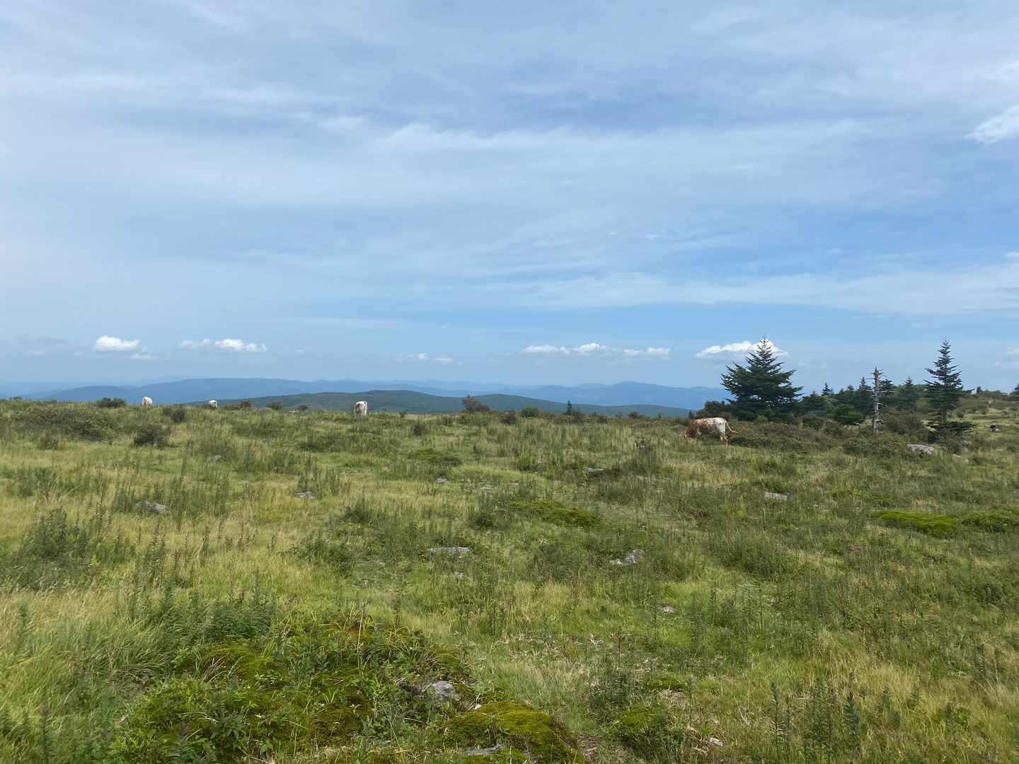
Wilburn Ridge & the Grayson Highlands balds: The defining feature is the open, wind-swept high country—broad grassy areas punctuated by boulders and low shrubs. On clear days, the views are expansive and constant rather than “one big overlook.”
Appalachian Trail corridor: Once you’re on the AT, the character shifts toward classic southern Appalachian high-elevation forest. The canopy and understory can feel surprisingly dense compared to the open ridge, and the trail surface often turns to roots, mud, and leaf litter.
Mount Rogers summit area: Mount Rogers (Virginia’s highest point at 1,746 m / 5,729 ft) is famously wooded with no panoramic summit view. The “summit” is essentially a high point in thick forest, often marked by a sign. The reward is the journey across the highlands rather than a dramatic peak vista.
Nature, wildlife, and what to look out for
Wild ponies: The Grayson Highlands are well known for feral ponies that often graze near the balds and along trail corridors. They’re habituated to people, which can make them seem approachable—treat them like wildlife: - Don’t feed them (it encourages aggressive behavior and harms their health). - Give them space, especially around foals. - Secure snacks; ponies can be persistent.
Birdlife and open-country species: The balds and edges can be great for hawks and other soaring birds when winds are up. In summer, expect pollinators and wildflowers in open areas.
Black bears and smaller wildlife: Bears are present in the broader region. Encounters are uncommon on busy daytime routes, but carry food securely and keep a clean pack. Ticks are a bigger day-to-day concern in warm months—use repellent and do a thorough check after.
High-elevation weather: This is the hazard that surprises people most. - Wind can be strong and chilling on Wilburn Ridge even when it’s calm at the trailhead. - Fog can erase landmarks quickly; visibility can drop to a few dozen meters. - Thunderstorms build fast in warm seasons—open balds are not where you want to be during lightning.
Navigation and planning notes (keep it simple, avoid wrong turns)
This area has multiple intersecting trails and social paths across open ground. In clear weather it

Surfaces
Ground
Unpaved
Unknown
Gravel
Comments and Reviews
User comments, reviews and discussions about the Mount Rogers via Wilburn Ridge Trail and Appalachian Trail, Virginia.
average rating out of 5
0 rating(s)