Download
3D Flyover
Add to list
More
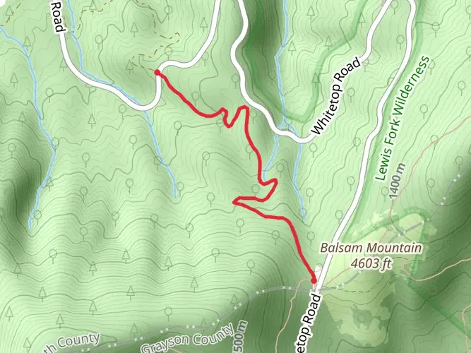
54.5 km
~2 days
234 m
Multi-Day
“Embark on a scenic 33.5-mile trek through Virginia's highlands, rich with history, nature, and adventure.”
The Virginia Creeper Trail stretches approximately 54 kilometers (about 33.5 miles) through the beautiful highlands of southwestern Virginia. With an elevation gain of around 200 meters (approximately 650 feet), the trail offers a moderately challenging experience that is accessible to hikers and bikers of various skill levels.
Getting to the Trailhead
The trailhead is located near Grayson County, Virginia, and is most easily reached by car. For those coming from further afield, the nearest significant town is Abingdon, Virginia, where you can find accommodations and other amenities before starting your journey. Public transport options are limited in this rural area, so driving is recommended. Parking is available at the trailhead, which serves as the starting point for this point-to-point adventure.
Navigating the Trail
As you embark on the Virginia Creeper Trail, you can rely on the HiiKER app for detailed maps and navigation assistance. The trail is well-marked, but having a digital tool can enhance your experience and ensure you stay on the right path.
Historical Significance and Landmarks
The trail's name, "Virginia Creeper," refers to the native plant that grows in the area and the early steam locomotives that once climbed the rails here. The trail follows the path of a former railroad, which has been converted into a recreational trail, part of the Rails-to-Trails Conservancy project. Along the route, you'll encounter several restored train stations that serve as reminders of the region's rich history.
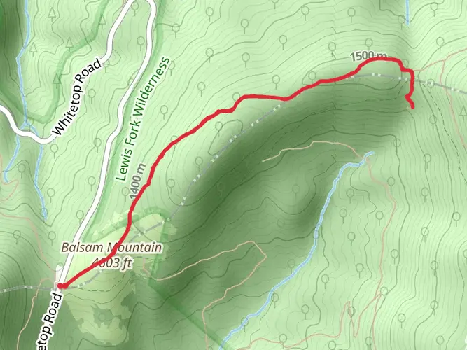
One of the most significant landmarks you'll pass is the Green Cove Station, which is now a visitor center and museum. This station is roughly 15 miles into the trail and provides an excellent opportunity to learn more about the area's past.
Nature and Wildlife
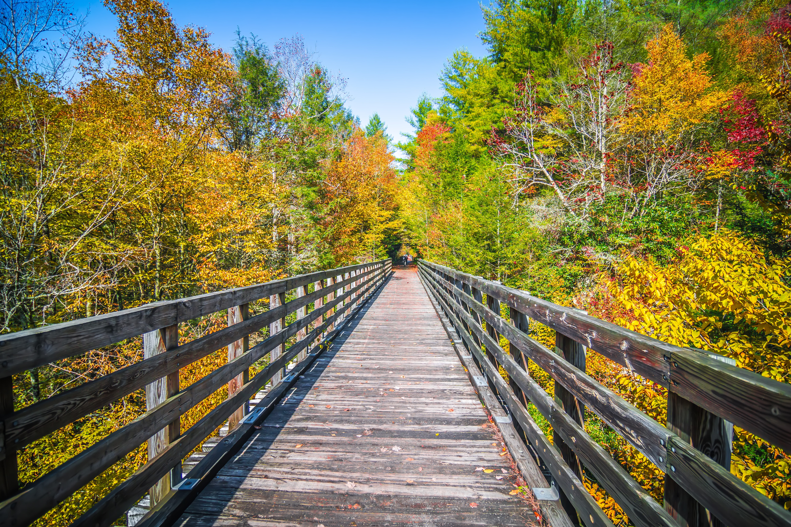
The Virginia Creeper Trail is renowned for its stunning natural scenery. As you travel through dense forests, open farmlands, and alongside rushing streams, you'll be enveloped by the Appalachian Mountains' beauty. The trail crosses numerous wooden trestle bridges, offering breathtaking views of the surrounding landscapes.
Wildlife is abundant in this region, so keep an eye out for deer, wild turkeys, and a variety of bird species. The trail also passes through several ecological preserves, which protect the diverse flora and fauna of the area.
Seasonal Considerations
The trail can be enjoyed year-round, but each season offers a unique experience. Spring brings wildflowers and budding trees, while autumn features a spectacular display of fall foliage. Summer provides lush greenery, and winter offers a stark, quiet beauty with fewer crowds.
Preparation and Planning
Before setting out, ensure you have sufficient water, snacks, and a basic first-aid kit. The trail is remote in sections, so be prepared for limited access to facilities. Wear appropriate footwear and clothing for the weather, and consider bringing a spare tire or repair kit if you're biking.
For those not looking to complete the entire trail in one go, there are several access points along the route where you can start or end your journey. Shuttles are available in the towns of Damascus and Abingdon that can transport you and your bike back to your starting point.
Remember, the Virginia Creeper Trail is a shared space, so be courteous to other hikers, bikers, and equestrians you may encounter. Enjoy the journey through this historically rich and naturally beautiful part of Virginia.

What to expect?
Activity types
Frequently asked questions
How long does it take to hike the Virginia Creeper Trail from Whitetop to Abingdon?
The full Virginia Creeper Trail is about 54.46 km, or roughly 34 miles, from Whitetop Station to Abingdon. A through-hike is usually a full-day effort for strong hikers, while many people split it into two days with Damascus near the midpoint. The route is gentler overall when traveled from Whitetop toward Abingdon because the upper half trends downhill.
Where can you park for the Virginia Creeper Trail in Abingdon, Damascus, or Whitetop?
The Virginia Creeper Trail has several established access points with parking. Common starting points include the Virginia Creeper Trail Welcome Center at 300 Green Spring Road in Abingdon, Damascus Town Park at 301 S Beaver Dam Ave in Damascus, and Whitetop Station on Whitetop Gap Road in Whitetop. Other access points include Watauga, Alvarado Station, Straight Branch, Taylors Valley, Creek Junction, and Green Cove Station.
Is the Virginia Creeper Trail open all the way from Whitetop Station to Damascus right now?
No. The upper Virginia Creeper Trail section between Whitetop Station and Damascus was damaged by Hurricane Helene in September 2024 and is currently closed, with reopening expected in fall 2026. At present, there is no access beyond Damascus on that upper section, so current trips need to focus on open portions such as Damascus to Abingdon.
Are dogs allowed on the Virginia Creeper Trail?
Yes, dogs are allowed on the Virginia Creeper Trail, but they must be on a leash. Trail rules also require users to share the corridor safely with cyclists, walkers, and horses. The route is multi-use, so leash control matters most on busier stretches near Abingdon and Damascus.
Is the Virginia Creeper Trail good for a multi-day hike?
Yes. At 54.46 km with only about 234 m of total elevation gain recorded for the route, the Virginia Creeper Trail is a practical multi-day hike for many walkers. Damascus sits roughly halfway along the corridor, making it a natural overnight split between the Abingdon and Whitetop ends when the full trail is open.
What landmarks and scenery are on the Virginia Creeper Trail?
The Virginia Creeper Trail follows a former railroad corridor through Abingdon, Damascus, and up toward Whitetop. Along the route are restored rail depots, nearly 50 wooden trestles, views of farmland and forest, and several points where the trail meets the Appalachian Trail. Between Damascus and Whitetop, the trail also runs beside Whitetop Laurel Creek, a well-known mountain stream.
Is the Virginia Creeper Trail hard to hike?
The Virginia Creeper Trail is generally considered moderate rather than steep or technical. Its 54.46 km length makes it a substantial outing, but the grade is relatively gentle because it follows an old rail bed. The biggest challenge is endurance and planning the point-to-point logistics, not sustained climbing.
Comments and Reviews
User comments, reviews and discussions about the Virginia Creeper Trail, Virginia.
3.67
average rating out of 5
3 rating(s)