Download
3D Flyover
Add to list
More
16.6 km
~4 hrs 6 min
466 m
Point-to-Point
“Trace quiet ridgelines past Civil War breastworks, where hardwood shadows and rolling climbs reward steady hikers.”
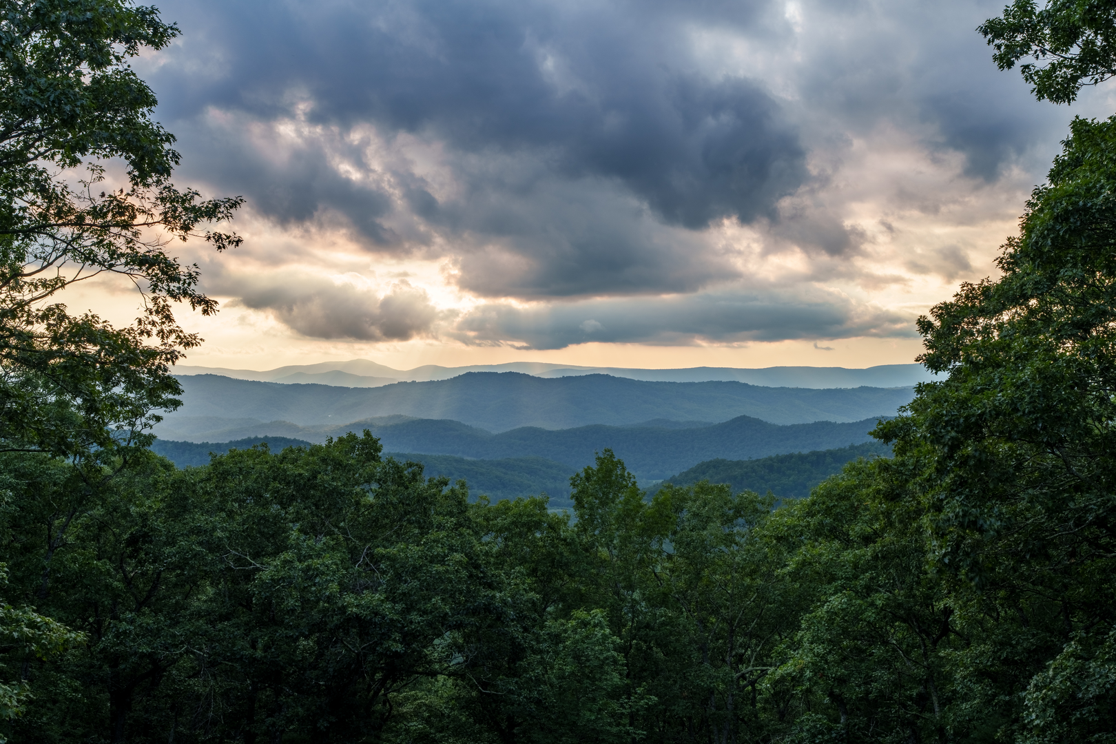
This is a longer, ridge-and-valley day hike (about 17 km / 10.6 mi with roughly 500 m / 1,640 ft of climbing) that mixes Civil War-era earthworks, classic Shenandoah Mountain hardwood forest, and extended stretches of quiet ridgeline walking. Expect a steady pace rather than constant steepness: the elevation gain is spread out across multiple climbs and rollers, with a few short, punchy pitches where the trail pulls up to the ridge.
Getting to the trailhead (car + public transport options)
Because “near” and the hike type/trailhead coordinates weren’t provided, the most reliable way to plan the approach is to locate “Confederate Breastworks” in HiiKER first, then use the “Directions”/map pin to confirm the exact pull-off, parking area, or forest road access point.
By car - Most starts labeled “Confederate Breastworks” in the Shenandoah Mountain region are reached via rural state routes and/or Forest Service roads with limited signage. - Plan for patchy cell service and allow extra time for the last few miles—gravel surfaces, potholes, and occasional washboarding are common. - Bring a full-size spare if you have one; at minimum, ensure your tire repair kit and jack are accessible.
By public transport - Public transit is typically not practical to remote Shenandoah Mountain trailheads. The closest you can usually do is: - Take intercity rail/bus to a nearby town (often in the Shenandoah Valley), then - Use a taxi/rideshare to the trailhead. - Rideshare availability can be inconsistent outside towns; if you’re attempting this, pre-arrange a pickup and have a backup plan.
If you share the lon/lat for the start point, I can convert it to the nearest known address or landmark and tailor the approach directions precisely.
What the hike feels like underfoot
You’ll likely start on a narrower singletrack or old roadbed that quickly transitions into a forest climb. Footing is usually a mix of: - Leaf litter over dirt (can hide rocks/roots), - Embedded stones and occasional rocky tread on steeper pitches, - Short sections that may be muddy after rain, especially in shaded hollows.
The “medium” rating fits: the distance is the main challenge, and the elevation gain is enough to make the day feel earned—especially if the route includes ridge undulations rather than one clean ascent and descent.
Confederate breastworks and regional history
“Breastworks” refers to field fortifications—earth-and-log defensive structures built quickly to control movement through mountain gaps, ridgelines, and approaches. In the Shenandoah region, these features are strongly associated with Civil War-era maneuvering and attempts to hold strategic corridors through the mountains and valleys. On the ground, breastworks can look like: - Low, linear earthen berms, - Shallow trenches or depressions, - Rock-and-soil alignments that follow a tactically sensible line (often along a crest or just below it).
Treat these as fragile cultural resources: stay on the tread, avoid climbing on the berms, and don’t move stones or “improve” viewpoints from the earthworks.
Ridgeline walking, views, and terrain changes
After the initial climb, the hike typically settles into longer ridge travel. This is where the route becomes rhythm-based: - Rolling grades with intermittent short climbs, - Occasional rocky outcrops or open patches that can provide partial views, - More exposure to wind and sun than the lower forest.
Even when the ridge is wooded, you’ll often notice a change in vegetation and feel: slightly drier tread, more oak/hickory presence, and a more consistent breeze. If the route crosses any open ledges, take extra care in wet or icy conditions—lichen-coated rock can be slick.
Nature and wildlife to expect
Shenandoah Mountain forests commonly feature oak, hickory, maple, and mixed understory depending on elevation and aspect. Seasonal highlights: - Spring: wildflowers in moist hollows; streams can run higher and crossings may be splashy. - Summer: dense canopy shade but higher humidity; ticks and biting insects increase. - Fall: excellent visibility through thinning leaves; acorns on trail can roll underfoot. - Winter: freeze–thaw can create hard, uneven tread and icy patches on shaded slopes.
Wildlife you may encounter: - White-tailed deer (often at dawn/dusk), - Black bear (generally avoidant—make noise in low-visibility brushy sections), - Wild turkey and a variety of songbirds and raptors riding ridge thermals. Also plan for ticks in warm months—use repellent, do a full check at the car, and consider gaiters or long socks.
Navigation and planning notes (use HiiKER)
This is the kind of route where small junctions and old roadbeds can create “almost-right” turns. Before you go: - Download the route for offline use in HiiKER. - In HiiKER, identify key decision points (trail junctions, ridge intersections, stream crossings) and note their approximate mile/km marks. - Keep an eye on time-on-feet: 17 km / 10.6 mi with 500 m / 1,640 ft often lands in the 5–7 hour range for many hikers depending on stops, tread, and conditions.
Water, weather, and what to

Surfaces
Dirt
Unknown
Comments and Reviews
User comments, reviews and discussions about the Shenandoah Mountain Trail from Confederate Breastworks, Virginia.
average rating out of 5
0 rating(s)