Download
3D Flyover
Add to list
More
8.6 km
~1 hrs 43 min
0 m
Loop
“A breezy coastal loop of shore, dunes, and open fields—best savoured with tide sense.”
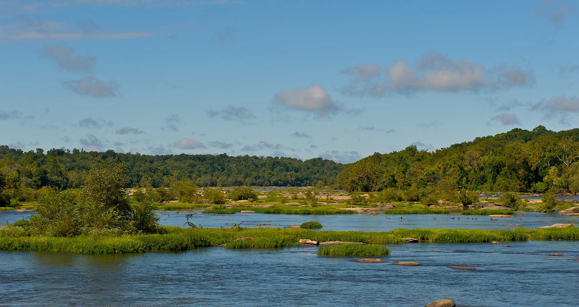
A flat, coastal loop of roughly 9 km (5.6 mi) with essentially 0 m (0 ft) of climbing, this walk links open shoreline, low dunes, and broad grassy fields with long views across the water. Expect an easy-going pace on mostly level ground, with the main “effort” coming from wind exposure, soft sand patches, and the occasional muddy or waterlogged section after rain or high tides.
Getting to the start (car + public transport)
Because “Belle Isle” and “Neck Fields” are place names used in multiple regions, the exact trailhead depends on which one you mean. If you share a town/state (or a HiiKER link / coordinates), I can pin the start to the nearest real-world address or landmark precisely.
In the meantime, here’s the most practical way to plan your arrival:
- By car: Aim for the nearest signed coastal access point / nature reserve parking area serving Belle Isle/Neck Fields. These trailheads are typically at a small public lot near a beach access road, sometimes labeled as a “Coastal Access,” “Wildlife Management Area,” “Nature Reserve,” or “Conservation Area” parking area. Arrive early on weekends—coastal lots can fill quickly in fair weather.
- By public transport: Most coastal field-and-shoreline trailheads are reached by:
1) Train or intercity bus to the nearest coastal town, then
2) A local bus toward the waterfront, and
3) A short walk (often 0.5–2 km / 0.3–1.2 mi) from the last stop to the trail access.
If you tell me the nearest town, I’ll translate that into a specific route (which station, which bus corridor, and the likely walking distance).
What the route feels like underfoot
With minimal elevation change, the trail’s character is defined by surface and exposure:
- Firm paths / mown grass tracks: Common through “neck” fields—wide, open, and easy to follow.
- Sandy stretches: Near the shoreline or dune edges; these can slow you down and make shoes fill with grit.
- Boardwalks or compacted coastal paths (where present): Helpful over marshy ground, but can be slick with algae or sea spray.
- Seasonal wet spots: After heavy rain, low-lying field margins can hold water; waterproof footwear isn’t mandatory, but water-resistant shoes and spare socks are smart.
Plan on 2–3 hours for most hikers at a relaxed pace with stops for views and wildlife watching.
Landmarks and scenery you can expect
This kind of Belle Isle/Neck Fields pairing usually means a classic coastal “neck” landscape: a narrow strip of land (the “neck”) connecting or bordering open water, with fields that historically supported grazing or small-scale agriculture.
- Shoreline viewpoints: Look for long, low horizons—excellent for spotting seabirds and watching changing light on the water.
- Field edges and hedgerows (or scrub lines): These transition zones often hold the most bird activity.
- Dune or salt-tolerant vegetation zones: Even subtle rises can host different plant communities—tough grasses, low shrubs, and hardy wildflowers adapted to wind and salt.
If the route passes any old stone boundaries, drainage ditches, or remnants of farm tracks, those are often clues to the area’s land-use history—coastal fields were commonly managed for pasture, hay, or small plots, with the shoreline used for fishing access and local transport.
Nature and wildlife (what to look for, and what to watch out for)
Coastal field-and-shore systems can be surprisingly rich:
- Birdlife: Expect gulls, terns, cormorants, and depending on season, shorebirds/waders (sandpipers, plovers) along the waterline. In migration periods, fields can host raptors (harriers, hawks) quartering low over grass.
- Marine edge activity: On calm days you may see seals hauled out on distant rocks/sandbars (where applicable) or fish activity close to shore.
- Insects and ticks: In warmer months, field margins can have biting flies and ticks. Long socks and a quick tick check after the hike are worthwhile.
- Nesting areas: Some coastal paths pass near sensitive nesting habitat. If you see signage, keep to the path and give roped-off areas a wide berth—ground-nesting birds are easily disturbed.
Weather, exposure, and timing
Even on an “easy” flat route, coastal conditions can be the deciding factor:
- Wind: The most common challenge—bring a light shell even on mild days.
- Sun exposure: Fields and shorelines often have little shade. Carry water and consider sun protection.
- Tides (if the route uses beach segments): If any portion follows the beach or crosses a tidal inlet, check tide times and be ready to use the inland alternative. Use HiiKER to confirm whether the official line stays above the high-tide mark.
Navigation and practical prep (keep it easy)
This is typically straightforward terrain, but open fields and braided shoreline tracks can create “choice points.”
- Use HiiKER to download the route for offline use and to confirm any seasonal diversions (flooding, nesting closures, or storm damage).
- Footwear: trail runners or light hikers are fine; choose something that handles sand + damp grass.
- Water/snacks: bring enough for

Surfaces
Unpaved
Grass
Unknown
Comments and Reviews
User comments, reviews and discussions about the Belle Isle and Neck Fields Trail, Virginia.
average rating out of 5
0 rating(s)