Download
3D Flyover
Add to list
More
12.2 km
~3 hrs 34 min
682 m
Loop
“Climb Whiteoak’s waterfall staircase, crest the ridge, then descend Cedar Run’s slippery pools—challenging when wet.”
This route links two of Shenandoah National Park’s best waterfall corridors into a demanding-but-manageable loop: a steady climb past a staircase of cascades in Whiteoak Canyon, a high point on the ridge, then a long descent beside Cedar Run’s pools, slides, and falls. Even at a “medium” rating, the combination of slick rock, repeated stream crossings, and ~700 m (≈2,300 ft) of gain over ~12 km (≈7.5 mi) makes it feel closer to “medium-hard” after rain or during leaf-fall.
Getting to the start (car + public transport realities)
Start area: the most common and practical start is Whiteoak Canyon Parking Area / Trailhead on VA-600 (Weakley Hollow Road), near the community of Syria, Virginia, just outside Shenandoah National Park’s boundary. A useful nearby landmark for trip planning is Graves Mountain Lodge (Syria, VA)—the trailhead is a short drive from there.
- By car:
- From the Madison, VA area, you’ll typically approach via US-29 and then local roads toward Syria and VA-600 (Weakley Hollow Rd).
- Parking fills early on weekends and peak foliage days; arriving early reduces the risk of having to reroute.
- From the Madison, VA area, you’ll typically approach via US-29 and then local roads toward Syria and VA-600 (Weakley Hollow Rd).
- By public transport:
- There is no reliable public transit to the Whiteoak Canyon trailhead. The closest you can reasonably get by intercity options is the Charlottesville, VA region (train/bus), but you’ll still need a rental car or rideshare for the final rural stretch. Cell coverage can be inconsistent, so don’t assume a rideshare will be available for pickup.
Route flow and what to expect underfoot
Most hikers do this as a loop: up Whiteoak Canyon Trail to the ridge, then down Cedar Run Trail back to the trailhead area. Total distance is about 12 km (7.5 mi) with about 700 m (2,300 ft) of elevation gain.
0.0–1.5 km (0.0–0.9 mi) | Warm-up into the canyon
You’ll start on a well-used path that quickly commits to the drainage. The tread is often packed dirt with embedded rock and roots. Early on, you’ll hear water before you see it—this is a good place to check footwear traction and trekking pole length before the steeper, wetter sections.
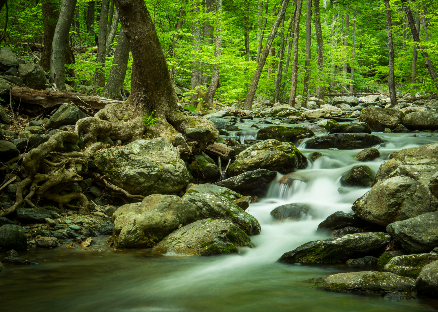
1.5–4.5 km (0.9–2.8 mi) | Waterfall ladder on Whiteoak Canyon
This is the signature climb: a series of waterfalls and cascades stacked up the canyon. Expect:
- Rock steps and slick slabs beside the stream
- Short, steep pitches where the trail narrows
- Frequent wet spots even in dry weather due to spray and seepage
You’ll pass multiple falls in succession; the biggest “wow” moments tend to come where the trail edges close to the water and you can look upstream at the next drop. Plan extra time here—people naturally slow down for photos and careful footing.
4.5–6.5 km (2.8–4.0 mi) | Steeper push to the ridge (most of the gain)
The grade typically stiffens as you leave the most dramatic falls behind and climb toward higher ground. This is where the elevation gain is most noticeable. If you’re tracking effort: this segment is where pacing and hydration matter most, especially in humid Mid-Atlantic summers.
6.5–7.5 km (4.0–4.7 mi) | Ridge/connector section (breather + navigation check)
You’ll transition away from the stream corridor. The forest canopy can open slightly depending on season, and the footing usually dries out. This is a good place to confirm your junctions on HiiKER, because several trails intersect in this part of the park and it’s easy to follow the “most worn” path in the wrong direction when traffic is heavy.
Cedar Run descent: pools, crossings, and slippery rock
7.5–12.0 km (4.7–7.5 mi) | Long descent beside Cedar Run
Dropping down Cedar Run is beautiful and deceptively technical. The trail often runs right along the watercourse, with:
- Natural rock “stairs” that can be slick with algae
- Stream crossings that vary from rock-hops to ankle-deep wades depending on recent rain
- Deep pools and small slides that attract swimmers in warm months (expect crowds and wet footprints on rock)
This descent can be harder on knees than the climb—take shorter steps, keep your center of gravity over your feet, and don’t rush the slick sections. After storms, expect downed branches and occasional trail washouts near the stream.
Landmarks, nature, and wildlife to look for
- Waterfalls and cascades: Whiteoak Canyon’s falls come in quick succession, while Cedar Run is more about continuous cascades, plunge pools, and streamside boulders.
- Forest and plants: You’ll move through classic Blue Ridge hardwood forest—oak, hickory, tulip poplar, and (seasonally) dense understory. Spring brings wildflowers; autumn brings heavy leaf cover that can hide rocks and holes.
- Wildlife:
- White-tailed deer are common.
- Black bears live throughout Shenandoah—usually shy, but you should still store food securely and keep distance if seen.
- Snakes (including venom
- White-tailed deer are common.

Surfaces
Ground
Unpaved
Wood
Asphalt
Comments and Reviews
User comments, reviews and discussions about the White Oak Falls via White Oak Canyon Trail and Cedar Run Trail, Virginia.
average rating out of 5
0 rating(s)