Chimney Rock, Three Ridges and Bee Mountain via Appalachian Trail and Mau Har Trail
Download
3D Flyover
Add to list
More
22.3 km
~6 hrs 26 min
1192 m
Loop
“A ridge-to-creek wilderness loop of airy overlooks, rocky grind, and a waterfall-cooled return.”
This is a big, ridge-heavy loop in Virginia’s Three Ridges Wilderness (George Washington & Jefferson National Forests), linking the Appalachian Trail (white blazes) with the Mau-Har Trail (blue blazes). Expect sustained climbing, long stretches of rocky tread, and a very different feel on the return: airy ridge walking and viewpoints on the way out, then a cooler, creek-and-waterfall descent and return. The stats you’ve got—~22 km / ~13.7 mi and ~1,200 m / ~3,940 ft—are right in the “medium-to-hard day” range depending on pace, heat, and how slick the Mau-Har side is.
Start / trailhead location (nearest landmark/address)
Most hikers start at Reeds (Reids) Gap Parking Area, a gravel pull-off where VA-664 (Beech Grove Rd) meets the Blue Ridge Parkway (often referenced around milepost ~13–14). (onxmaps.com)
If you’re building the route in HiiKER, use Reeds Gap as the start and confirm you’re following the Three Ridges loop that tags Bee Mountain → Chimney Rock → Three Ridges before dropping to the Mau-Har return.
Getting to the start
By car
- From the Shenandoah Valley side, you’ll typically approach via I-81 to the Waynesboro/Rockfish Gap area, then take local roads toward VA-664 and the Blue Ridge Parkway. (Road choices vary depending on whether you approach from the east via Wintergreen/Nelson County or from the west via the valley.)
- Parking is a simple pull-off—arrive early on weekends and peak foliage days.
By public transport (practical reality) There isn’t reliable public transit to Reeds Gap itself. The most workable low-car option is: - Get to Waynesboro, VA (regional buses/rail connections to nearby cities can get you into the area), then arrange a taxi/rideshare to the Blue Ridge Parkway/VA-664 junction. Service can be spotty once you’re up on the Parkway, so plan pickup/drop-off carefully and don’t assume cell coverage.
What the hike feels like, segment by segment (clockwise is common)
Reeds Gap to Bee Mountain: the “warm-up” that isn’t
From the parking area you’ll step onto the Appalachian Trail and begin climbing almost immediately. The grade is steady and can feel abrupt if you start cold. Over roughly 3–4 km / 2–2.5 mi, you gain on the order of 300–450 m / 1,000–1,500 ft as you work up toward Bee Mountain (often cited around the low 3,000-foot range). (tidewateratc.com)
Underfoot & navigation: rocky patches, roots, and short steep pitches. In leaf season, rocks hide under leaves—ankle-turner terrain. Keep HiiKER handy here because the ridge has side paths to campsites and viewpoints that can distract you from the main white blazes.
Nature notes: This is classic central Blue Ridge forest—oak/hickory and mixed hardwoods, with mountain laurel and rhododendron in places. In warmer months, ticks are common; in spring, watch for slick mud on shaded grades.
Bee Mountain to Chimney Rock: ridge walking with payoff views
Past Bee Mountain the AT continues along the ridge with intermittent openings. The tread stays rugged, but the walking becomes more “rolling ridge” than pure climb for a bit—until the next pushes.
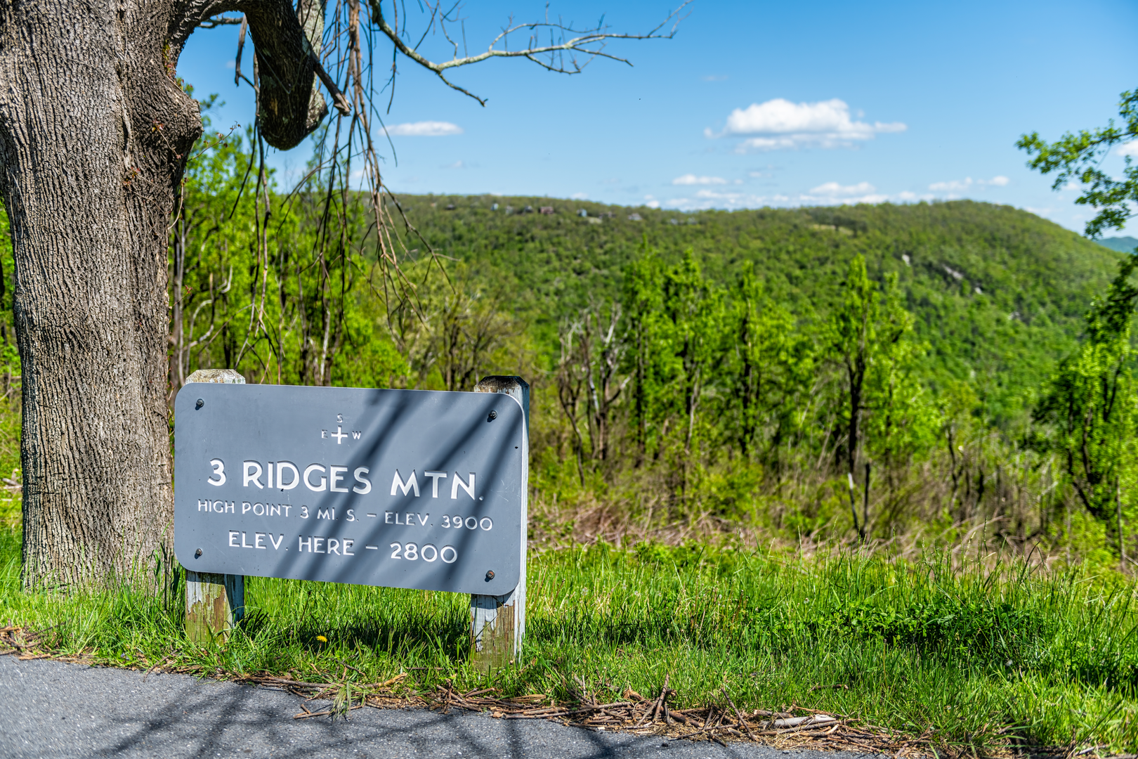
You’ll reach Chimney Rock around the mid-to-late first half of the loop (commonly shown near ~9.5 km / ~5.9 mi from Reeds Gap on some loop references). (tidewateratc.com)
Chimney Rock is one of the signature landmarks: a rocky outcrop with broad views across the Blue Ridge and into the valleys. It’s also a place where wind exposure and sudden weather changes are noticeable—layer up if clouds build.
What to look out for - Crowded rock edges on nice weekends; give space and watch footing. - Lightning risk: if thunderstorms are in the forecast, treat Chimney Rock and the open ridge as “move through quickly” zones.
Chimney Rock to Three Ridges high point: the long grind

Surfaces
Ground
Unknown
Wood
Comments and Reviews
User comments, reviews and discussions about the Chimney Rock, Three Ridges and Bee Mountain via Appalachian Trail and Mau Har Trail, Virginia.
average rating out of 5
0 rating(s)