Download
3D Flyover
Add to list
More
112.8 km
~5 days
2647 m
Multi-Day
“Embark on the historic and scenic Great Massanutten Loop for an unforgettable 70-mile trek through Virginia's wilderness.”
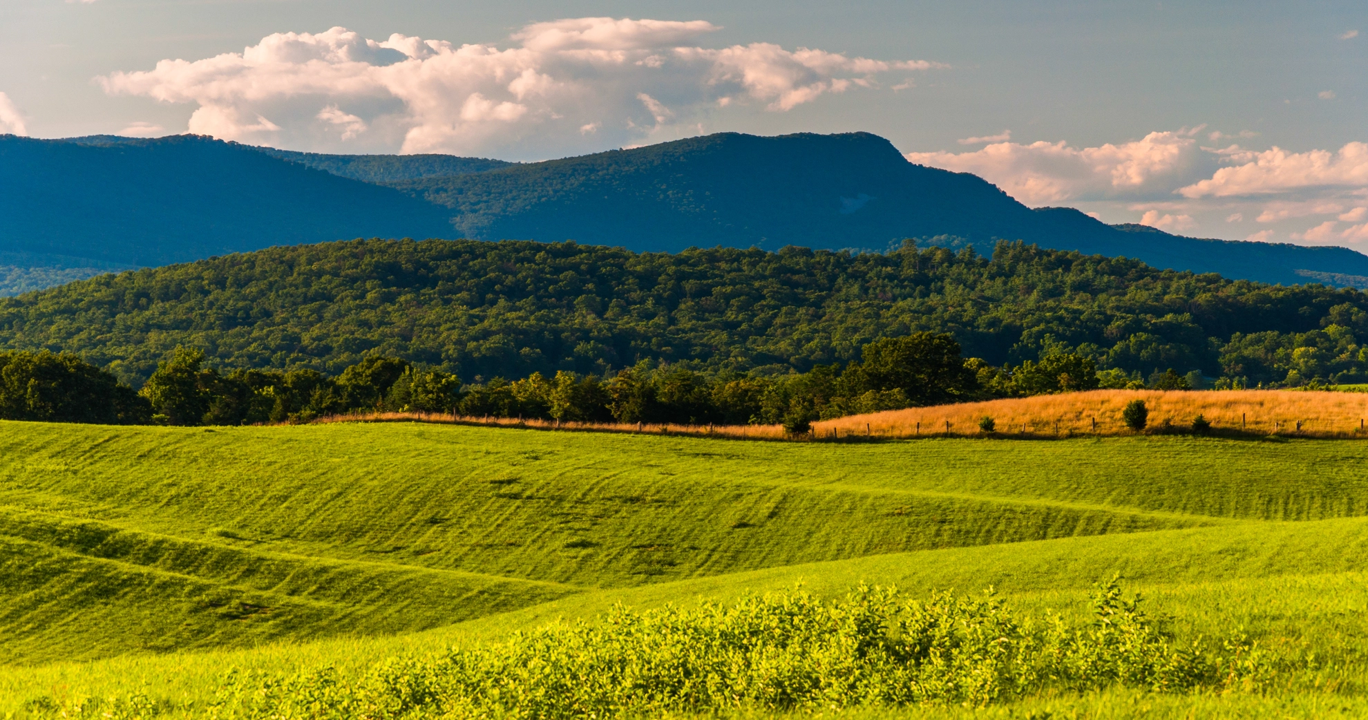
The Great Massanutten Loop is a challenging and rewarding trek that spans approximately 113 kilometers (70 miles) with an elevation gain of around 2600 meters (8530 feet). This loop trail is nestled in the heart of Virginia's Shenandoah Valley, near Page County, and encircles the Massanutten Mountain range.
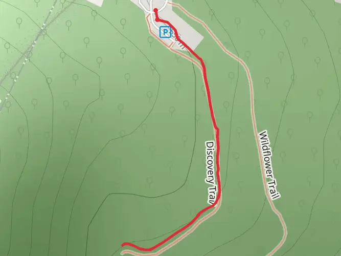
Getting to the Trailhead
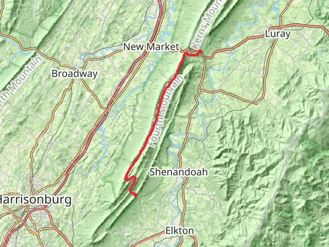
To begin your journey on the Great Massanutten Loop, you'll want to make your way to the trailhead located near Page County, Virginia. For those driving, the closest significant landmark is the town of Luray, from which you can follow signs to the Massanutten trail system. Public transportation options are limited in this rural area, so driving is the most feasible option for reaching the starting point.
Navigating the Trail
As you embark on the Great Massanutten Loop, it's essential to have a reliable navigation tool like HiiKER to help you stay on track. The trail is well-marked in most sections, but due to its length and remote nature, having a digital map can be invaluable, especially at trail intersections or during inclement weather.
Trail Experience
The trail offers a diverse hiking experience, with sections that meander through dense forests, rocky ridges, and along tranquil streams. The initial segment of the hike will take you through a gradual ascent, allowing you to acclimate to the elevation gain. As you progress, you'll encounter more challenging terrain, including steep climbs and technical descents.
Wildlife and Nature
The Massanutten Mountain range is home to a rich array of wildlife. Keep an eye out for white-tailed deer, black bears, and a variety of bird species, including the pileated woodpecker and the scarlet tanager. The flora is equally impressive, with wildflowers in the spring and a vibrant display of fall foliage in autumn.
Historical Significance
The region is steeped in history, with the Massanutten Mountain itself being a significant geological feature formed over 200 million years ago. The area has seen human activity for thousands of years, from indigenous peoples to European settlers. During the Civil War, the Massanutten Mountain served as a strategic lookout point, and hikers can visit historical sites along the trail that recount these stories.
Landmarks and Points of Interest
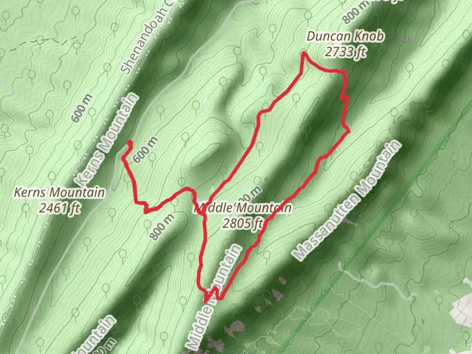
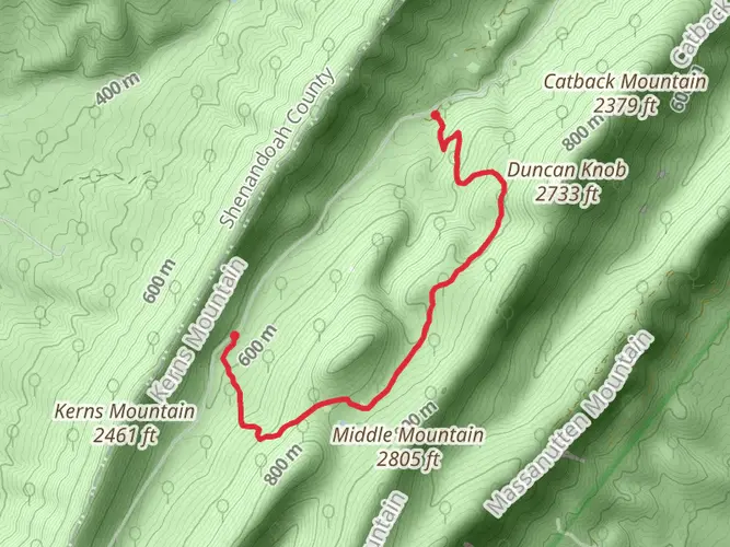
Notable landmarks along the Great Massanutten Loop include Signal Knob, which offers panoramic views of the Shenandoah Valley and the Allegheny Mountains. Approximately halfway through the hike, you'll reach the Elizabeth Furnace Recreation Area, a historic site where iron was once smelted in the 1800s.
Preparation and Planning
Given the trail's difficulty and length, it's crucial to be well-prepared. Ensure you have enough food and water for several days, as well as a water filtration system for refilling from natural sources. Proper gear is essential, including sturdy hiking boots, weather-appropriate clothing, and a first aid kit. It's also wise to inform someone of your hiking plans and expected return time due to the remote nature of the trail.
Conclusion
The Great Massanutten Loop is a must-hike for those seeking a challenging adventure through historical and natural landscapes. With proper preparation and respect for the trail's difficulty, hikers will find this loop to be a memorable and enriching experience.

What to expect?
Activity types
Frequently asked questions
How long does the Great Massanutten Loop take to hike in Page County, Virginia?
The Great Massanutten Loop is 112.77 km, or about 70 miles, so most backpackers split it into 3 to 5 days depending on pace and weather. Strong hikers sometimes move faster, but the route’s 2,647 m of climbing and long ridge sections make it a demanding multi-day loop rather than a casual overnight.
How difficult is the Great Massanutten Loop and what kind of terrain does it have?
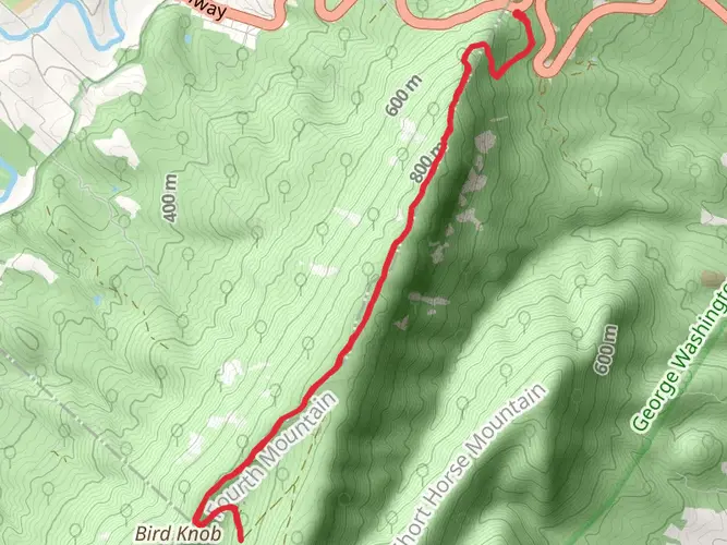
The Great Massanutten Loop is generally rated medium, but that still means a serious effort over 112.77 km with 2,647 m of elevation gain. The route circles the Massanutten Mountain range through the George Washington National Forest, with a mix of forest track, rocky ridges, steep climbs, technical descents, and more remote backcountry sections around Fort Valley.
Where do hikers usually start the Great Massanutten Loop near Luray, Virginia?
Many hikers begin the Great Massanutten Loop from access points near Luray and Fort Valley on the Massanutten Trail system, since the loop wraps around the Massanutten Mountain range in Page County and adjacent Shenandoah Valley backcountry. Driving is usually the practical option because public transportation in this part of rural Virginia is very limited.
Is the Great Massanutten Loop the same as the Massanutten Trail loop?
Yes. The Great Massanutten Loop corresponds to the well-known Massanutten Trail loop, a roughly 71-mile circuit around Fort Valley on Massanutten Mountain. The listed distance of 112.77 km matches that classic long loop closely, so hikers can expect the same broad route through the George Washington National Forest near Page County.
Are dogs allowed on the Great Massanutten Loop in Virginia?
Dogs are generally allowed on the Massanutten Trail system used by the Great Massanutten Loop, but they should be kept under control and leashed where required. Because this is a long, rugged backcountry route with rocky footing, sustained climbs, and limited services, it is best suited to trail-experienced dogs with strong endurance.
What is the best time of year to hike the Great Massanutten Loop?
Spring and fall are usually the best seasons for the Great Massanutten Loop, when temperatures in the Shenandoah Valley are more manageable and ridge walking is less exposed to summer heat. Summer can be hot and humid on the long climbs, while winter can bring icy rock, colder wind on the ridges, and slower travel across the 112.77 km route.
Comments and Reviews
User comments, reviews and discussions about the Great Massanutten Loop, Virginia.
4.36
average rating out of 5
14 rating(s)