Download
3D Flyover
Add to list
More
12.5 km
~3 hrs 26 min
567 m
Loop
“From Blue Ridge heights to a whispering river valley, expect shaded, honest effort on slick, muddy tread.”
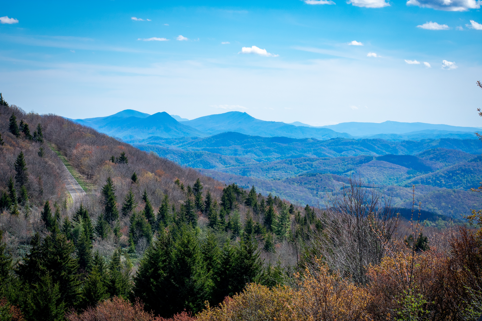
You’ll start on the crest of the Blue Ridge in Shenandoah National Park and spend most of the day dropping into (and later climbing out of) a cool, river-cut valley. For a “medium” effort, this one feels honest: steady grades, lots of shade, frequent water sounds, and a few spots where wet rock and streamside mud can slow you down.
Stats to plan around
- Distance: ~12 km / ~7.5 mi
- Elevation gain: ~600 m / ~1,970 ft (expect most of that to come on the return climb)
- Typical time: ~4–6 hours depending on stops, footing, and water levels
- Difficulty: Medium (can feel harder in heat/humidity or after rain)
Getting to the start (and what “near” usually means here)
Most hikers access Thornton River Trail from Skyline Drive in Shenandoah National Park, using the Thornton River Trailhead parking area around Skyline Drive mile ~25.5. (nps.gov)
A reliable “nearest significant landmark” for trip planning is the Thornton Gap Entrance Station area (US-211 / Lee Highway), which is the main east–west gateway into this part of the park. (en.wikipedia.org)
By car
- Navigate to Shenandoah National Park – Thornton Gap Entrance Station (US-211), then drive north on Skyline Drive to the Thornton River Trailhead area near mile ~25.5. (en.wikipedia.org)
- Expect limited parking at many Skyline Drive trailheads on weekends and peak foliage days; arrive early.
By public transport
- There isn’t practical public transit directly to Skyline Drive trailheads. The closest “base” towns for arranging a taxi/rideshare (availability varies) are typically Sperryville, VA on the east side of Thornton Gap. (en.wikipedia.org)
If you’re trying to do this car-free, plan on a private shuttle/taxi from a larger hub (often Washington, DC area to Front Royal/Luray/Sperryville region) and confirm service ahead of time.
On the hike: what the terrain feels like
From the Skyline Drive trailhead, the route quickly commits to a long descent into the Thornton River drainage. Early on, you’ll be in classic Shenandoah hardwood forest—oak, hickory, and tulip poplar—with a leaf-litter tread that can hide slick rocks and roots.
As you lose elevation, the sound of water becomes constant and the trail settles into a streamside rhythm: gentle bends, short rises over small spurs, and occasional narrow spots where the hillside presses close to the river. Even when the grade is easy, the footing can demand attention—rounded river stones, wet leaves, and muddy patches where seeps cross the trail.
Water, crossings, and “Shenandoah wet feet”
This valley is defined by water. After rain, expect: - Slick rock on streamside sections - Soft mud in low spots - Higher, faster water at any crossings or side-stream inlets
If your 12 km / 7.5 mi plan includes any spur or loop options (common in this area), confirm the exact junctions and crossing points in HiiKER before you go, and re-check them at each signed intersection—several trails in Shenandoah share similar “valley” character and it’s easy to drift onto the wrong connector when you’re focused on the river.
Landmarks and natural highlights
- Thornton River corridor: The Thornton River rises at Thornton Gap and flows east toward Sperryville, so you’re essentially hiking along the river’s upper reaches where the valley is tight and shaded. (en.wikipedia.org)
- Seasonal wildflowers: Spring brings ephemeral blooms (trillium and other woodland flowers) in richer soils near water; summer is lush and green but more humid and buggy.
- Foliage: Autumn color can be excellent here because the route samples both ridgetop hardwoods and the moister, mixed forest of the drainage.
Wildlife you may see (and what to watch for) - White-tailed deer are common. - Black bears

Surfaces
Ground
Asphalt
Comments and Reviews
User comments, reviews and discussions about the Thornton River Trail, Virginia.
average rating out of 5
0 rating(s)