Download
3D Flyover
Add to list
More
32.2 km
~7 hrs 20 min
537 m
Multi-Day
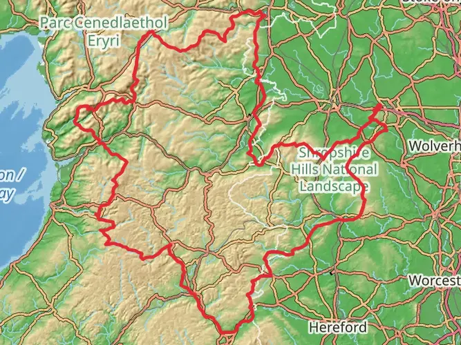
The Ystwyth Trail is a 32.2 km trail that starts in , Ceredigion, Wales. Based on our data, the hike is graded as Easy. For information on how we grade trails, please read measuring the difficulty of a hiking trail on hiiker. Also, check our latest community posts for trail updates. This hike can be completed in approx 7 hrs 20 mins. Caution is advised on trail times as this depends on multiple variables. For more info read about how we calculate hike time.

What to expect?
Activity types
Frequently asked questions
How long is the Ystwyth Trail and how difficult is the full hike?
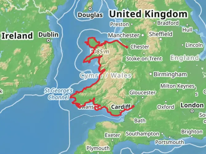
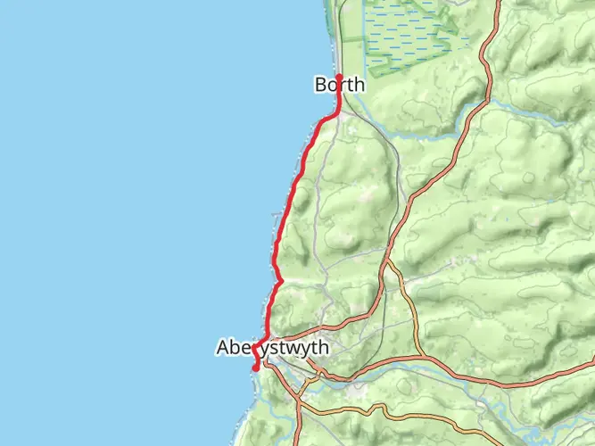
The Ystwyth Trail is 32.21 km long with 537 m of elevation gain, which puts it in the easy category overall. It is a multi-day route in Ceredigion, and much of the trail follows the old Great Western Railway line between Aberystwyth and Tregaron, so gradients are generally gentler than on a typical hill walk.
Where does the Ystwyth Trail start and finish in Ceredigion?
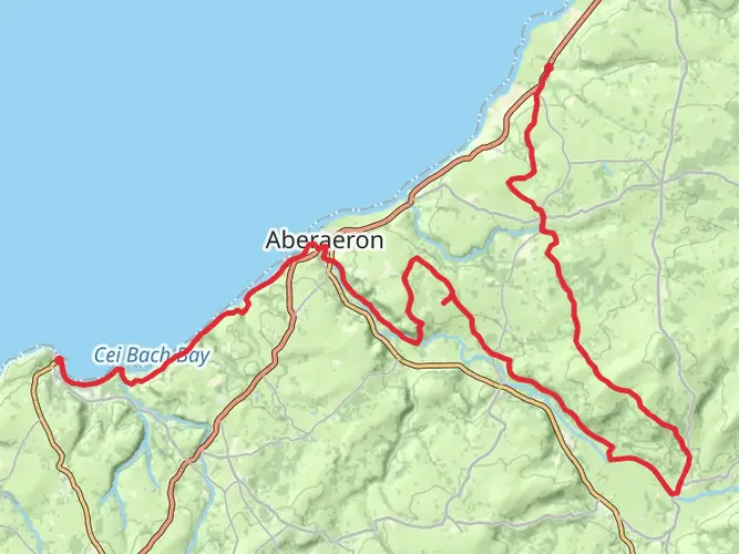
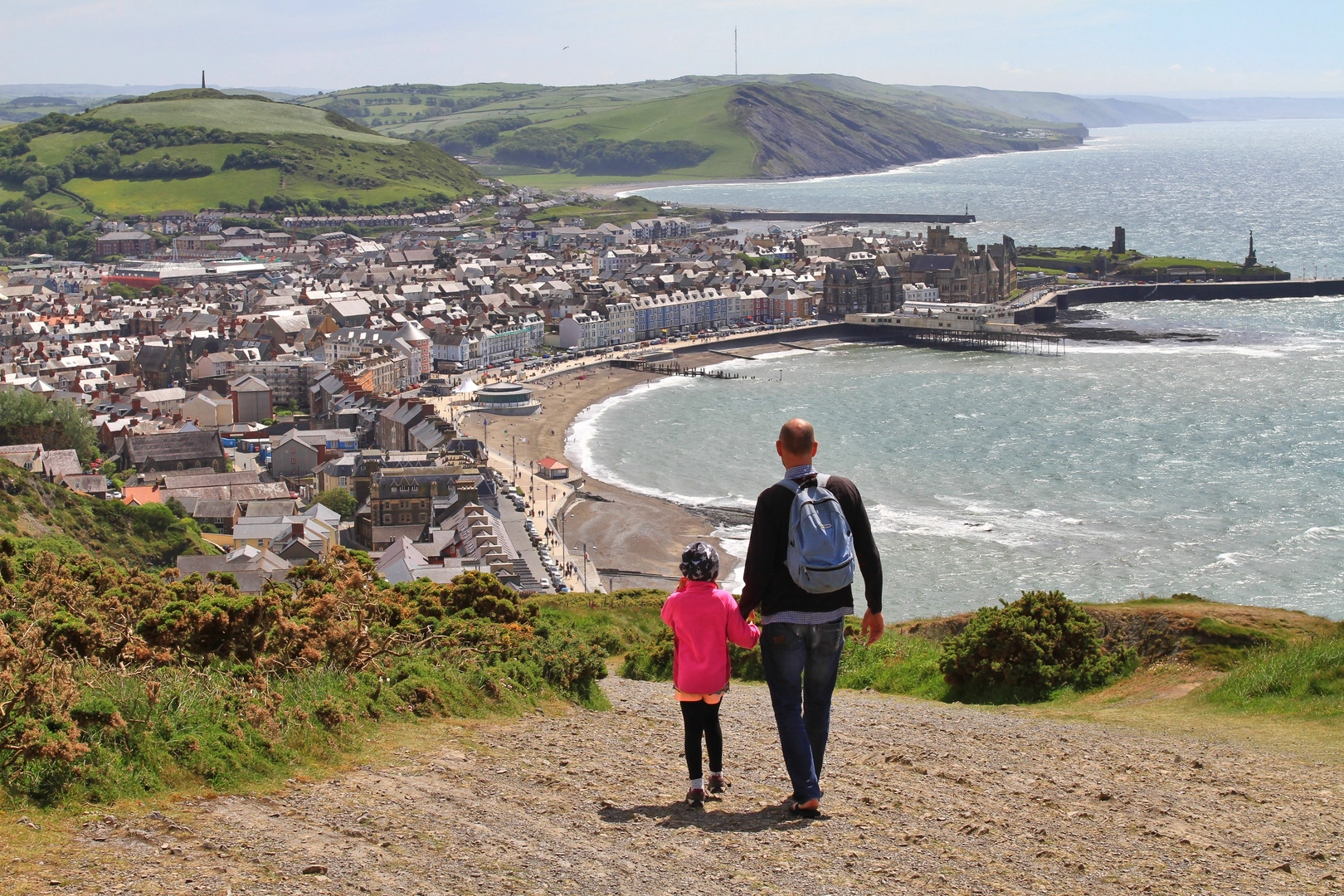
The Ystwyth Trail links Aberystwyth and Tregaron in Ceredigion. Published route information places the western end in Aberystwyth and the eastern end in Tregaron, following the Ystwyth valley for much of the way and passing places including Llanfarian and Ystrad Meurig on the broader corridor of the trail.
How many days does it take to walk the Ystwyth Trail?
Most walkers split the 32.21 km Ystwyth Trail into 2 days, especially if treating it as an easy multi-day outing rather than a long single push. Strong hikers can cover the distance in 1 day, but dividing it into 2 stages leaves more time for transport logistics between Aberystwyth and Tregaron and for slower sections at road crossings and mixed-use stretches.
Is the Ystwyth Trail suitable for families or less experienced walkers?
The Ystwyth Trail is generally a good option for families and less experienced walkers because it is rated easy and includes long off-road sections with relatively moderate climbing. Local tourism and council information also describe many off-road parts as family friendly, though the route does cross public highways in places, so supervision is still important near road sections.
Can dogs go on the Ystwyth Trail?
Dogs can go on the Ystwyth Trail, but they should be kept under close control and local visitor information advises keeping them on a lead. That matters because the route is shared by walkers, cyclists, and in some areas horse riders, and it also crosses roads at several points between Aberystwyth and Tregaron.
Is the Ystwyth Trail only for walkers, or is it shared with cyclists too?
The Ystwyth Trail is a multi-use route rather than a walkers-only path. It is described locally as a scenic cycle route, bridleway, and footpath, and it also connects with National Cycle Network routes 81 and 82, so walkers should expect to share space with bikes and, on some sections, horses.
Where can you park for the Ystwyth Trail in Aberystwyth or Tregaron?
Parking is available in both trail towns. Ceredigion County Council lists pay-and-display parking in Aberystwyth, including Park Avenue, North Road, Lower Park Avenue, Maesyrafon, and New Promenade, and it also lists pay-and-display parking in Tregaron, making either end practical for a one-way walk with a shuttle or pickup.
Comments and Reviews
User comments, reviews and discussions about the Ystwyth Trail, Wales.
4.49
average rating out of 5
39 rating(s)