Download
Preview
Add to list
More
247.4 km
~14 days
7674 m
Multi-Day
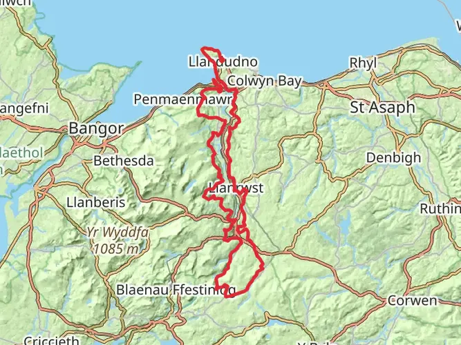
The Caerhun to Carmarthen via Wales Coast Path is a 247.4 km trail that starts in , Conwy, Wales. Based on our data, the hike is graded as Medium. For information on how we grade trails, please read measuring the difficulty of a hiking trail on hiiker. Also, check our latest community posts for trail updates. This hike can be completed in approx 11 days. Caution is advised on trail times as this depends on multiple variables. For more info read about how we calculate hike time.

What to expect?
Activity types
Frequently asked questions
How long does the Caerhun to Carmarthen via Wales Coast Path hike take?
Caerhun to Carmarthen via Wales Coast Path is 247.38 km long with 7,674 m of climbing, so it is a true multi-day route rather than a weekend walk. Most hikers break a route of this length into roughly 10 to 16 days, depending on daily mileage, weather, and how many stops are planned in coastal towns along the way.
How difficult is the Caerhun to Carmarthen via Wales Coast Path hike?
Caerhun to Carmarthen via Wales Coast Path is rated medium, but the numbers make it a substantial undertaking. The route covers 247.38 km and gains 7,674 m in elevation, so the challenge comes from sustained distance and repeated climbs over many days rather than from a single steep mountain ascent.
Where do you start and finish the Caerhun to Carmarthen via Wales Coast Path hike?
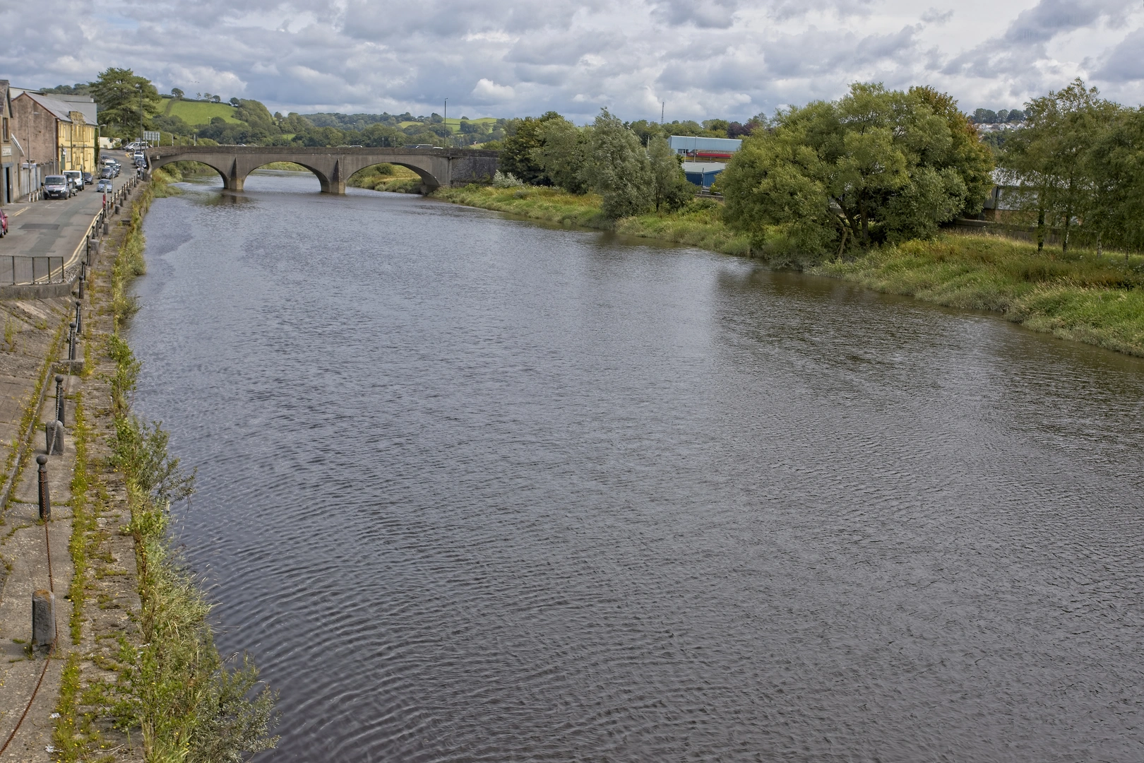
Caerhun to Carmarthen via Wales Coast Path starts in the Conwy area of North Wales and finishes in Carmarthen in southwest Wales. Carmarthen sits on the Wales Coast Path and the town’s rail station is directly on the route, with parking available at Carmarthen Railway Station, The Quay, and Blue Street near the bus station. ([walescoastpath.gov.uk](https://www.walescoastpath.gov.uk/plan-your-visit/itineraries/circular-walks/carmarthenshire/carmarthen-town/?lang=en&utm_source=openai))
Can you use public transport for the Caerhun to Carmarthen via Wales Coast Path hike?
Public transport is practical at the Carmarthen end of Caerhun to Carmarthen via Wales Coast Path. Carmarthen has daily train services on the South Wales Mainline and West Wales Line, and bus links connect the town with destinations across southwest Wales, including services toward Llansteffan and St Clears. ([walescoastpath.gov.uk](https://www.walescoastpath.gov.uk/plan-your-visit/itineraries/circular-walks/carmarthenshire/carmarthen-town/?lang=en&utm_source=openai))
Is the Caerhun to Carmarthen via Wales Coast Path hike dog friendly?
Caerhun to Carmarthen via Wales Coast Path can be walked with a dog on many sections, but rules can change by location and season because the Wales Coast Path passes beaches, farmland, and livestock areas. Some stretches may have local restrictions or require dogs to be on a lead, especially near grazing land and sensitive coastal sections, so each day’s section needs checking before setting out.
What is the best time of year to hike Caerhun to Carmarthen via Wales Coast Path?
Late spring through early fall is usually the most practical window for Caerhun to Carmarthen via Wales Coast Path. A 247.38 km coastal route is easier to manage when daylight is longer and transport, town services, and trail conditions are more reliable, while winter can bring stronger winds, wet ground, and occasional flooding on low-lying riverside sections near Carmarthen. ([walescoastpath.gov.uk](https://www.walescoastpath.gov.uk/plan-your-visit/itineraries/circular-walks/carmarthenshire/carmarthen-town/?lang=en&utm_source=openai))
Are there any route quirks near the end of the Caerhun to Carmarthen via Wales Coast Path hike?
One notable feature near the Carmarthen end of Caerhun to Carmarthen via Wales Coast Path is the River Towy estuary. The official Wales Coast Path can involve a long inland estuary section of about 18 miles or 29 km between Ferryside and Llansteffan before reaching Carmarthen, which is worth factoring into daily planning. ([walescoastpath.gov.uk](https://www.walescoastpath.gov.uk/plan-your-visit/transportation/getting-around-on-the-path/?lang=en&utm_source=openai))
Comments and Reviews
User comments, reviews and discussions about the Caerhun to Carmarthen via Wales Coast Path, Wales.
4.56
average rating out of 5
41 rating(s)