Download
3D Flyover
Add to list
More
4.2 km
~52 min
18 m
Loop
“A tranquil Wye Valley wander pairs broad river views, historic bridges, and lush village charm.”
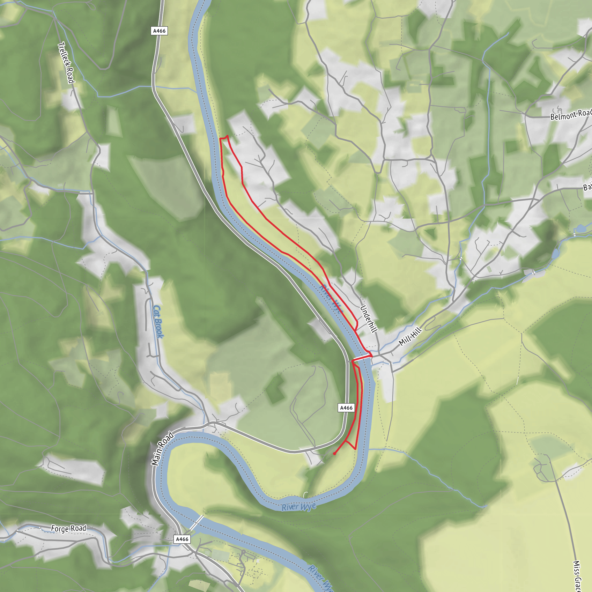
This easy loop explores one of the gentlest stretches of the lower Wye Valley, combining quiet riverside walking, a historic village setting, and broad views of the River Wye with very little climbing. At around 4 km / 2.5 miles and roughly 0 m / 0 ft of ascent, it suits walkers looking for a short outing with plenty of interest packed into a compact route. The terrain is mostly level, but expect a mix of riverside path, village lanes, bridge crossings, and potentially muddy sections after rain. Sources describing nearby versions of this walk note flat or gently graded ground, with some short steps and muddy patches by the river in wet conditions. (visorando.com)
The walk is centered on Brockweir, near Brockweir Bridge, Brockweir, Chepstow NP16 7NW, United Kingdom, which is the clearest significant landmark for the trailhead area based on the available route information. Some nearby route descriptions also use The Old Station Tintern, Station Road, Tintern, Chepstow NP16 6TQ as a start for longer variations in the same area, but for a short Brockweir and River Wye loop, Brockweir Bridge and the village itself are the most practical reference point. (historicengland.org.uk)
If arriving by car, the simplest approach is via the A466 Wye Valley road, which runs through Tintern and past Brockweir. Parking in Brockweir is limited, so it is worth checking for informal roadside options only where permitted and without blocking village access. If village parking is full, a common fallback is to park at The Old Station Tintern, Station Road, Tintern, Chepstow NP16 6TQ, where route guides note parking and visitor facilities, then adapt the walk from there. (dean-wye.files.svdcdn.com)
For public transport, the nearest practical hub is usually Chepstow, with onward travel into the Wye Valley by local bus along the A466 corridor toward Tintern and Brockweir, though services in this rural area can be limited and seasonal frequency may vary. It is wise to check current timetables before setting out and map the route in HiiKER in advance, especially if you plan to combine walking with a bus return. (visitdeanwye.co.uk)
What to expect on the route
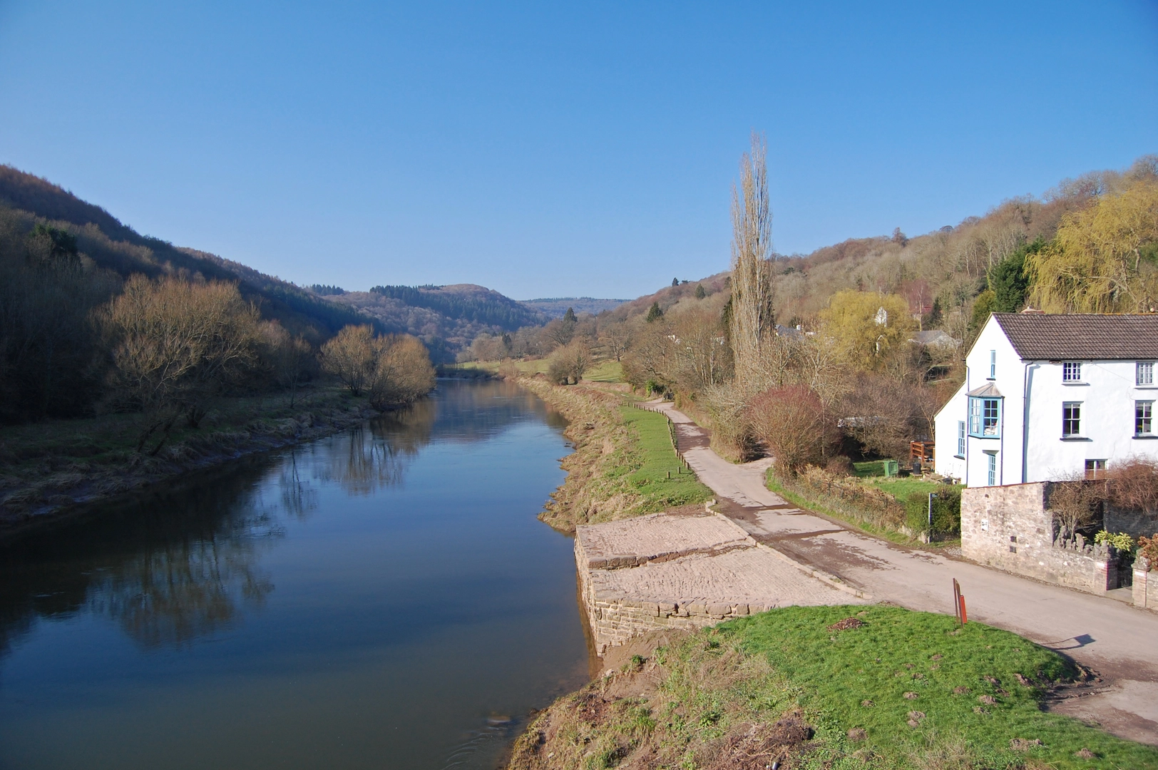
From the Brockweir area, the loop typically follows the river closely at first, giving a calm start with open water beside you and wooded valley sides rising beyond. This lower part of the Wye can feel surprisingly broad for such a short walk, and the river is a constant feature rather than an occasional glimpse. The walking here is generally straightforward, but riverside ground can be soft after wet weather, so waterproof footwear is a sensible choice even on an easy route. (visorando.com)
Within the first 1 km / 0.6 miles, the most obvious landmark is Brockweir Bridge, the road bridge that links the Gloucestershire side with Monmouthshire. Historic England records the bridge as an early-20th-century structure that has continuously carried road traffic since opening, replacing earlier crossing arrangements in a settlement long associated with river transport. Crossing here gives a good sense of the valley’s shape and of Brockweir’s long role as a crossing point. (historicengland.org.uk)
As the loop continues, you may also encounter or view the line of the Old Tramway Bridge, often called Wireworks Bridge, another important local structure. Historic England notes that this bridge later became a public footpath crossing and remains a distinctive reminder of the industrial transport links that once served the valley. Even on a short walk, these bridges help explain why this small place mattered so much historically. (historicengland.org.uk)
Landscape, wildlife, and seasonal interest
The Wye Valley is known for its wooded slopes, river-edge habitats, and rich birdlife, and even a short loop around Brockweir gives a good sample of that character. Expect alder, willow, and mixed broadleaf woodland near the water, with denser tree cover in places and more open views from bridge approaches and bends in the river. Nearby walk descriptions mention wildlife areas and riverside habitats, while broader Wye Valley sources describe the river as an important wildlife corridor and breeding area for notable species. (dean-wye.files.svdcdn.com)
Birdwatchers should keep an eye out for common river and woodland species such as herons, ducks, swans, woodpeckers, and songbirds, while the river margins may also support dragonflies in warmer months. In spring and summer, the greenery can make the route feel enclosed and lush; in autumn, leaf color adds a lot of visual appeal; and in winter, the more open tree cover can reveal better views of the valley and village. Because this is a low-level riverside route, conditions can be damp at any time
Surfaces
Unknown
Grass
Asphalt
Comments and Reviews
User comments, reviews and discussions about the Brockweir and River Wye Loop, Wales.
average rating out of 5
0 rating(s)
