Download
3D Flyover
Add to list
More
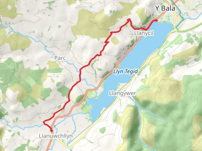
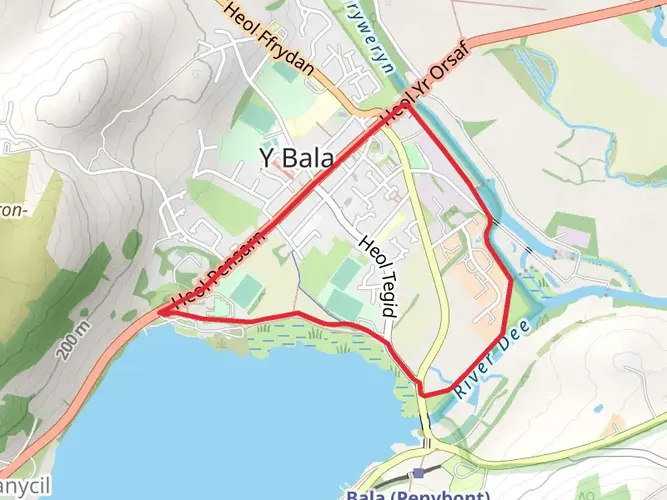
16.5 km
~5 hrs 44 min
809 m
Loop
Mountain Craft Verified. This is the official line used on our guided events, optimised for safety and efficient movement in all weather conditions.
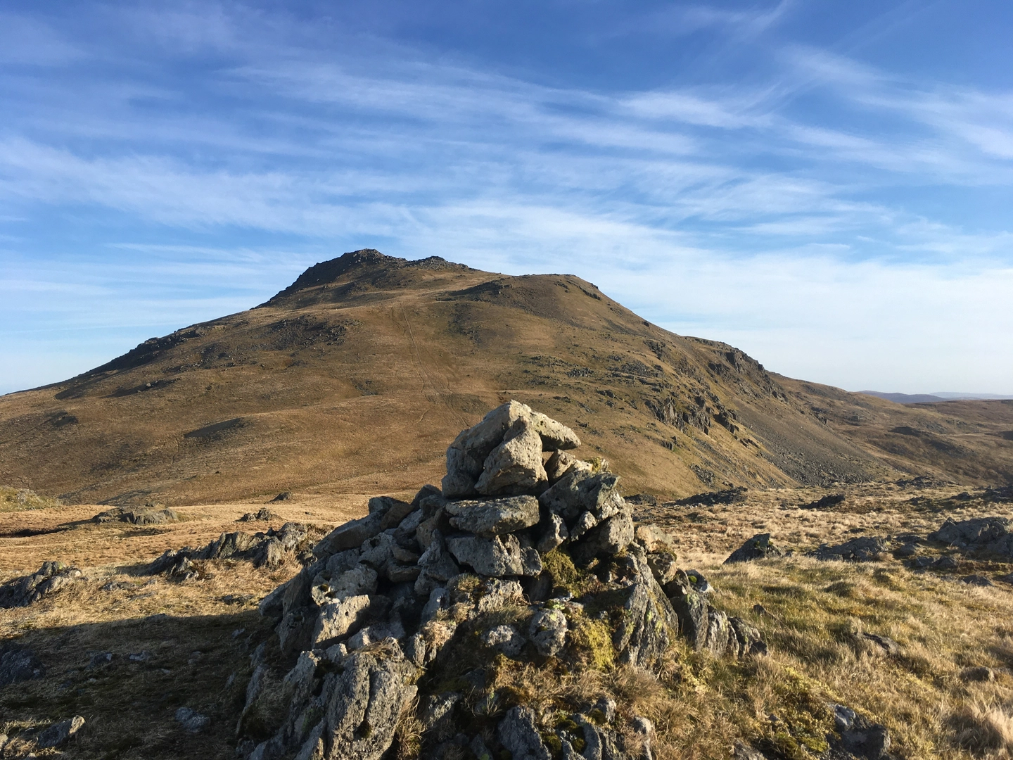
ROUTE OVERVIEW This 16km circuit from the shores of Llyn Arenig Fawr is a deep dive into the silent, trackless heart of the Arenig range. It traverses the dramatic Y Castell ridge to reach the summit of Arenig Fawr (805m) before committing to the wild south ridge and a pathless crossing to the rocky ribs of Moel Llyfnant. It is a journey defined by complete isolation and a total absence of trail markers.
THE TERRAIN Purely wild and uncompromising. After the initial track past the bothy, the ground becomes increasingly remote. You will face steep, rocky ridge lines, trackless moorland, and a significant pathless drop into the valley separating the two peaks. The ascent of Moel Llyfnant via its southeast spur is a masterclass in reading the ground, crossing impressive rocky features that most walkers never see.
CHALLENGE RATING High physical and navigational demand. While the 900m of ascent is moderate on paper, the trackless nature of the ridges and the raw ground between summits make for a long, taxing day. This is a route for those who can navigate through complex, featureless terrain when visibility drops.
NOTE This is one of our favourite "off-grid" days. Mountain Craft runs this circuit as a guided navigation day, perfect for those wanting to transition from established paths to the deep ground of the outliers. Check our profile for current availability and event dates.


What to expect?
Activity types
Comments and Reviews
User comments, reviews and discussions about the Arenig Fawr & Moel Llyfnant, Wales.
average rating out of 5
0 rating(s)