Download
3D Flyover
Add to list
More
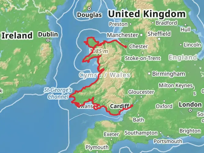
145.9 km
~6 days
4046 m
Multi-Day
“Embark on the Snowdonia Slate Trail, a tapestry of Welsh heritage and scenic splendor.”
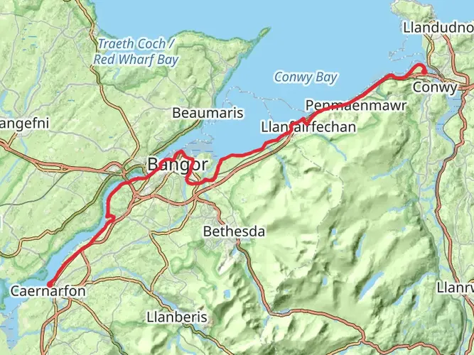
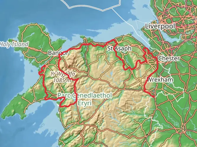
The Snowdonia Slate Trail is an immersive journey through the historical heartland of Wales' slate industry, offering hikers a unique blend of cultural heritage and natural beauty. Spanning approximately 146 kilometers (around 91 miles) with an elevation gain of roughly 4600 meters (about 15,091 feet), this loop trail begins and ends in the vicinity of Gwynedd, Wales, encircling the Snowdonia National Park.
Getting to the Trailhead
To reach the starting point of the Snowdonia Slate Trail, travelers can drive to the town of Bangor, which is the closest significant landmark to the trailhead. For those relying on public transport, Bangor is well-served by trains and buses. From Bangor, local bus services can take you closer to the trailhead, where your adventure will begin.
Navigating the Trail
The trail is well-marked, but carrying a reliable navigation tool like HiiKER is advisable to ensure you stay on the correct path, especially in areas where the trail may become less distinct. The app will also provide real-time updates on your location and progress along the trail.
Historical Significance and Landmarks
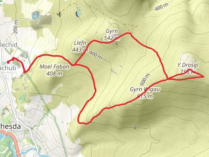
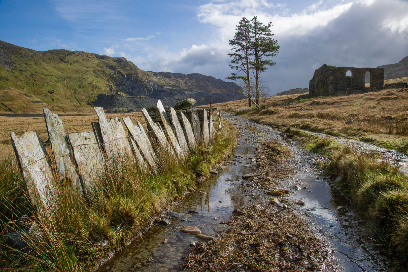
As you embark on the Snowdonia Slate Trail, you'll be walking through areas that were once the lifeblood of the Welsh slate industry. The trail takes you past abandoned quarries and through old mining towns, where the echoes of the past are still palpable. Notable historical landmarks include the imposing Penrhyn Quarry, once the largest slate quarry in the world, and the quaint village of Bethesda, which thrived during the slate industry's peak.
Natural Beauty and Wildlife
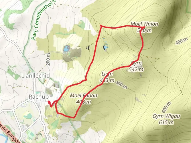
The trail offers a diverse range of landscapes, from serene lakes and prehistoric forests to rugged mountain vistas. The ascent of Moel Siabod provides panoramic views of Snowdonia, while the passage through the Gwydyr Forest is a tranquil experience amidst ancient woodland. Wildlife enthusiasts may spot a variety of birds, including peregrine falcons and red kites, as well as the occasional otter near riverbanks.
Trail Experience
The Snowdonia Slate Trail is rated as medium difficulty, making it accessible to hikers with a reasonable level of fitness. The trail can be completed in sections for those who prefer shorter hikes, or over several days for a more immersive experience. Accommodations along the route vary from campsites to bed and breakfasts, allowing for a range of preferences.
Preparation and Planning
Hikers should be prepared for the unpredictable Welsh weather by packing waterproof gear and layers for warmth. Sturdy hiking boots are essential for the varied terrain, which includes rocky paths and potentially muddy trails. It's also important to carry sufficient water and food, although there are opportunities to resupply in the towns along the route.
Conclusion
The Snowdonia Slate Trail is not just a hike; it's a journey through time, offering a window into Wales' industrial heritage set against the backdrop of its stunning natural landscapes. Whether you're a history buff, a nature lover, or simply seeking a challenging trek, this trail promises a rich and rewarding experience.

What to expect?
Activity types
Surfaces
Unknown
Asphalt
Gravel
Dirt
Unpaved
Frequently asked questions
How long does it take to hike the Snowdonia Slate Trail?
The Snowdonia Slate Trail is a 145.93 km multi-day route, so most hikers split it across about a week on the ground. A common benchmark for the route is seven days, which works out to roughly 20 to 21 km per day, though the 4,046 m of climbing can make some stages feel longer than the mileage suggests.
Where does the Snowdonia Slate Trail start and finish?
The Snowdonia Slate Trail is a circuit in Gwynedd, so it can be walked from several access points, but Bangor and Porth Penrhyn are commonly used starting points. The route links major slate landscape locations including Bethesda, Llanberis, the Nantlle Valley, Beddgelert, Llan Ffestiniog, Betws-y-Coed, and Penmachno before closing the loop.
Is the Snowdonia Slate Trail a loop trail or a point-to-point walk?
The Snowdonia Slate Trail is a loop, not a one-way crossing. That makes logistics simpler than many long-distance walks because the route circles through the slate landscapes of Gwynedd and returns to the wider Bangor area rather than finishing far from the start.
How difficult is the Snowdonia Slate Trail?
The Snowdonia Slate Trail is generally rated medium, but it is still a serious long-distance walk at 145.93 km with 4,046 m of total ascent. The challenge comes less from technical ground and more from the cumulative distance, repeated climbs, and the need to manage several full days of walking through upland terrain in North Wales.
What towns and landmarks does the Snowdonia Slate Trail pass through?
The Snowdonia Slate Trail is built around the historic slate landscapes of Gwynedd and passes through or links places such as Bangor, Bethesda, Llanberis, Beddgelert, Llan Ffestiniog, Betws-y-Coed, and Penmachno. Key slate heritage highlights associated with the route include Penrhyn Quarry, the National Slate Museum, and landscapes within the UNESCO Slate Landscape of Northwest Wales.
Can the Snowdonia Slate Trail be done in sections?
Yes. Although the full Snowdonia Slate Trail is 145.93 km, it is widely described as a route that can be completed either as a continuous multi-day hike or in shorter sections. That makes it practical for walkers who want to break the trail into day hikes around places like Bangor, Bethesda, Llanberis, or Beddgelert.
Is the Snowdonia Slate Trail good for history as well as scenery?
Yes. The Snowdonia Slate Trail is unusual because it combines a substantial long-distance hike with North Wales industrial heritage, tracing the quarrying landscapes that helped define Gwynedd. The route passes through the UNESCO-recognized slate landscape and connects quarry communities, working and former quarry areas, and museum sites as well as mountain and valley scenery.
Comments and Reviews
User comments, reviews and discussions about the Snowdonia Slate Trail, Wales.
4.75
average rating out of 5
110 rating(s)