Download
3D Flyover
Add to list
More
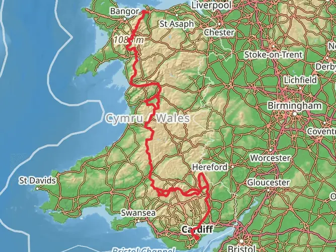
154.8 km
~6 days
3277 m
Multi-Day
“Embark on the Snowdonia Way: a scenic, historical 155km Welsh hiking adventure with diverse landscapes and wildlife.”
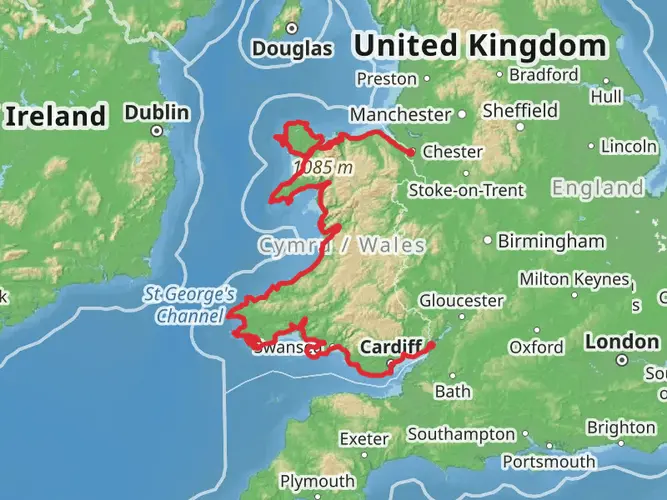
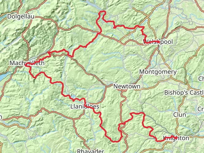
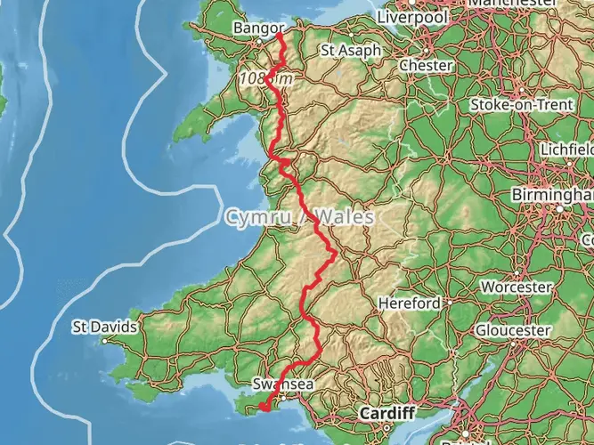
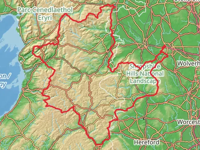
The Snowdonia Way is a captivating journey through the heart of the Snowdonia National Park in Wales, stretching approximately 155 kilometers (96 miles) and encompassing an elevation gain of around 3200 meters (10,500 feet). This point-to-point trail begins near the quaint village of Machynlleth, Powys, and concludes in the bustling town of Conwy, offering a medium difficulty rating that caters to hikers with a reasonable level of fitness and experience.
Getting to the Trailhead To reach the starting point near Machynlleth, hikers can utilize public transport options such as trains and buses that service the area. The town is well-connected, with direct train links from major cities like Shrewsbury and Birmingham. For those driving, Machynlleth is accessible via the A487 road, and parking is available in the town.
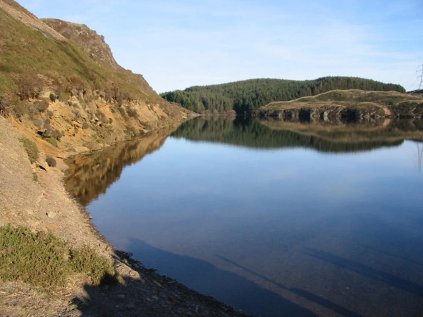
Navigating the Trail The Snowdonia Way is well-marked, but it's advisable to use a reliable navigation tool like HiiKER to ensure you stay on the correct path. The trail meanders through a variety of landscapes, including rolling hills, dense woodlands, and rugged mountain terrain.
Landmarks and Scenery As you embark on the Snowdonia Way, you'll be greeted by the imposing Cadair Idris, a mountain steeped in legend and offering panoramic views. The trail continues north, skirting the edge of the Rhinogydd range, where hikers can witness the untamed beauty of this lesser-traveled area.
Wildlife and Nature The diverse habitats along the Snowdonia Way are home to an array of wildlife. Keep an eye out for birds of prey such as peregrine falcons and red kites, as well as the elusive otters that inhabit the riverbanks. The trail also passes through areas of ancient woodland, a haven for native flora and fauna.
Historical Significance Snowdonia is rich in history, with remnants of the past evident along the trail. You'll encounter ancient standing stones, Iron Age forts, and the remnants of slate mining communities. The region's cultural heritage is palpable, with Welsh language and traditions thriving in the local villages.
Preparing for the Hike Given the trail's length and varied terrain, it's essential to be well-prepared with appropriate gear, including waterproof clothing, sturdy hiking boots, and sufficient food and water. Accommodation options range from wild camping (with permission) to cozy bed and breakfasts in the welcoming villages along the route.
Conclusion The Snowdonia Way offers an immersive experience into the wild heart of Wales, providing a challenging yet rewarding adventure for those who undertake its journey. With its stunning landscapes, rich history, and vibrant wildlife, this trail is a must-hike for enthusiasts looking to explore the Welsh countryside.

Frequently asked questions
How long is the Snowdonia Way and how many days does the Snowdonia Way usually take?
The Snowdonia Way is 154.75 km, or about 96 miles, with roughly 3,277 meters of climbing. Most hikers split it into about 6 to 8 days, depending on pace, weather, and whether they choose any of the higher mountain alternatives on the route north from Machynlleth to Conwy.
Where does the Snowdonia Way start and finish in Wales?
The Snowdonia Way is a point-to-point walk that starts near Machynlleth in Powys and finishes in Conwy on the north coast of Wales. That south-to-north line takes the route through the heart of Eryri, the Welsh name for Snowdonia, rather than making a circuit.
Is the Snowdonia Way hard, and is the Snowdonia Way suitable for intermediate hikers?
The Snowdonia Way is generally rated medium difficulty, but it is still a demanding multi-day walk at nearly 155 km with more than 3,200 meters of ascent. It suits hikers with solid day-after-day fitness and some experience of rougher upland terrain, especially if the higher mountain-route options are included.
Can the Snowdonia Way be done by train and bus from Machynlleth and Conwy?
Yes. Machynlleth and Conwy both have railway stations, which makes the Snowdonia Way one of the easier Welsh long-distance walks to access without a car. The official route information also notes that the end of every stage has a public transport link, which helps with section hiking and logistics.
Does the Snowdonia Way go over high mountains or stay on lower ground?
The Snowdonia Way has a mainly lower-level main route, but every stage has a mountain-route alternative for hikers who want a tougher, higher line. That means the walk can be tailored: the standard route is more moderate, while the mountain options add extra ascent, exposure, and time on high ground.
What are the main landmarks and landscapes on the Snowdonia Way?
The Snowdonia Way runs from Machynlleth to Conwy through mountain country that includes views around Cadair Idris and the wild Rhinogydd. Over its 154.75 km, the route mixes upland scenery, valleys, woodland, and more rugged northern terrain as it approaches Conwy on the coast.
Comments and Reviews
User comments, reviews and discussions about the Snowdonia Way, Wales.
4.67
average rating out of 5
61 rating(s)