Download
Preview
Add to list
More
54.9 km
~4 days
1654 m
Multi-Day
“Embark on the Central Alpine Lakes Loop for an unforgettable trek through Washington's captivating alpine wilderness.”
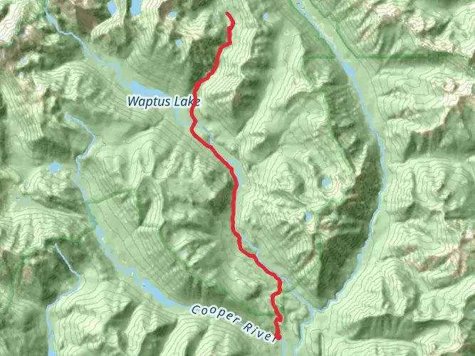
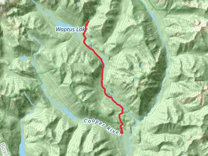
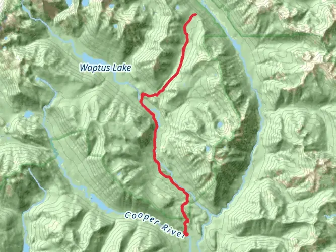
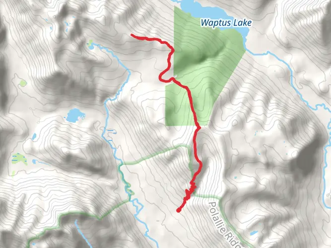
The Central Alpine Lakes Loop is a challenging and rewarding trek nestled in the heart of the Cascade Range, starting near Kittitas County, Washington. This approximately 55 km (34 miles) loop trail, with an elevation gain of around 1600 meters (5250 feet), offers hikers a chance to immerse themselves in the rugged beauty of the Alpine Lakes Wilderness.
Getting to the Trailhead To reach the trailhead, you can drive to the nearest significant landmark, which is the town of Cle Elum. From Cle Elum, take Highway 903 north until you reach Salmon La Sac Road, which will lead you to the trailhead parking area. For those relying on public transportation, options are limited, but during the hiking season, there may be shuttle services available from nearby towns.
Navigating the Trail As you embark on the Central Alpine Lakes Loop, ensure you have the HiiKER app downloaded for up-to-date trail maps and navigation. The trail is well-marked, but due to its length and remote nature, having a digital tool like HiiKER can be invaluable for staying on course.
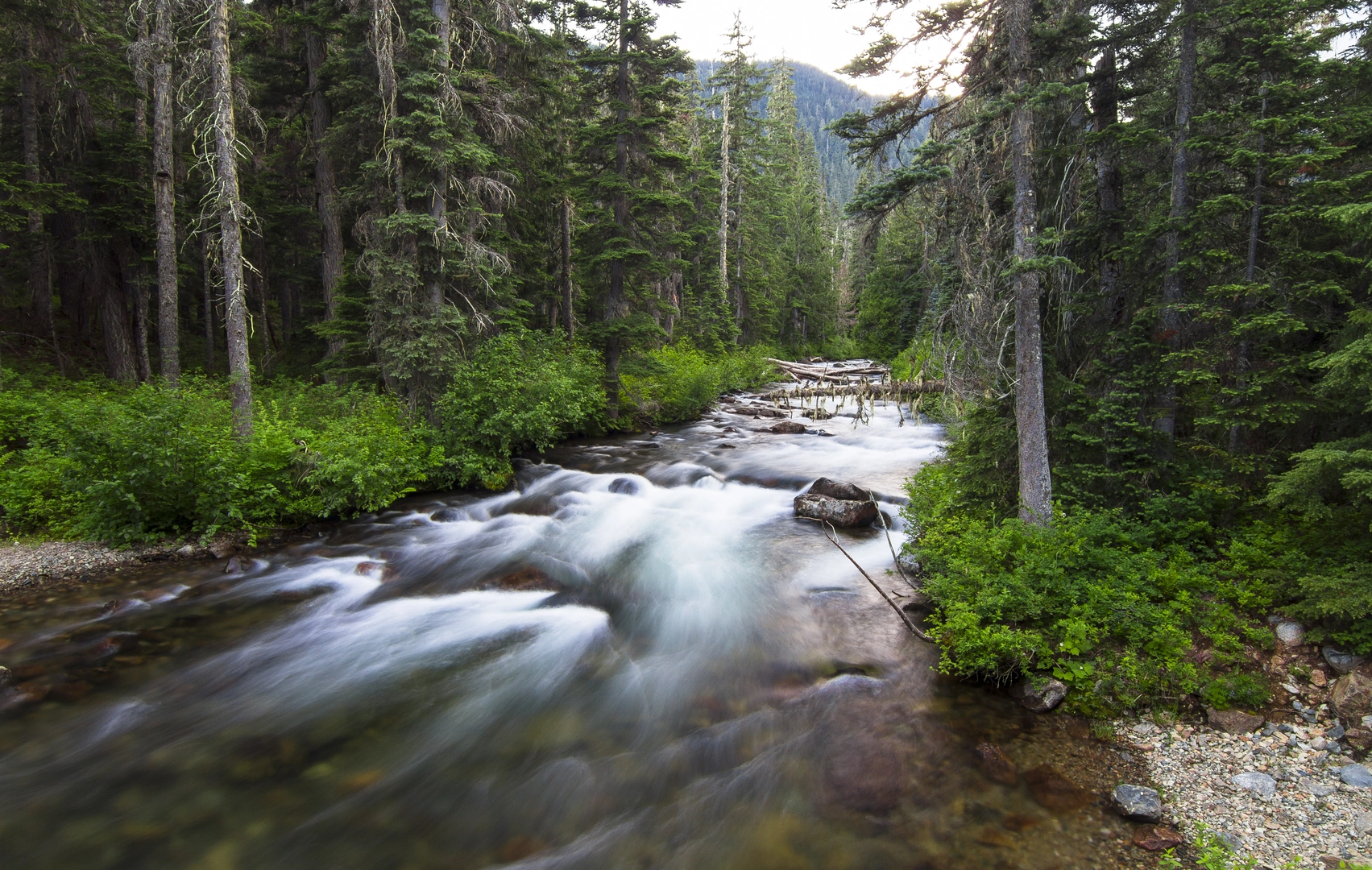
Trail Highlights and Landmarks The journey begins with a steady climb through dense forests of Douglas fir and western hemlock, opening up to subalpine meadows dotted with wildflowers in the late spring and summer. Approximately 10 km (6.2 miles) in, you'll reach the first of many alpine lakes, each offering unique vistas and a chance for reflection.
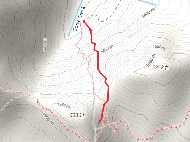
As you continue, the trail weaves through passes and valleys, with significant elevation changes that will test your endurance. You'll encounter several notable landmarks, such as the Chikamin Peak and the Four Brothers, which stand as sentinels over the landscape. The views from these higher elevations are breathtaking, with glimpses of distant peaks and the serene lakes below.
Wildlife and Nature The Alpine Lakes Wilderness is home to a diverse array of wildlife. Keep an eye out for mountain goats, black bears, and marmots. Birdwatchers will delight in the opportunity to spot species such as the gray jay, Clark's nutcracker, and the occasional golden eagle. Remember to practice Leave No Trace principles to minimize your impact on this pristine environment.
Historical Significance The region holds a rich history, with the Alpine Lakes Wilderness being a testament to conservation efforts that date back to the 1970s. The area was designated as wilderness to preserve its natural state, a victory for environmentalists and a legacy that continues to protect the land for future generations.
Preparation and Planning Given the difficulty of the trail, it's essential to be well-prepared. Pack sufficient food and water, as well as a water filter for refilling from the lakes and streams. Weather can change rapidly in the mountains, so bring layers and be prepared for both sun and snow, even in summer. A good pair of hiking boots, trekking poles, and navigation tools are also must-haves for this adventure.
Access and Regulations The trail is typically accessible from July through October, but snow can linger on higher sections well into the summer. Wilderness permits are required for overnight stays, which can be obtained at the trailhead or local ranger stations. Campfires are often prohibited above certain elevations to protect the delicate alpine environment.
By respecting the trail and its surroundings, hikers can ensure that the Central Alpine Lakes Loop remains a stunning destination for all who seek the solitude and beauty of the Cascades.

What to expect?
Activity types
Frequently asked questions
How long is the Central Alpine Lakes Loop in Washington, and how many days does it usually take?
The Central Alpine Lakes Loop is 54.93 km, or about 34.1 miles, with 1,654 m of elevation gain. That length and climbing put it firmly in multi-day territory for most parties, and many hikers split it into 2 to 4 days depending on pace, camp locations, and how much time is spent at the alpine lakes and passes.
How difficult is the Central Alpine Lakes Loop, and is it suitable for beginners?
The Central Alpine Lakes Loop is rated Extra Difficult, with nearly 55 km of travel and 1,654 m of total ascent. That combination makes it a better fit for experienced hikers or backpackers who are comfortable with long days, sustained climbing, and remote wilderness travel rather than first-time backpackers.
Where do you park for the Central Alpine Lakes Loop trailhead near Cle Elum?
The usual access is from the Cle Elum area via WA-903 and Salmon La Sac Road toward the Salmon La Sac trailhead area in the Cle Elum Ranger District. The Forest Service notes that Salmon La Sac Trailhead gets extremely busy seven days a week in summer, parking can be limited, and day-use parking requires a fee or valid recreation pass.
Do you need a permit for the Central Alpine Lakes Loop in the Alpine Lakes Wilderness?
Yes. Trips entering the Alpine Lakes Wilderness require a free self-issued wilderness permit filled out at the trailhead. That is separate from trailhead parking fees, so hikers should plan for both the wilderness permit and the required parking pass or payment at the access point.
When is the best time of year to hike the Central Alpine Lakes Loop?
The main hiking season is typically late May through early November from the Salmon La Sac side, which aligns with the Forest Service season of use for that trailhead. Summer and early fall are usually the most reliable windows for a 54.93 km alpine loop, because higher terrain in the Alpine Lakes Wilderness can hold snow well into late spring.
Is the Central Alpine Lakes Loop dog-friendly?
Dogs are generally allowed in much of the Alpine Lakes Wilderness, but some specific protected zones have restrictions, so rules depend on the exact line of travel. For a long loop in this area, hikers should expect wilderness regulations to apply throughout and confirm whether any segment enters a zone with dog limits before starting.
Where is the Central Alpine Lakes Loop located, and what is the nearest town?
The Central Alpine Lakes Loop is in Kittitas County, Washington, in the Cascade Range within the Alpine Lakes Wilderness. Cle Elum is the nearest major town commonly used for access, with the route typically approached by driving north on WA-903 and continuing along Salmon La Sac Road toward the trailhead area.
Comments and Reviews
User comments, reviews and discussions about the Central Alpine Lakes Loop, Washington.
4.83
average rating out of 5
6 rating(s)