Download
Preview
Add to list
More
51.0 km
~4 days
2162 m
Multi-Day
“Embark on the Goat Rocks Circuit, a stunning, challenging trek through diverse landscapes and vibrant wildlife in Washington's Cascades.”
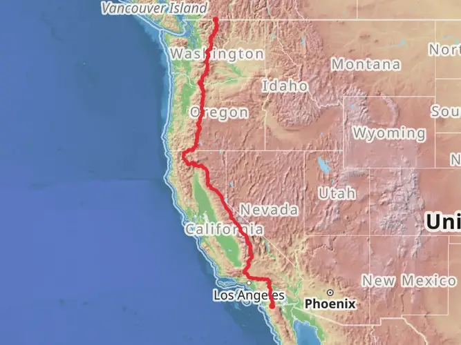
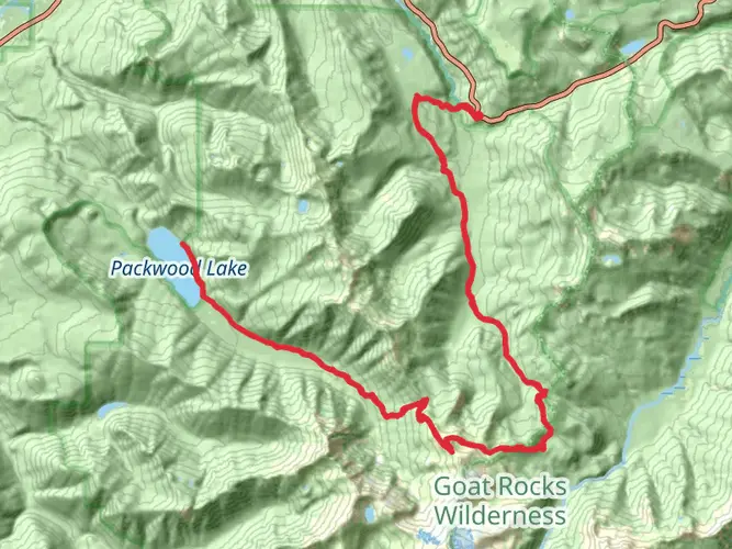
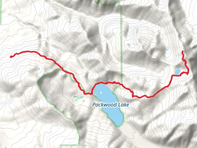
The Goat Rocks Circuit is a challenging and rewarding trek that spans approximately 51 kilometers (around 31.7 miles) with an elevation gain of around 2100 meters (nearly 6890 feet). This point-to-point trail is nestled in the heart of the Cascade Range, near Lewis County, Washington, and is known for its breathtaking vistas, alpine meadows, and diverse wildlife.
Getting to the Trailhead
To reach the trailhead, hikers can drive to the Berry Patch Trailhead, which is the common starting point for the Goat Rocks Circuit. The trailhead is accessible via Forest Road 21, which branches off from US Highway 12. For those relying on public transportation, options are limited, and it's generally recommended to arrange a private shuttle or carpool to the starting point.
Navigating the Trail
Hikers should prepare for a demanding journey that typically takes several days to complete. It's crucial to have a reliable navigation tool like HiiKER to track your progress and stay on course. The trail is well-marked in most sections, but weather conditions can obscure the path, making navigation tools essential.
Landmarks and Scenery
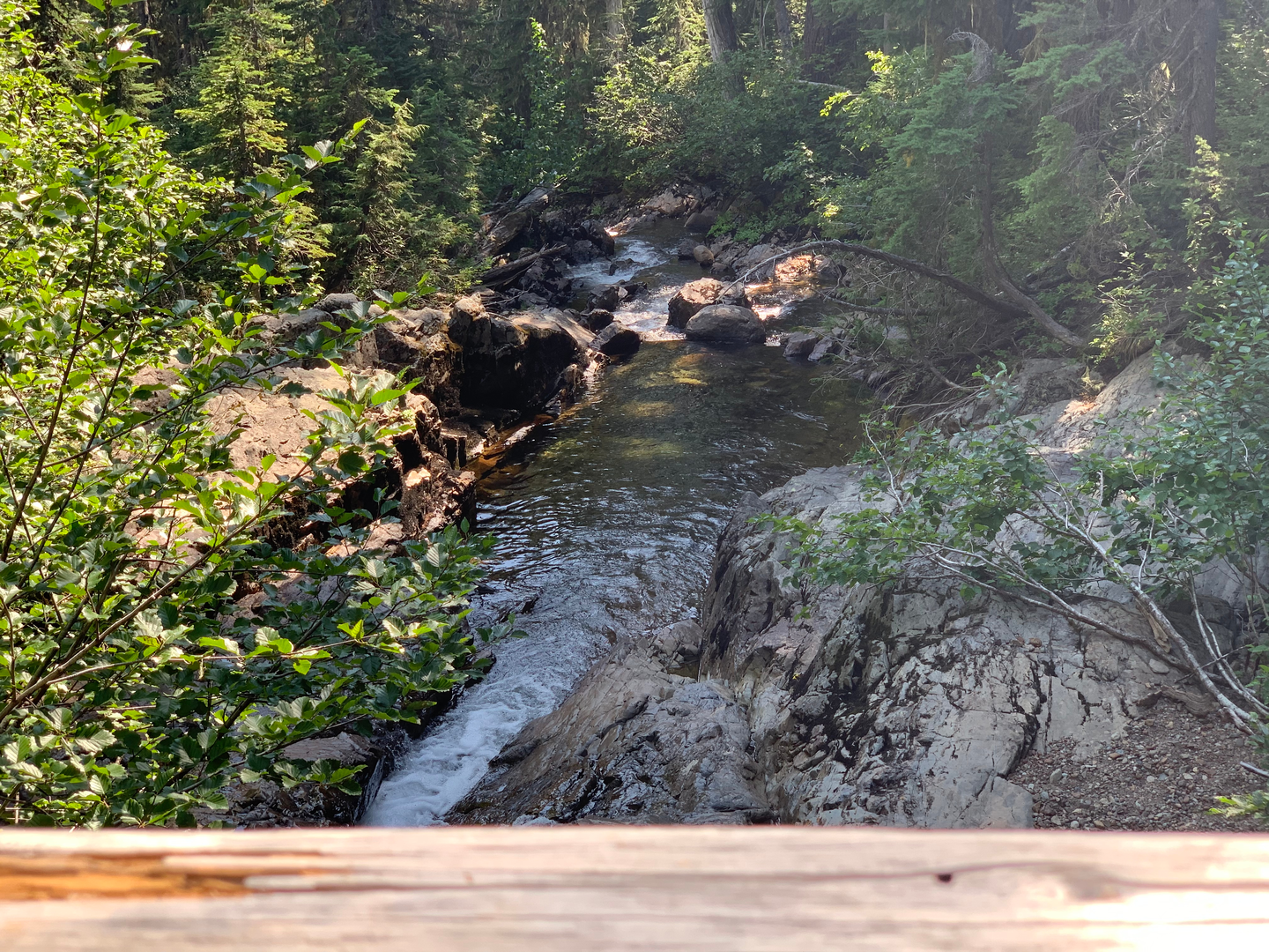
As you embark on the Goat Rocks Circuit, you'll traverse a variety of landscapes, including dense forests, subalpine meadows, and rugged ridgelines. One of the highlights is the Packwood Glacier, which you'll encounter early in the hike. The glacier is a remnant of the extensive ice that once covered the region, and it's a stark reminder of the area's glacial history.
Further along, you'll reach the Goat Rocks Crest, an exposed ridge that offers panoramic views of Mount Rainier to the north and Mount Adams to the south. This section can be particularly challenging, with steep ascents and potentially strong winds.
Wildlife and Flora
The Goat Rocks area is home to a diverse array of wildlife, including mountain goats, which are often seen grazing on the high slopes. Black bears, elk, and marmots are also common, so hikers should be knowledgeable about wildlife safety and food storage practices.
The trail is also renowned for its wildflower displays in the late summer. Fields of lupine, Indian paintbrush, and aster add splashes of color to the landscape, making for an unforgettable hiking experience.
Historical Significance
The Goat Rocks region holds historical significance as it was once an active volcanic area, part of the same volcanic arc as Mount St. Helens and Mount Rainier. The area's geology is a testament to its fiery past, with volcanic rock formations and pumice fields dotting the landscape.
Preparation and Safety
Given the trail's difficulty rating, hikers should be in good physical condition and have experience with backcountry travel. The weather can change rapidly, so it's important to pack layers and be prepared for all conditions. Snow can linger on the trail well into the summer, and river crossings can be hazardous, especially during high water periods in the spring and early summer.
Water sources are generally plentiful, but all water should be treated before drinking. As with any backcountry excursion, leave no trace principles should be strictly followed to preserve the natural beauty of the area for future generations.
Conclusion
The Goat Rocks Circuit is a must-do for seasoned hikers seeking a challenging adventure amidst some of the most stunning scenery in the Pacific Northwest. With proper preparation and respect for the natural environment, this trail promises an unforgettable experience.

What to expect?
Activity types
Frequently asked questions
How long is the Goat Rocks Circuit and how many days does the Goat Rocks Circuit take?
The Goat Rocks Circuit is 50.96 km, or about 31.7 miles, with 2,162 m of elevation gain, so it is a serious multi-day backpack rather than a casual overnight. Most hikers split it into 2 to 4 days depending on pace, weather, pack weight, and how much time is spent on high ridges and meadow sections.
Where do you start the Goat Rocks Circuit and where is parking for the Goat Rocks Circuit?
The usual starting point for the Goat Rocks Circuit is Berry Patch Trailhead in the Goat Rocks Wilderness access area near Packwood. Drivers reach it from US Highway 12 via Forest Road 21 and then Forest Road 2150, which serves the Berry Patch, Chambers Lake, and Snowgrass Flats trailheads; Berry Patch has pit toilets and requires a recreation pass or day fee for parking.
Do you need a permit for the Goat Rocks Circuit in Washington?
A wilderness permit is required for travel in the Goat Rocks Wilderness, but it is a free self-issuing permit available at trailheads. Parking at Berry Patch is separate from the wilderness permit and typically requires a Northwest Forest Pass, an interagency pass, or the posted day-use fee.
Are dogs allowed on the Goat Rocks Circuit?
Dogs are generally allowed on trails in the Goat Rocks Wilderness, including access from Berry Patch and Snowgrass, as long as wilderness regulations are followed and pets are kept under control around other hikers, stock, and wildlife. This route passes through fragile alpine terrain where mountain goats are common, so strong voice control and careful campsite management matter.
What are the camping rules on the Goat Rocks Circuit?
Camping on the Goat Rocks Circuit is regulated in several sensitive areas. Camping is prohibited within 100 feet of lakes and within 100 feet of the Pacific Crest National Scenic Trail, and there is no camping or campfires at Snowgrass Flats or in the Shoe Lake basin; the usual alternative named by the Forest Service is Hidden Springs, about 1 mile west of Shoe Lake.
When is the best time of year to hike the Goat Rocks Circuit?
The main hiking season for the Goat Rocks Circuit is typically mid-summer into early fall, when the high country is more likely to be snow-free and the meadows around Snowgrass Flat are in bloom. July and August are especially popular for wildflowers, but lingering snow can still affect higher sections earlier in the season, and autumn weather can turn quickly on exposed ridges.
Is the Goat Rocks Circuit hard?
Yes. The Goat Rocks Circuit is rated Extra Difficult, and the numbers explain why: 50.96 km of distance and 2,162 m of climbing in rugged Cascade terrain. The route combines long mileage with sustained elevation gain, exposed alpine sections, and backcountry logistics that make it better suited to experienced hikers with solid navigation and mountain-weather judgment.
Comments and Reviews
User comments, reviews and discussions about the Goat Rocks Circuit, Washington.
4.5
average rating out of 5
8 rating(s)