Download
Preview
Add to list
More
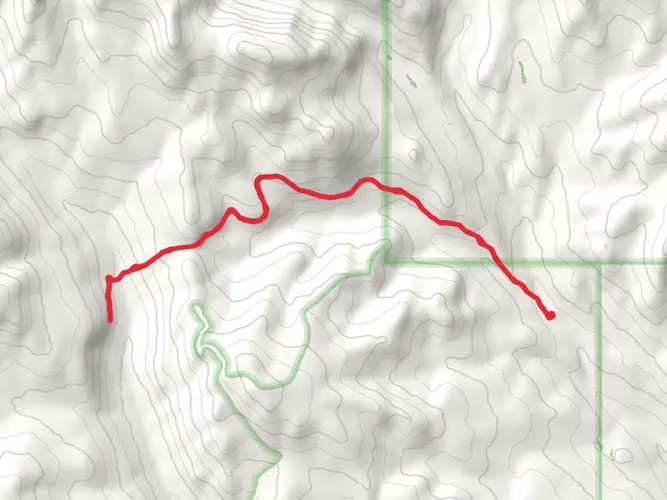
98.1 km
~6 days
3177 m
Multi-Day
“Embark on a scenic 61-mile trek through the Eastern Pasayten Loop, rich in history and diverse natural splendors.”
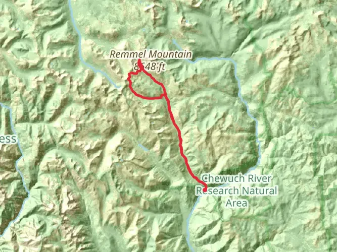
Embarking on the Eastern Pasayten Loop, hikers will traverse approximately 98 kilometers (about 61 miles) of diverse landscapes, with an elevation gain of around 3100 meters (approximately 10,170 feet). This loop, nestled in the expansive Pasayten Wilderness near Okanogan County, Washington, offers a medium difficulty rating, making it accessible to hikers with a moderate level of experience.
Getting to the Trailhead
The trailhead is most conveniently reached by car. From the nearest town of Winthrop, Washington, take the East Chewuch Road north for about 22 miles until it becomes the Chewuch River Road/Forest Road 51. Continue for another 26 miles to Thirtymile Trailhead, which serves as the starting point for the Eastern Pasayten Loop. Public transport options are limited in this remote area, so driving or arranging a shuttle service is recommended.
Navigating the Trail
Hikers can rely on the HiiKER app for up-to-date trail maps and navigation assistance throughout their journey. The loop can be tackled in either direction, but many choose to go clockwise to gradually acclimate to the elevation.
Trail Highlights and Landmarks
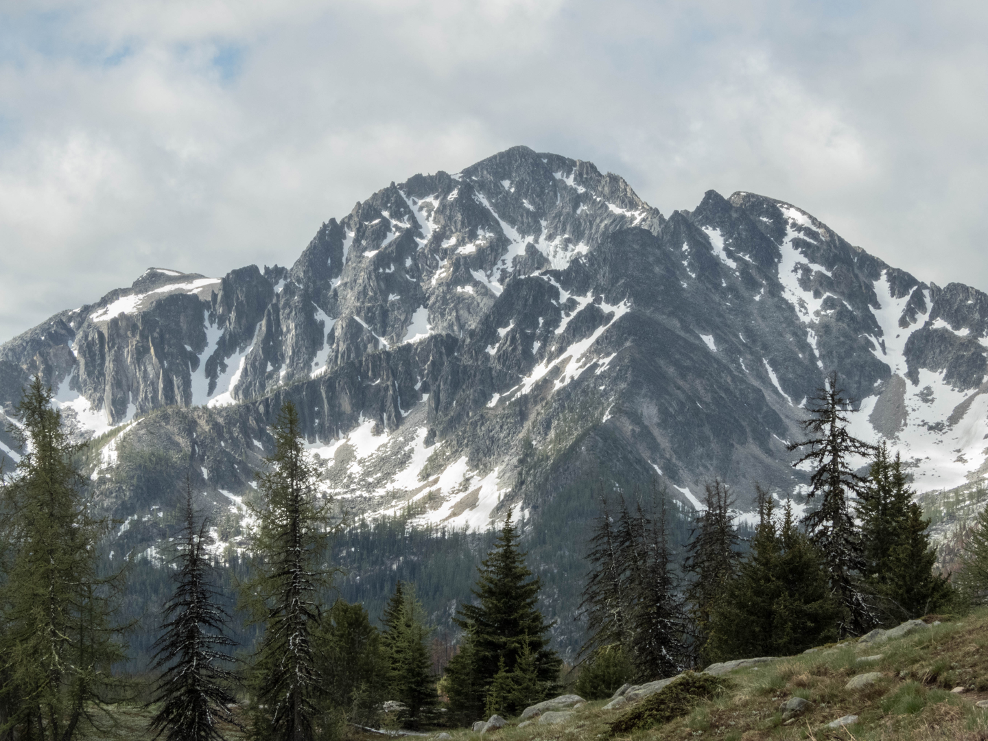
As you set out, the trail meanders through dense forests, opening up to vast meadows dotted with wildflowers, particularly vibrant in the late spring and early summer. The route offers panoramic views of the North Cascades and the opportunity to spot local wildlife, including deer, black bears, and the elusive lynx.
After approximately 20 kilometers (12.4 miles), you'll reach the first significant landmark, the remnants of an old fire lookout at Cathedral Peak. This spot provides a historical glimpse into the region's past efforts to monitor forest fires and is a perfect place for a rest with a view.
Continuing on, the trail ascends to the high alpine passes, where the landscape shifts to reveal rocky outcrops and the occasional snowfield, even in summer. The highest point of the loop is at Windy Peak, around 40 kilometers (25 miles) in, where hikers are rewarded with a stunning 360-degree view of the surrounding wilderness.
Flora and Fauna
The Eastern Pasayten Loop is home to a rich array of plant and animal life. The lower elevations are characterized by Ponderosa pines and Douglas firs, while subalpine fir and Engelmann spruce dominate the higher altitudes. The diverse habitats support a variety of bird species, including the mountain bluebird and Clark's nutcracker.
Historical Significance
The Pasayten Wilderness area is steeped in history, with evidence of Native American presence dating back thousands of years. The region was later explored by miners and trappers, and the trail itself crosses paths with the Pacific Northwest National Scenic Trail, a testament to the enduring importance of these routes for exploration and commerce.
Preparation and Safety
Given the remote nature of the trail, hikers should be well-prepared with adequate supplies, including food, water, and emergency gear. Weather can change rapidly in the mountains, so layered clothing is essential. It's also important to practice bear safety, including storing food in bear-proof containers and making noise while hiking to avoid surprise encounters.
Conclusion
The Eastern Pasayten Loop is a journey through time, nature, and the rugged beauty of the North Cascades. With its moderate difficulty, it offers an immersive experience for those looking to explore the wilderness and its history. Whether you're marveling at the views from Windy Peak or enjoying the tranquility of the forested valleys, this trail promises an unforgettable adventure.

What to expect?
Activity types
Frequently asked questions
How long does the Eastern Pasayten Loop usually take to hike?
The Eastern Pasayten Loop is 98.15 kilometers, or about 61 miles, with 3,177 meters of climbing, so it is typically planned as a multi-day backpacking trip rather than a long day hike. Most strong backpackers split a loop of this length into roughly 4 to 7 days, depending on pace, camp locations, and how much time is spent on high-country passes and side views.
Where is the trailhead for the Eastern Pasayten Loop and where do you park?
The Eastern Pasayten Loop starts from Thirtymile Trailhead in the Pasayten Wilderness access area north of Winthrop. The Forest Service lists Thirtymile Trailhead as the access point for Chewuch Trail #510, and the drive approaches via East Chewuch Road and Forest Road 51, with parking at the trailhead.
Is the Eastern Pasayten Loop a hard hike?
Yes. The Eastern Pasayten Loop is rated Difficult, and the numbers explain why: 98.15 kilometers of trail and 3,177 meters of elevation gain add up to a demanding wilderness circuit. The route is best suited to experienced hikers who are comfortable with long mileage, sustained climbing, remote backcountry travel, and multi-day logistics.
When is the best time of year to hike the Eastern Pasayten Loop?
The usual hiking season for the Eastern Pasayten Loop is mid-summer into early fall, when the eastern side of the Pasayten is more likely to be free of lingering snow. July and August are the classic months for open high-country travel and wildflowers, while September often brings cooler temperatures and fewer bugs, though early-season snow and late-season weather can still affect conditions.
Can dogs go on the Eastern Pasayten Loop?
Dogs are generally allowed on trails in the Pasayten Wilderness, which includes access from Thirtymile Trailhead, but wilderness travel rules still apply and control is important around stock users, wildlife, and camps. Because this is a long, difficult 98.15-kilometer loop with major elevation gain, it is only realistic for very fit trail dogs that are used to remote multi-day trips.
Is there public transportation to the Eastern Pasayten Loop?
No regular public transit serves Thirtymile Trailhead, so the Eastern Pasayten Loop is normally reached by private vehicle or a prearranged shuttle. The trailhead is in a remote part of Okanogan County well beyond Winthrop, and the final approach uses forest roads rather than a transit-connected trailhead.
What kind of scenery and terrain does the Eastern Pasayten Loop have?
The Eastern Pasayten Loop crosses classic Pasayten Wilderness terrain, with long stretches of forest, open meadows, and broad mountain views in the eastern part of the range. Hikers can expect a mix of valley travel and higher exposed sections, with the route’s 3,177 meters of elevation gain spread across a substantial backcountry loop in Okanogan County.
Comments and Reviews
User comments, reviews and discussions about the Eastern Pasayten Loop, Washington.
4.6
average rating out of 5
5 rating(s)