Download
Preview
Add to list
More
73.9 km
~5 days
2542 m
Multi-Day
“Explore the regenerating wonders of Mount St. Helens on a challenging and scenic 46-mile hiking adventure.”
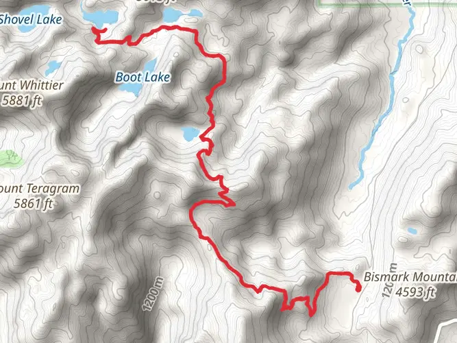
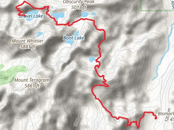
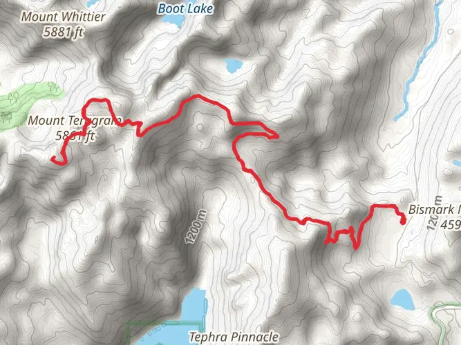
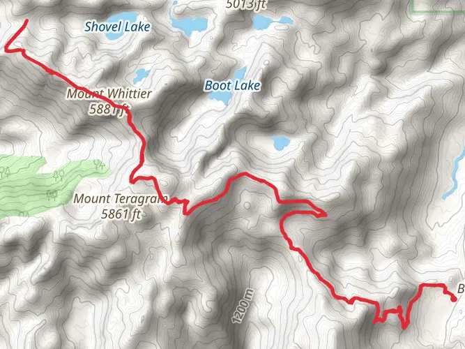
The Mount St Helens Area Loops encompass a network of trails that offer an immersive experience into the heart of the Pacific Northwest's volcanic landscape. With a total distance of approximately 74 kilometers (46 miles) and an elevation gain of around 2500 meters (8200 feet), hikers can expect a challenging journey that traverses through the regenerating ecosystem surrounding the infamous Mount St. Helens.
Getting to the Trailhead
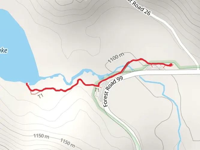
The trailhead is situated near Skamania County, Washington. For those driving, the starting point can be accessed by taking State Route 504, also known as the Spirit Lake Highway, which leads to the Mount St. Helens National Volcanic Monument. Public transportation options are limited in this remote area, so a personal vehicle or a car rental is recommended to reach the trailhead.
Navigating the Trail
Hikers should prepare for a point-to-point trek that will require either arranging a pick-up at the end of the trail or a two-car shuttle system. It's essential to have a reliable navigation tool, such as HiiKER, to keep track of your location and the route, as the trail can be complex with its various loops and junctions.
Landmarks and Natural Features
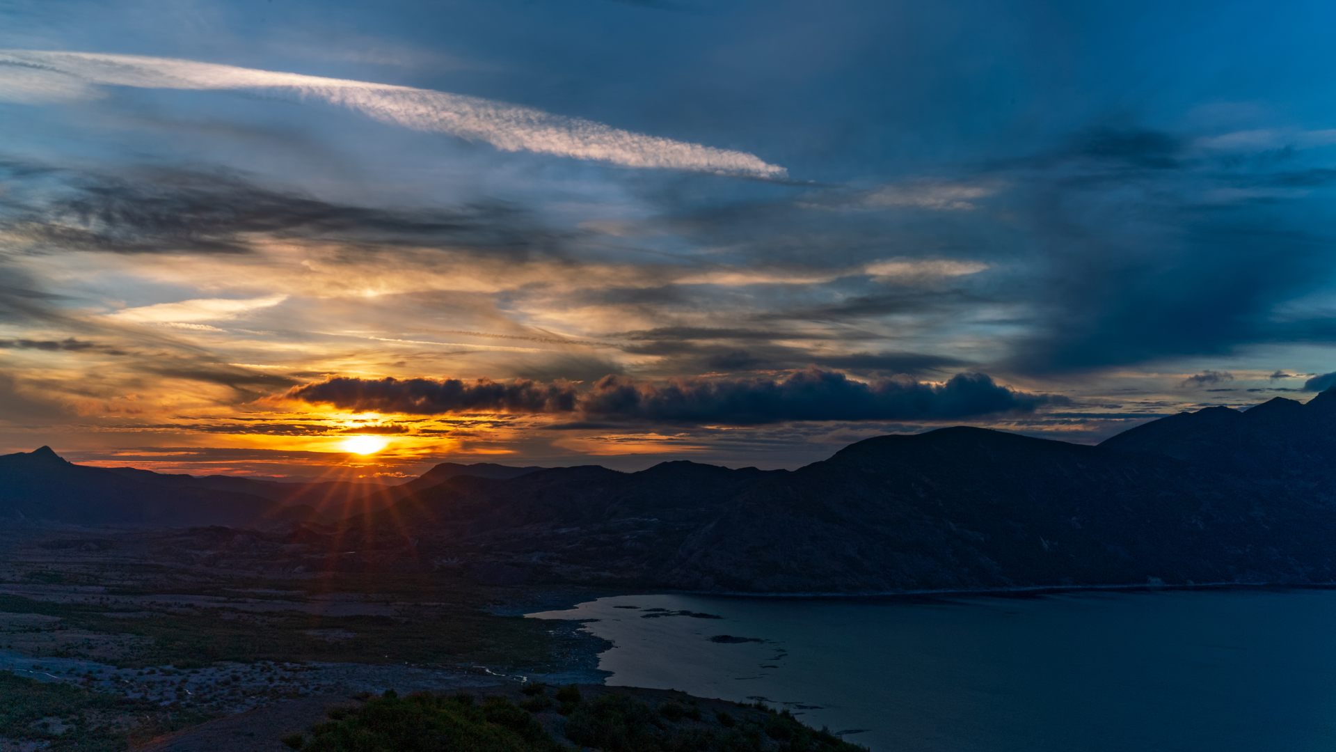
As you embark on the trail, you'll be greeted by the stark contrast between the lush old-growth forests and the blast zone left by the 1980 eruption. The first section of the trail will take you through dense woodland, gradually ascending towards more open areas with panoramic views of the surrounding landscape.
One of the most significant landmarks you'll encounter is the Johnston Ridge Observatory, located approximately 8 kilometers (5 miles) from the trailhead. This observatory offers educational exhibits about the eruption and its aftermath, as well as breathtaking views of Mount St. Helens' crater.
Further along the trail, hikers will come across the Plains of Abraham, a vast, pumice-covered plain that showcases the raw power of volcanic activity. This area is roughly 16 kilometers (10 miles) into the hike and provides a unique opportunity to observe the ongoing natural recovery process.
Wildlife and Flora
The Mount St Helens Area Loops are home to a variety of wildlife, including elk, black bears, and mountain goats. Birdwatchers may also spot species such as the northern pygmy-owl and the American dipper. The flora is diverse, with wildflowers like lupine and Indian paintbrush dotting the landscape, especially in the late spring and summer months.
Historical Significance
Mount St. Helens is a site of profound geological interest due to the catastrophic eruption on May 18, 1980. The event drastically altered the topography and ecology of the region, making it a living laboratory for scientists and a point of interest for hikers. The trail offers a firsthand look at the destructive power of nature and the resilience of life as the area continues to recover.
Preparation and Safety
Given the trail's difficulty rating and remote nature, hikers should be well-prepared with adequate supplies, including water, food, and layers for changing weather conditions. It's also wise to inform someone of your hiking plans and expected return time. Due to the elevation gain and the length of the trail, physical fitness and acclimatization to altitude are important considerations.
Remember, the Mount St Helens Area Loops are not just a physical challenge but also an opportunity to witness the awe-inspiring transformation of a landscape shaped by volcanic forces. With careful planning and respect for the natural environment, hikers can enjoy a memorable experience in this unique corner of the world.

What to expect?
Activity types
Frequently asked questions
How long is the Mount St Helens Area Loops hike and how many days does it usually take?
Mount St Helens Area Loops covers 73.93 km, or about 46 miles, with 2,542 meters of climbing. At that length and elevation gain, it fits best as a multi-day backpacking route, and many strong hikers would split it into roughly 3 to 5 days depending on camp locations, weather, and pace across the volcanic terrain.
How difficult is the Mount St Helens Area Loops hike in Skamania County?
Mount St Helens Area Loops is rated Extra Difficult, which matches its nearly 74 km distance and 2,542 m of ascent. The challenge comes not just from the mileage, but from long exposed sections, steep climbing, and the loose volcanic surfaces common around Mount St. Helens, especially on routes linked to the Loowit Trail and nearby junctions.
Where do hikers usually start the Mount St Helens Area Loops hike?
Common access is from the Mount St. Helens National Volcanic Monument road network in Skamania County, with State Route 504 serving the west side and trail access also used from the south side near Cougar. Trailheads commonly associated with longer loop travel around the volcano include Ape Canyon and June Lake, while the monument itself is managed within Gifford Pinchot National Forest.
Is parking easy for the Mount St Helens Area Loops hike?
Parking depends on which trailhead is used, but access is more limited than at a typical front-country trail. June Lake is day-use only, so it is not a good choice for leaving a vehicle on a multi-day trip, and west-side access on SR 504 has also been affected by the long-running Johnston Ridge area closure after the 2023 South Coldwater Slide, with reconstruction work underway in 2026.
Do you need a permit for the Mount St Helens Area Loops hike?
A summit permit is required only for climbing above 4,800 feet on Mount St. Helens itself, not for ordinary hiking on lower monument trails. Overnight travel can require backcountry permits in specific managed zones, especially in the Mount Margaret Backcountry between May 1 and November 30, so permit needs depend on the exact loop and camps used.
Can you bring dogs on the Mount St Helens Area Loops hike?
Dog access is not universal around Mount St. Helens, and rules can vary by trail segment and management zone, so it should not be assumed that the full Mount St Helens Area Loops route is dog-friendly. Because this route links multiple monument trails and backcountry areas, checking the current regulations for the exact trailheads and segments planned is important before setting out.
What is the best time of year to hike the Mount St Helens Area Loops?
The main hiking season is typically summer into early fall, when higher roads and snowbound trail sections are more likely to be open. On the east side, the road to Windy Ridge is commonly closed until late June or early July as snow melts, so July through September is usually the most reliable window for a long loop in the Mount St. Helens area.
Are there water and camping challenges on the Mount St Helens Area Loops hike?
Yes. Longer loops around Mount St. Helens often cross dry volcanic slopes where water can be scarce, especially on exposed sections of the Loowit Trail. Camping is also regulated in some areas, and there are no-camping stretches near sensitive zones, so daily mileage often has to be planned around both legal camps and dependable water rather than distance alone.
Comments and Reviews
User comments, reviews and discussions about the Mount St Helens Area Loops, Washington.
4.42
average rating out of 5
12 rating(s)