Download
Preview
Add to list
More
42.4 km
~3 days
1230 m
Multi-Day
“Embark on the Mount Adams Highline Trail for a challenging trek through Washington's stunning volcanic landscapes.”
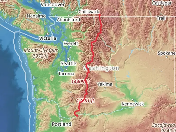
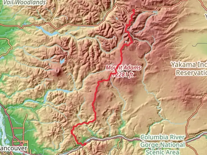
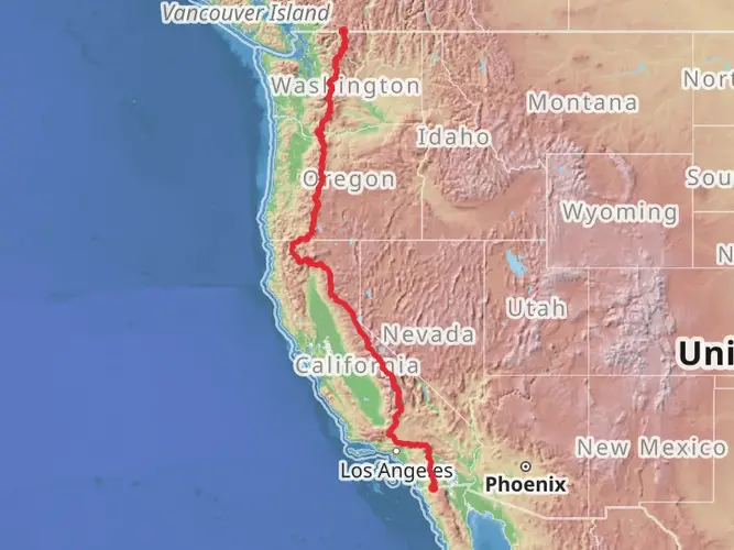
The Mount Adams Highline Trail, spanning approximately 42 kilometers (26 miles) with an elevation gain of around 1200 meters (3937 feet), is a challenging point-to-point hike located near Yakima County, Washington. This trail is not for the faint-hearted and is considered difficult due to its length and elevation profile.
Getting to the Trailhead
To reach the trailhead, hikers can drive to the eastern side of Mount Adams, where the trail begins. The closest significant landmark is the town of Trout Lake, Washington. From there, follow the signs leading towards Mount Adams Recreation Area. Parking is available near the trailhead. Public transport options are limited in this region, so driving is the most feasible option for accessing the start of the hike.
Navigating the Trail
Hikers should prepare for a remote and rugged experience as they navigate the Highline Trail. It's recommended to use a reliable navigation tool like HiiKER to stay on track, as the trail can be challenging to follow in places. The trail offers a mix of dense forest paths, alpine meadows, and rocky ridges, with several stream crossings that may be difficult during high water.
Landmarks and Scenery
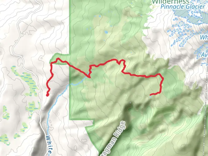
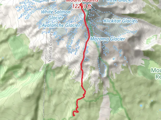
As you progress along the trail, you'll be treated to stunning views of Mount Adams, which is the second-highest peak in Washington. The trail skirts around the mountain's eastern flank, providing unique perspectives of the volcanic landscape. You'll pass by landmarks such as Hellroaring Viewpoint, offering panoramic vistas of the surrounding Cascade Range.
Flora and Fauna
The trail traverses through diverse ecosystems, from lush old-growth forests to subalpine meadows bursting with wildflowers in the spring and summer months. Keep an eye out for wildlife such as deer, elk, and the occasional black bear. Birdwatchers may also spot a variety of species, including the Clark's nutcracker and the mountain bluebird.
Historical Significance
Mount Adams and its surrounding areas are rich in history. The region is part of the traditional lands of the Yakama Nation, and many sites along the trail are of cultural significance. The mountain itself is named after the second President of the United States, John Adams, but it is also known by its original name, Pahto, given by the indigenous people.
Trail Conditions and Preparation
The trail is best tackled from late July to October when the snow has melted, and the weather is more stable. Snow can linger on higher sections well into the summer, so it's essential to check current conditions before setting out. Due to the trail's length and difficulty, hikers should be in good physical condition and carry sufficient water, food, and gear for changing weather conditions. It's also wise to inform someone of your hiking plans and expected return time.
Safety and Regulations
Given the trail's remote nature, it's crucial to be prepared for emergencies. Carry a first aid kit, a means of purification for water from natural sources, and be bear-aware by storing food properly. Always practice Leave No Trace principles to preserve the natural beauty of the area for future hikers.
Remember, the Mount Adams Highline Trail is an adventure that will test your limits and reward you with some of the most breathtaking scenery that the Pacific Northwest has to offer.

What to expect?
Activity types
Frequently asked questions
How long is the Mount Adams Highline Trail and how much climbing does it involve?
The Mount Adams Highline Trail is 42.36 km, or about 26.3 miles, with 1,230 meters of elevation gain, roughly 4,035 feet. That makes it a substantial multi-day route rather than a short out-and-back, and the climbing is spread across high volcanic terrain on the east side of Mount Adams.
How difficult is the Mount Adams Highline Trail in Washington?
The Mount Adams Highline Trail is generally rated medium, but the numbers make it a serious backcountry hike: 42.36 km with 1,230 meters of ascent. The challenge comes from its length, sustained elevation change, remote setting, and the fact that it travels through exposed alpine country around Mount Adams rather than staying on easy valley trail.
How many days does the Mount Adams Highline Trail usually take to hike?
Most hikers should plan on 2 to 3 days for the Mount Adams Highline Trail. At 42.36 km, strong parties can cover it in a long day, but the route is better known as a multi-day trip because of the elevation gain, the remote setting near Trout Lake, and the time needed for camp setup, water stops, and routefinding in open alpine sections.
When is the best time of year to hike the Mount Adams Highline Trail?
The best window for the Mount Adams Highline Trail is usually mid-summer into early fall, when the high country around Mount Adams is more likely to be snow-free. This route reaches exposed alpine terrain and steep sections near the Yakama Nation boundary, so lingering snow and seasonal closures can affect access earlier in the season.
Where do hikers start the Mount Adams Highline Trail and is there parking nearby?
The Mount Adams Highline Trail is commonly approached from the Mount Adams Recreation Area on the east side of the mountain, with Trout Lake serving as the nearest well-known town for supplies and access. Parking is typically available near the trail approach roads and recreation-area trailheads, but this is a remote part of Yakima County and public transit options are very limited.
What landmarks and views are on the Mount Adams Highline Trail?
The Mount Adams Highline Trail is known for close-up views of Mount Adams and its glaciers, plus broad volcanic scenery on the mountain’s eastern flank. Named features associated with this route and its immediate connections include Hellroaring country and the Pacific Crest Trail, with stretches of forest, alpine meadows, rocky ridges, and long sightlines across the Mount Adams Recreation Area.
Is the Mount Adams Highline Trail a loop or a point-to-point hike?
The Mount Adams Highline Trail is a point-to-point route, not a loop. That matters for planning because a 42.36 km one-way hike around Mount Adams requires a shuttle, a second vehicle, or a longer itinerary using connecting trails rather than simply returning to the same trailhead.
Comments and Reviews
User comments, reviews and discussions about the Mount Adams Highline Trail, Washington.
4.5
average rating out of 5
6 rating(s)