Download
Preview
Add to list
More
40.2 km
~3 days
2555 m
Multi-Day
“Embark on the Glacier Trail to Gannett Peak for a challenging, scenic adventure through Wyoming's rugged wilderness.”
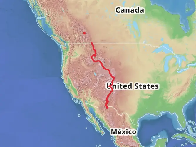
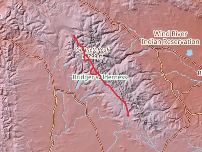
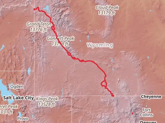
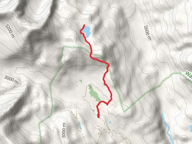
Embarking on the Glacier Trail to Gannett Peak, hikers will traverse approximately 40 kilometers (about 25 miles) with an elevation gain of around 2500 meters (roughly 8200 feet). This point-to-point trail is nestled near Fremont County, Wyoming, and is known for its challenging terrain, making it suitable for experienced adventurers. The trailhead is accessible by car, located near the end of Whiskey Mountain Road, which is the closest landmark to the starting point.
Getting to the Trailhead
To reach the trailhead, hikers can drive to Dubois, Wyoming, and then take Whiskey Mountain Road to its terminus. This remote location does not offer public transportation options, so a personal vehicle or a rented car is necessary. There is a parking area where hikers can leave their vehicles before starting the journey.
Navigating the Trail
The Glacier Trail is a demanding hike that requires good physical condition and navigation skills. Hikers should download the trail map on HiiKER before departure to ensure they have offline access to the route, as cell service is unreliable. The trail is well-marked in places, but weather conditions can obscure the path, so GPS navigation is recommended.
Landmarks and Scenery
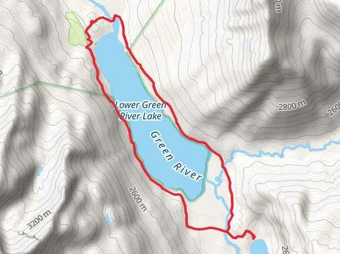
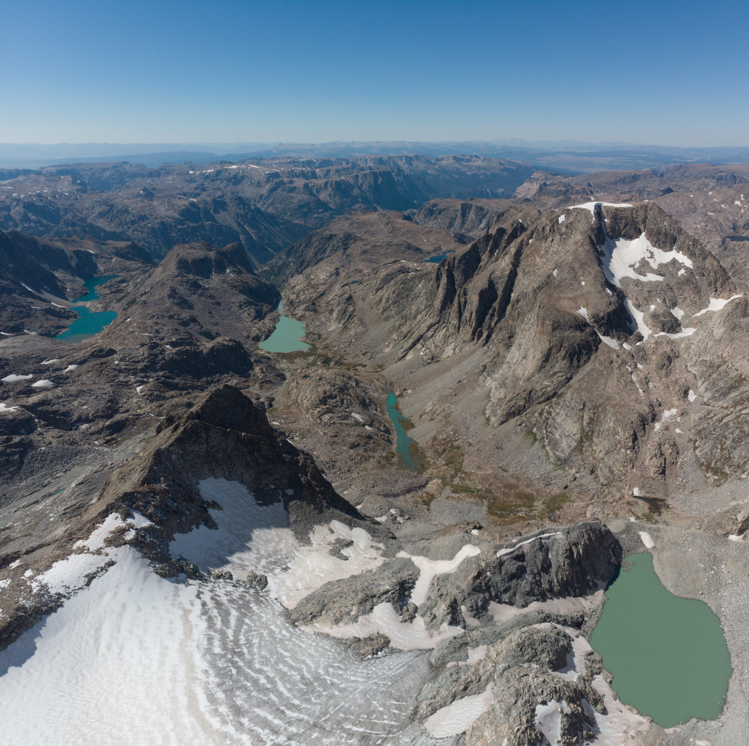
The trail offers breathtaking views of the Wind River Range, with the first section leading through dense forests and alpine meadows. Approximately 10 kilometers (6 miles) in, hikers will encounter the scenic Phillips Lake, a perfect spot for a rest and to take in the surrounding peaks.
As the trail ascends, the terrain becomes rockier, and the vegetation sparse. The path winds its way past glacial moraines and high-altitude lakes, including the stunning Twins Glacier, which lies roughly halfway to Gannett Peak. This is also where hikers will experience the majority of the elevation gain.
Wildlife and Nature
The area is rich in wildlife, with chances to spot elk, moose, and even bears, so hikers should be knowledgeable about wildlife safety. The trail also crosses through diverse ecosystems, from lush forests to fragile alpine tundra, which is home to a variety of wildflowers, especially in the summer months.
Historical Significance
The region holds historical significance as part of the Greater Yellowstone Ecosystem and is home to Gannett Peak, the highest mountain in Wyoming. The area has been a destination for mountaineers and explorers for over a century, and the trail itself is a testament to the ruggedness of the American West.
Preparation and Safety
Given the trail's difficulty, hikers should be well-prepared with appropriate gear, including sturdy hiking boots, warm clothing, and a reliable tent for overnight trips. The weather can change rapidly, and snow can be encountered even in summer at higher elevations. It's essential to bring enough food, water, and a water filtration system, as well as a first-aid kit.
Environmental Considerations
Hikers are encouraged to practice Leave No Trace principles to preserve the natural beauty of the area. This includes packing out all trash, being careful with campfires, and respecting wildlife habitats.
Final Tips
Before setting out, hikers should check the local weather forecast and trail conditions, as well as inform someone of their itinerary. It's also advisable to have a contingency plan in case of emergencies. With proper preparation and respect for the natural environment, the Glacier Trail to Gannett Peak offers an unforgettable adventure through some of Wyoming's most spectacular landscapes.

What to expect?
Activity types
Frequently asked questions
How long is the Glacier Trail to Gannett Peak hike in Wyoming?
Glacier Trail to Gannett Peak is about 40.23 km, or roughly 25 miles, with around 2,555 meters of elevation gain. That combination of distance and climbing puts it firmly in the extra difficult category, and most parties treat it as a multi-day mountain objective rather than a single-day hike.
How hard is the Glacier Trail to Gannett Peak route?
Glacier Trail to Gannett Peak is rated Extra Difficult, with about 2,555 meters of ascent over 40.23 km in the Wind River Range. The route is remote, physically demanding, and high altitude, and the upper mountain near Gannett Peak adds serious alpine terrain beyond a standard backpacking trail.
Where do you park for the Glacier Trail to Gannett Peak trailhead?
The usual access is from the Glacier Trailhead near the end of Whiskey Mountain Road outside Dubois, Wyoming, where there is a parking area at or near the trailhead. The approach is remote and road conditions can vary, so a personal vehicle is generally needed and it is worth checking current forest road access before setting out.
Can you hike the Glacier Trail to Gannett Peak as a day hike?
For most hikers, Glacier Trail to Gannett Peak is not a realistic day hike. At 40.23 km with 2,555 meters of elevation gain and a remote trailhead in Fremont County, it is better understood as a multi-day outing that requires strong fitness, careful pacing, and solid backcountry planning.
What is the best time of year to hike Glacier Trail to Gannett Peak?
The main hiking season for Glacier Trail to Gannett Peak is typically mid-summer into early fall, when access roads are open and high-country snow has eased. In the Wind River Range, snow can linger well into July at higher elevations, and conditions near Gannett Peak can stay wintry much longer because of the glaciers and permanent snowfields.
What landmarks do you pass on the Glacier Trail to Gannett Peak?
Glacier Trail to Gannett Peak begins near Whiskey Mountain Road and heads into the Wind River Range, passing forest, alpine meadows, and Phillips Lake before climbing toward the high basins below Gannett Peak. Gannett Peak itself is the highest mountain in Wyoming, and the upper route is defined by big alpine terrain and glacier scenery.
Is Glacier Trail to Gannett Peak suitable for beginner hikers?
Glacier Trail to Gannett Peak is not a beginner-friendly route. The 40.23 km length, 2,555 meters of climbing, remote access near Dubois, and extra difficult rating make it a better fit for experienced backpackers and mountaineers with strong navigation and mountain travel skills.
Comments and Reviews
User comments, reviews and discussions about the Glacier Trail to Gannett Peak, Wyoming.
4.71
average rating out of 5
17 rating(s)