Download
Preview
Add to list
More
107.1 km
~7 days
3278 m
Multi-Day
“Embark on the Backbone Trail's breathtaking journey through California's diverse landscapes, steeped in rich history and vibrant ecosystems.”
Spanning approximately 107 kilometers (66.5 miles) with an elevation gain of around 3200 meters (10,500 feet), the Backbone Trail is a point-to-point trek that traverses the Santa Monica Mountains in California. This challenging route is known for its scenic vistas, diverse ecosystems, and the historical significance of the region.
Getting to the Trailhead
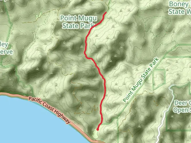
The eastern trailhead is located near Will Rogers State Historic Park, which can be accessed by car via Sunset Boulevard. For those relying on public transportation, there are bus services that run close to the park, requiring a short walk to reach the trailhead. The western terminus is near Point Mugu State Park in Ventura County, accessible via the Pacific Coast Highway. Hikers often arrange for a shuttle or a two-car system to facilitate transportation back to the starting point after completing the trail.
Trail Experience
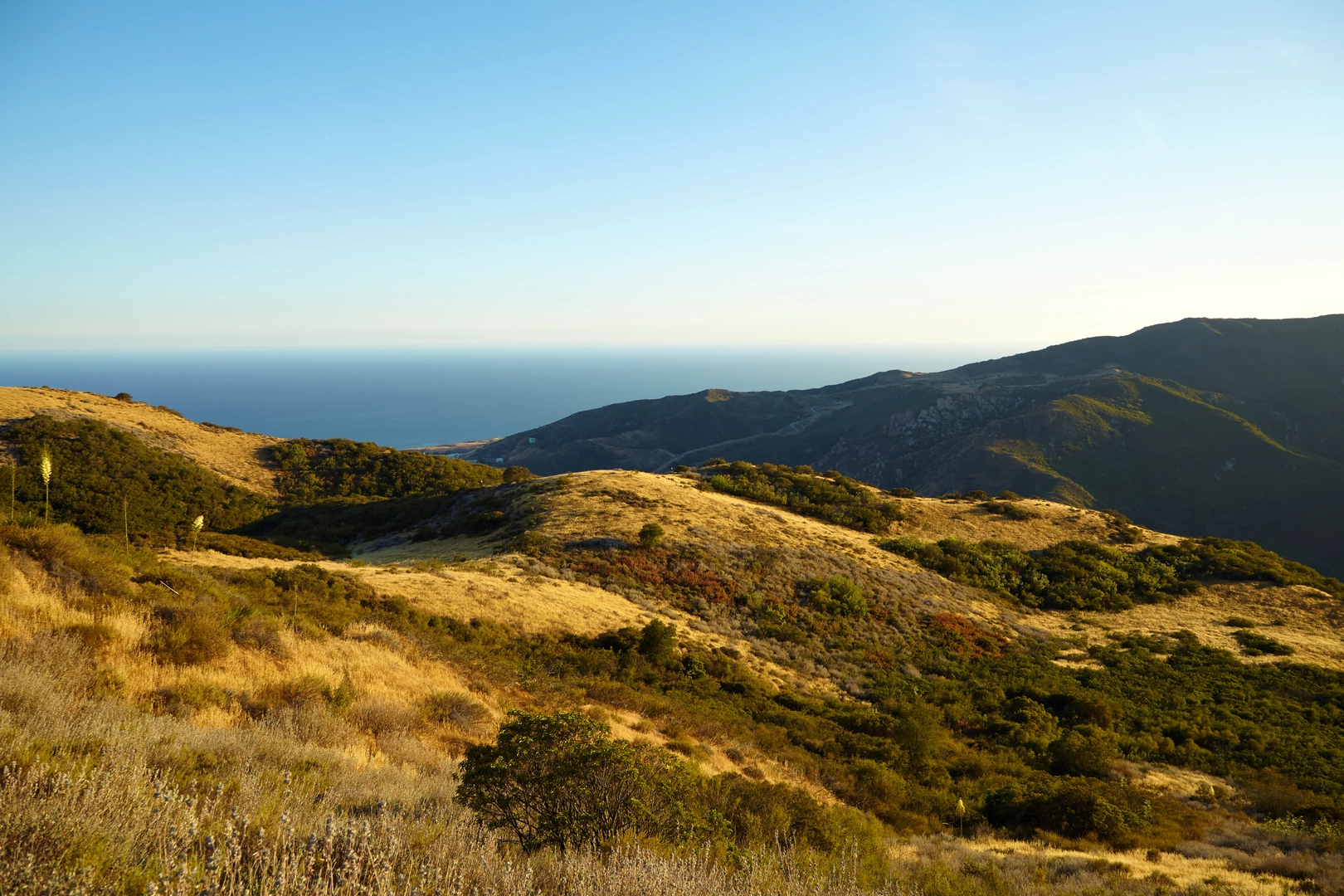
As you embark on the Backbone Trail, you'll begin a journey through chaparral-covered hillsides, oak woodlands, and lush canyon bottoms. The trail offers a variety of landscapes, including high ridges with panoramic views of the Pacific Ocean and the Los Angeles Basin. The path is well-marked, but carrying a reliable navigation tool like HiiKER is advisable to keep track of your progress and ensure you stay on course.
Significant Landmarks and Nature
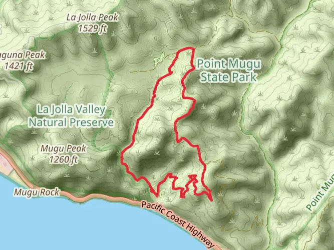
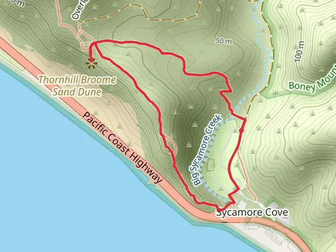
One of the first major landmarks you'll encounter is the Topanga State Park, approximately 18 kilometers (11 miles) from the eastern trailhead. Here, you can explore the Eagle Rock, a prominent sandstone formation offering expansive views. As you continue, you'll reach the highest point of the trail at Sandstone Peak, about 32 kilometers (20 miles) in. Standing at 948 meters (3,111 feet), it provides a breathtaking panorama of the surrounding area.
The trail also passes through the Mishe Mokwa area, known for its unique rock formations like Split Rock and Balanced Rock. Approximately halfway, you'll find the Danielson Monument, a tribute to a Boy Scout leader who played a significant role in the preservation of these lands.
Wildlife and Flora
The Santa Monica Mountains are home to a rich array of wildlife, including coyotes, bobcats, and even mountain lions. Birdwatchers can delight in spotting red-tailed hawks and the occasional California condor. The plant life is equally diverse, with springtime bringing a colorful display of wildflowers, including the California poppy, lupine, and the rare Malibu lily.
Historical Significance
The region holds a deep historical significance, with the Chumash Native American tribe having inhabited the area for thousands of years. Along the trail, you may come across ancient Chumash rock art, which serves as a reminder of the area's rich cultural heritage.
Preparation and Planning
Given the trail's difficulty and length, it's essential to plan accordingly. Water sources are scarce, so carrying sufficient hydration is crucial. The trail can be completed in sections for day hikes or tackled as a multi-day backpacking trip with designated backcountry campsites available for overnight stays. Be sure to check for any necessary permits or reservations in advance.
Weather conditions can vary greatly, so prepare for both the coastal breeze and the potential for high temperatures, especially in the summer months. Layered clothing, sun protection, and sturdy hiking boots are recommended.
By taking the time to prepare and respect the natural environment, hikers can enjoy a memorable experience on the Backbone Trail, immersed in the beauty and history of the Santa Monica Mountains.

What to expect?
Activity types
Frequently asked questions
How long is the Backbone Trail and how many days does it usually take to hike end to end?
The Backbone Trail is about 107.07 kilometers, or 66.5 miles, with roughly 3,278 meters of climbing, so it is a true multi-day route rather than a casual overnight. Most end-to-end hikers break it into about 4 to 7 days depending on pace, water planning, and whether they start at Will Rogers State Historic Park or Point Mugu State Park.
Where does the Backbone Trail start and finish in California?
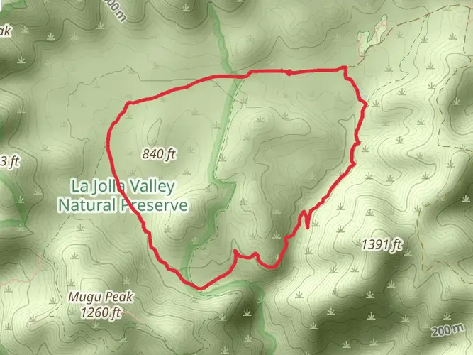
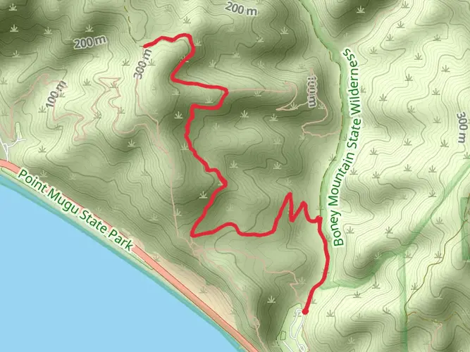
The Backbone Trail runs across the Santa Monica Mountains between Will Rogers State Historic Park on the eastern end and Point Mugu State Park on the western end. The route links major public lands including Topanga State Park and Malibu Creek State Park before reaching the coast-facing mountains of western Ventura County.
Is the Backbone Trail difficult, and what makes it challenging?
The Backbone Trail is rated difficult, and the challenge comes from its 107-kilometer length, about 3,278 meters of elevation gain, and long exposed stretches along ridges and chaparral-covered slopes. Even strong hikers need to account for heat, limited shade, and the cumulative effort of repeated climbs and descents through the Santa Monica Mountains.
Can dogs go on the Backbone Trail?
Dog access is limited and hikers should not assume dogs are allowed on the full Backbone Trail. California State Parks notes that dogs are not allowed on the Backbone Trail from Will Rogers State Historic Park, and Point Mugu State Park also restricts dogs in the Boney Mountain State Wilderness, so any dog-friendly planning has to be checked section by section rather than for the route as a whole.
Where can you park for the Backbone Trail at the east and west ends?
The main end-to-end trailheads are at Will Rogers State Historic Park and Point Mugu State Park, and both parks provide official visitor parking areas used by Backbone Trail hikers. Because it is a point-to-point route across Los Angeles and Ventura County, many hikers use a car shuttle or two-car setup instead of relying on a single trailhead lot.
What are the main landmarks and parks along the Backbone Trail?
The Backbone Trail crosses some of the best-known public lands in the Santa Monica Mountains, including Will Rogers State Historic Park, Topanga State Park, Malibu Creek State Park, and Point Mugu State Park. Along the way it follows ridgelines, oak woodlands, canyon crossings, and high viewpoints with Pacific Ocean and Los Angeles Basin views.
What is the best time of year to hike the Backbone Trail?
The most comfortable seasons for the Backbone Trail are usually fall through spring, when temperatures are cooler and long exposed sections are less punishing than in summer. The National Park Service also advises avoiding the trail after moderate to heavy rain because muddy conditions can make travel harder and can damage the route.
Comments and Reviews
User comments, reviews and discussions about the Backbone Trail, California.
4.43
average rating out of 5
7 rating(s)