Download
Preview
Add to list
More
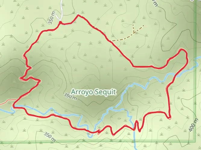
52.0 km
~4 days
1959 m
Multi-Day
“Embark on an endurance trek through Point Mugu's varied terrains for panoramic views and rich ecological tapestries.”
Embarking on the Point Mugu State Park Loop, hikers will traverse approximately 32 miles (52 km) of diverse landscapes, with an elevation gain of nearly 6233 feet (1900 meters). This challenging loop, nestled in the Santa Monica Mountains near Ventura County, California, is a test of endurance and offers a rewarding experience with its stunning vistas and rich biodiversity.
Getting to the Trailhead
The trailhead is conveniently located just off the Pacific Coast Highway (PCH), about an hour's drive from downtown Los Angeles. For those preferring public transportation, options are limited, but one can take a bus to the nearest stop along the PCH and then hike or take a taxi to the trailhead. Parking is available near the trailhead for those arriving by car.
Navigating the Trail
As you set out on the loop, it's essential to have a reliable navigation tool. HiiKER is a recommended app for this purpose, providing detailed maps and GPS tracking to ensure you stay on the right path. The trail is well-marked, but there are several intersecting paths, so vigilance with navigation is key.
Landmarks and Scenery
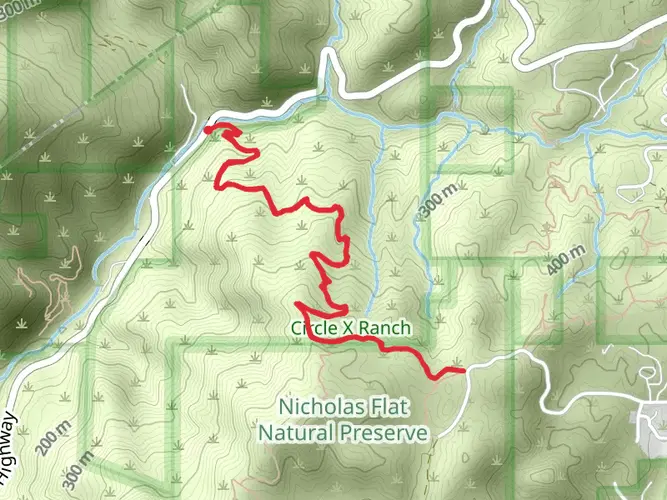
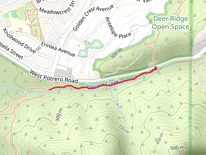
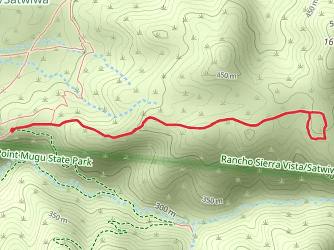
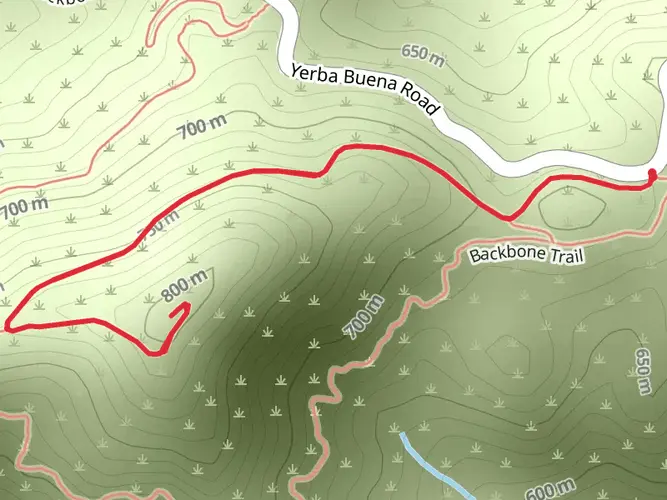
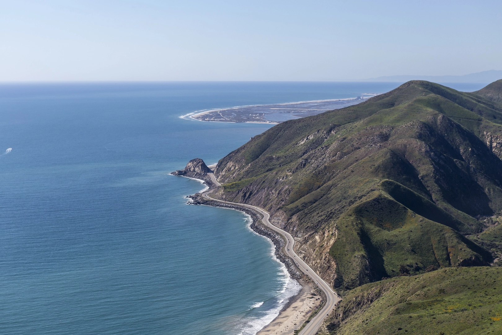
The trail offers a variety of landscapes, from coastal bluffs with ocean views to deep canyons and high ridges. One of the first significant landmarks you'll encounter is the La Jolla Valley, a lush area that contrasts with the surrounding dry peaks. As you ascend, you'll be treated to panoramic views of the Pacific Ocean and the Channel Islands.
Further along, the trail meanders through Sycamore Canyon, a serene spot where the sound of the creek accompanies you. The Boney Mountain Wilderness Area is another highlight, offering a rugged and remote feel with opportunities to spot local wildlife such as deer, coyotes, and even the elusive mountain lion.
Flora and Fauna
The park is home to a rich array of plant life, including chaparral, oak woodlands, and riparian habitats. Springtime hikers will be greeted with a colorful display of wildflowers. The area is also a haven for birdwatchers, with species like the California quail, red-tailed hawk, and various songbirds.
Historical Significance
The Chumash Native Americans once inhabited the region, and evidence of their presence can be seen in the form of shell middens and rock art scattered throughout the park. The area also played a role in the ranching history of Southern California, with remnants of old homesteads and ranch roads still visible along the trail.
Preparation and Planning
Given the trail's difficulty and length, it's crucial to be well-prepared. Adequate water, food, and sun protection are essential, as well as layers of clothing to adapt to changing temperatures. The trail can be completed in a single long day by very fit hikers, but many choose to split the journey into two days, camping at one of the backcountry sites (permits required).
Safety Considerations
The trail can be quite exposed, with limited shade, so it's important to plan your hike to avoid the heat of the day. Rattlesnakes are native to the area, so be vigilant and give them a wide berth if encountered. Poison oak is also present along the trail, so knowing how to identify and avoid it is important.
Remember, this loop is a test of endurance and preparation. With the right planning and respect for the natural environment, the Point Mugu State Park Loop is a rewarding adventure that showcases some of the best scenery Southern California has to offer.

What to expect?
Activity types
Frequently asked questions
How long does the Point Mugu State Park Loop take to hike?
The Point Mugu State Park Loop is about 52.02 km, or roughly 32.3 miles, with 1,959 m of climbing. Most hikers treat it as a strenuous multi-day route, though very strong hikers may complete it in a long single push. The combination of distance, repeated climbs, and exposed ridgelines makes it an extra difficult outing rather than a casual day hike.
Where do you park for the Point Mugu State Park Loop?
The usual access is from Point Mugu State Park along Pacific Coast Highway, with day-use parking available at Sycamore Cove, La Jolla Canyon, and Mugu Beach from 8:00 a.m. to sunset. Sycamore Canyon day-use parking stays open later, from 8:00 a.m. to 10:00 p.m. The park’s main entrance is at 9000 Pacific Coast Highway in Malibu, about 4 miles west of the Ventura County line.
Are dogs allowed on the Point Mugu State Park Loop?
Dogs are not allowed on the trails in Point Mugu State Park, so they cannot accompany hikers on the Point Mugu State Park Loop. Dogs are allowed in campground and day-use areas only. That matters on this route because the loop uses backcountry trails and fire roads rather than staying in developed picnic or camping zones.
What landmarks do you see on the Point Mugu State Park Loop?
The Point Mugu State Park Loop crosses some of the park’s best-known terrain, including La Jolla Valley, Sycamore Canyon, coastal bluffs, and high ridges with Pacific Ocean views. The park itself spans about 14,000 acres in the western Santa Monica Mountains and includes five miles of shoreline. On clear days, the higher sections can open up views toward the Channel Islands.
Is the Point Mugu State Park Loop hard?
Yes. The Point Mugu State Park Loop is rated Extra Difficult and packs 1,959 m, or about 6,430 feet, of elevation gain into 52.02 km. That level of climbing, combined with the route length and exposed mountain terrain above the coast, makes it better suited to experienced hikers with solid endurance and navigation skills.
What is the best time of year to hike the Point Mugu State Park Loop?
The most comfortable seasons for the Point Mugu State Park Loop are usually fall through spring, when temperatures in the Santa Monica Mountains are generally cooler. Summer can be much hotter on the exposed ridges and inland sections, with limited shade away from canyons like Sycamore Canyon. Winter and spring often bring the greenest hillsides and clearer contrast between the coastal bluffs and inland valleys.
Can you camp on the Point Mugu State Park Loop?
Because the Point Mugu State Park Loop is a multi-day route of just over 52 km, many hikers break it up with an overnight stay rather than hiking it all at once. Point Mugu State Park has established camping areas, including Sycamore Canyon Campground and Thornhill Broome Campground near the coast. Camp logistics should be planned around the specific trail segments being used, since the loop covers both canyon and ridge terrain.
Comments and Reviews
User comments, reviews and discussions about the Point Mugu State Park Loop, California.
5.0
average rating out of 5
4 rating(s)